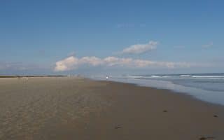
York is a coastal town in southern Maine, especially popular with families in summer. One of the most scenic in southern Maine is to combine York Beach with a loop around Cape Neddick. They can be run separately or combined for a terrific 10k.
York Beach. CC: Paul VanDerWerf
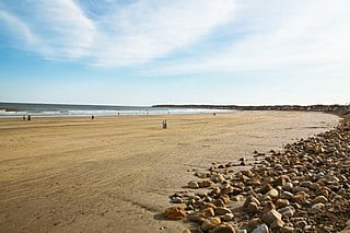
York Beach and Cape Neddick Loop. Starting at Camp Eaton, there’s a nice sidewalk on Rt. 1A alongside York Beach (also called Long Sands Beach), with great ocean views. It’s 1.6 miles to Nubble Rd. The beach is also very runnable.
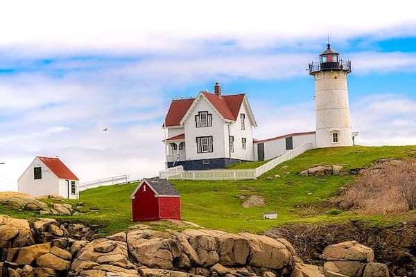
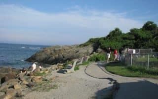
For the 2-mile Cape Neddick loop, turn RIGHT on Nubble Rd., which leads up a hill to the Nubble Lighthouse. Nice views and homes! Continue on Nubble Rd., then RIGHT on Kendall Rd. to Ocean Ave. Ext., which features great views and some spectacular oceanfront homes. Coming off Cape Neddick, there’s a nice 0.5 out and back jaunt along Short Sands Beach.
Add-On: For a longer run, join our York Village/York Harbor loop. Use York Ave. south for 0.5 miles, and start the route with the section around Easter Point.
Mt. Agamenticus. For a challenge, run the road to the summit of Mt. Agamenticus. It’s 0.6 miles with an elevation gain of 270 feet, and 8-9% grades! MAP
York is a coastal town in southern Maine, especially popular with families in summer. One of the most scenic in southern Maine is to combine York Beach with a loop around Cape Neddick. They can be run separately or combined for a terrific 10k.
York Beach. CC: Paul VanDerWerf
York Beach and Cape Neddick Loop. Starting at Camp Eaton, there’s a nice sidewalk on Rt. 1A alongside York Beach (also called Long Sands Beach), with great ocean views. It’s 1.6 miles to Nubble Rd. The beach is also very runnable.
For the 2-mile Cape Neddick loop, turn RIGHT on Nubble Rd., which leads up a hill to the Nubble Lighthouse. Nice views and homes! Continue on Nubble Rd., then RIGHT on Kendall Rd. to Ocean Ave. Ext., which features great views and some spectacular oceanfront homes. Coming off Cape Neddick, there’s a nice 0.5 out and back jaunt along Short Sands Beach.
Add-On: For a longer run, join our York Village/York Harbor loop. Use York Ave. south for 0.5 miles, and start the route with the section around Easter Point.
Mt. Agamenticus. For a challenge, run the road to the summit of Mt. Agamenticus. It’s 0.6 miles with an elevation gain of 270 feet, and 8-9% grades! MAP
Scroll Down For Route Maps
Essentials
Full Loop is 6.4 miles (10.2 km)
York Loop: 144 feet (44m); Mt. Agamenticus: 272 feet over 1.2 miles out & back
A really fun run with great water views and a variety of sights and terrain. It includes a tour of Peirce Island, and then the Memorial Bridge over to Kittery, ME. For a longer run, explore the streets of Portsmouth or do a section of our New Castle route.
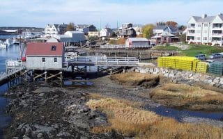
There's more to Kittery than outlet stores! We've put together a route map that mainly follows Rt. 103 and then Chauncy Creek Rd north toward York. This is the best spot in the area for water views. Up to 3.4 miles one-way.
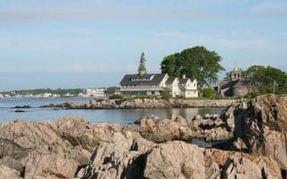
This is a lovely run incorporating the best of historic York Village and the seaport town of York Harbor. Much of the route is along waterside roads, including Wiggly Bridge over the York River, Fishermans's Walk, and the Cliff Walk in York Harbor.
One of our favorite beach runs in New England. The 2.4 miles on the beach between Ogunquit and Wells are wide, flat, open, and offer consistently good “beach running” conditions. Numerous access points.
Fantastic ocean views along the 1-mile shoreline path between Ogunquit and Perkins Cove. 2.2 mile loop with a run back along Shore Rd. For a longer run, enjoy the side streets off Shore Rd. or a section along Ogunquit Beach.
Great running options in Wells: The Wells Reserve at Laudholm, with offers 7 miles of gorgeous trails through marshes and grasslands; 4+ miles of beach is perfect for running; and our scenic route though the neighborhood, passing nice homes.
Wonderful waterside running in this popular summer report area. In Kennebunk, run for nearly 2 miles along Beach Rd., paralleling Kennebunk Beach. In Kennebunkport, the run along Ocean Ave. is one of our favorites in Maine.
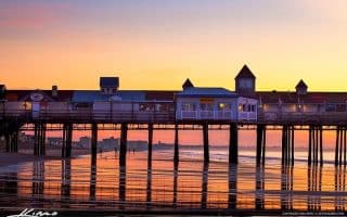
A fantastic beach for running. It’s nearly 7 miles from the southern end at Camp Ellis to the northern end at Pine Point, with great views of Saco Bay and Prouts Beck. Flat and wide, with firm sand.
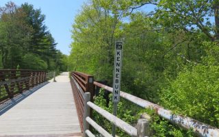
Wonderful rail-trail between Kennebunk and Portland. Mainly inland, through woods, marshes, & farms. Completed section is 28 miles (15% on-road). A 37-mile on-road section from Kittery to Kennebunk is also marked & mainly on low-trafficked roads.
Share your feedback on this route and see that of other Great Runs users. Click on the image icon to upload a photo. And please let us know if there are notes or changes we should incorporate!
Subscribe
0 Comments
Oldest
Newest
Inline Feedbacks
View all comments
Essentials
Full Loop is 6.4 miles (10.2 km)
York Loop: 144 feet (44m); Mt. Agamenticus: 272 feet over 1.2 miles out & back


Review or Comment on This Route/Share a Photo!
Share your feedback on this route and see that of other Great Runs users. Click on the image icon to upload a photo. And please let us know if there are notes or changes we should incorporate!