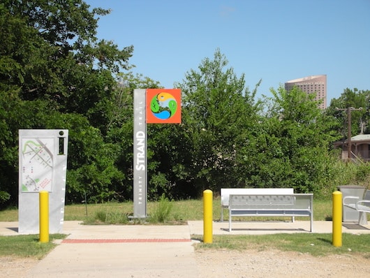
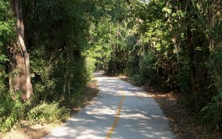
There is a developing series of trails in the area of the original Trinity River watercourse (now mainly dry). One section is the 2.5-mile Trinity Strand Trail, which runs from Oak Lawn Ave., just south of I-35, past the Hilton Anatole, paralleling Irving Blvd. It is paved and pretty urban, but a good off-road option. NEW [2025]: The Hi Line Connector is a new 1-mile paved trail linking Trinity Strand Trail just north of Turtle Creek Blvd with the Katy Trail @Victory Ave.
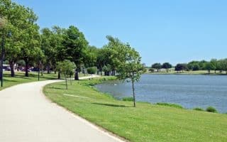
Trinity Skyline Trail (author photo)
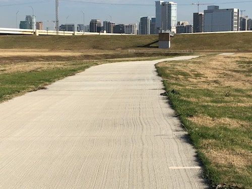
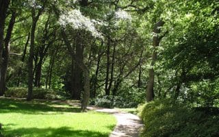
The second option in the area is the Trinity Skyline Trail, which offers 4.6 miles of paved path, plus several more miles of dirt path, in the old riverbed and along the levee (Trinity Levee Trail). It’s a pretty unique experience — a huge, open, below grade area, steps from and with great views of Dallas’ skyscrapers. The Trinity Skyline Trail is the paved path, while the other trails in the riverbed are a gravel/stone surface that can be a bit challenging for running. One can put together a long run here: From Moore Park at the eastern end, it’s 2.6 miles to the W. Commerce Bridge, 3.3 miles to the Ronald Kirk Pedestrian Bridge, and 7 miles to Inwood Rd. The trail is not well way-marked.
Trammell Crow Park is a good access point and parking area on the trail. Other good access points are from Main St./Dealey Plaza (JFK Assassination Site), Trinity Overlook Park off the Commerce St. bridge, and the Ronald Kirk Pedestrian Bridge. Note: this trail is very exposed–there is little shade. It can be windy, hot, muggy, or buggy, depending on the conditions.
There’s a plan to connect the Trinity Trail to the Katy Trail, which is also nearby. It’s part of a planned 8-mile trail, which will be a terrific addition to the downtown Dallas running scene. More info here.
There is a developing series of trails in the area of the original Trinity River watercourse (now mainly dry). One section is the 2.5-mile Trinity Strand Trail, which runs from Oak Lawn Ave., just south of I-35, past the Hilton Anatole, paralleling Irving Blvd. It is paved and pretty urban, but a good off-road option. NEW [2025]: The Hi Line Connector is a new 1-mile paved trail linking Trinity Strand Trail just north of Turtle Creek Blvd with the Katy Trail @Victory Ave.
Trinity Skyline Trail (author photo)
The second option in the area is the Trinity Skyline Trail, which offers 4.6 miles of paved path, plus several more miles of dirt path, in the old riverbed and along the levee (Trinity Levee Trail). It’s a pretty unique experience — a huge, open, below grade area, steps from and with great views of Dallas’ skyscrapers. The Trinity Skyline Trail is the paved path, while the other trails in the riverbed are a gravel/stone surface that can be a bit challenging for running. One can put together a long run here: From Moore Park at the eastern end, it’s 2.6 miles to the W. Commerce Bridge, 3.3 miles to the Ronald Kirk Pedestrian Bridge, and 7 miles to Inwood Rd. The trail is not well way-marked.
Trammell Crow Park is a good access point and parking area on the trail. Other good access points are from Main St./Dealey Plaza (JFK Assassination Site), Trinity Overlook Park off the Commerce St. bridge, and the Ronald Kirk Pedestrian Bridge. Note: this trail is very exposed–there is little shade. It can be windy, hot, muggy, or buggy, depending on the conditions.
There’s a plan to connect the Trinity Trail to the Katy Trail, which is also nearby. It’s part of a planned 8-mile trail, which will be a terrific addition to the downtown Dallas running scene. More info here.
The 260-acre Kiest Park Conservation Area is a pleasant spot for easy off-road running in the Oak Cliff area. There's a loop trail around the park with 2.3 & 3.5 mile options. Combination of meadows, athletic fields, some woodland.
The best bet for running in downtown Dallas. 3.5-mile elevated urban trail, between the American Airlines Center downtown and SMU. Pleasantly shaded in spots, good views, few street crossings. Lit at night! Can do return loop via Turtle Creek Trail.
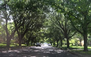
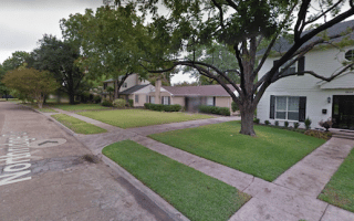
Parallels the Katy Trail, but more park-like. Follow Turtle Creek Blvd. and Lakeside Dr., combination of paths and sidewalk. Can also meander around the beautiful streets of Highland Park, featuring gorgeous homes and older trees.
Wonderful running in the one of Dallas' prettiest neighborhoods, with gracious, winding roads, estate homes, and older trees. A great 'holiday lights' run! Combine with pleasant running through the campus of SMU, just to the north.
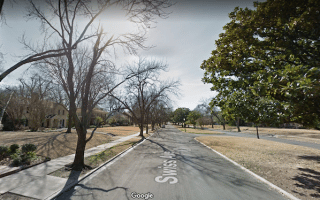
A wonderful run through three historic Dallas neighborhoods: the Deep Ellum entertainment district, tree-lined Swiss Ave., with its gracious homes well set back, and the Munger Place Historic District, another beautiful residential area.
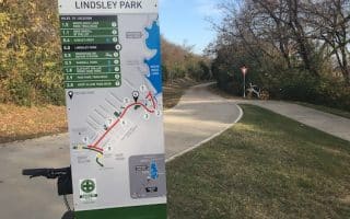
The best option from Dallas’ east end. It’s a 4.5 mile paved trail that connects multiple parks in the east part of Dallas, and runs out to popular White Rock Lake.
Some of the most scenic and enjoyable running in Dallas. Numerous options include lake perimeter trail of 9.1 miles, the White Rock Creek Greenbelt, and the pleasant Lakewood neighborhood just west.
Lovely neighborhood for running just to the west of White Rock Lake. Design your own route along these winding, hilly roads, which feature gracious homes and a nice canopy. Can be combined with White Rock Lake Trail.
A terrific and expanding paved trail system south of downtown, along Lemmon Lake to the Trinity River Audubon Center. Some sections wooded, other sections with good skyline views. Full loop is 6.4 miles, or do some sections.
A flat, 3.1 mile perimeter run around a freshwater lake. In the northwest section of Dallas, next to Love Field Airport. Paved path, other good facilities in park. Good views of the water. Quite open -- use caution on hot days.
Share your feedback on this route and see that of other Great Runs users. Click on the image icon to upload a photo. And please let us know if there are notes or changes we should incorporate!
Subscribe
1 Comment
Oldest
Newest
Inline Feedbacks
View all comments
Essentials
Strand Trail: 2.5 miles one-way; Skyline Trail: 4.6 miles of paved trail; Possible to run 7 miles one-way from Moore Park to Inwood Rd.
Strand Access Points: Hi-Line Trail Head and Turtle Creek Plaza - see map; Skyline Trail has many access points -- see description
Multiple access points; Union Station is good DART station for access to Skyline Trail


Review or Comment on This Route/Share a Photo!
Share your feedback on this route and see that of other Great Runs users. Click on the image icon to upload a photo. And please let us know if there are notes or changes we should incorporate!