The trails of James M. Robb – Colorado River State Park are among the running highlights of Grand Junction. The park — named after James M. Robb, a civic leader who helped make it happen — is divided into five non-contiguous sections. Most of the trails are around lakes or along the Colorado River (some overlapping with our Colorado River route). This trail map shows the different sections, with trail distances and difficulty ratings. A few recommendations:
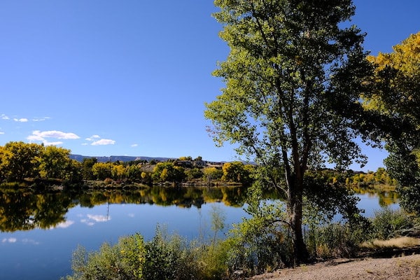
Connected Lakes Section: Pleasant running trails along the river and three small lakes, combination paved and unpaved. A loop is 2.5 miles, and can add with our Colorado River Paths route. Can access this from downtown on a path via Broadway, ~2.3 miles. ROUTE MAP DOWNTOWN ACCESS MAP
Corn Lake Area. East of Grand Junction on the Colorado River. An 0.8-mile trail around the lake and 6 miles of paved Riverfront Trail. (trails #7 & 11). AREA MAP
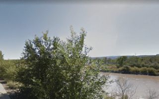
Fruita Section: Path around Red Rocks Lake and 1.4 miles along the Colorado River.
The trails of James M. Robb – Colorado River State Park are among the running highlights of Grand Junction. The park — named after James M. Robb, a civic leader who helped make it happen — is divided into five non-contiguous sections. Most of the trails are around lakes or along the Colorado River (some overlapping with our Colorado River route). This trail map shows the different sections, with trail distances and difficulty ratings. A few recommendations:
Connected Lakes Section: Pleasant running trails along the river and three small lakes, combination paved and unpaved. A loop is 2.5 miles, and can add with our Colorado River Paths route. Can access this from downtown on a path via Broadway, ~2.3 miles. ROUTE MAP DOWNTOWN ACCESS MAP
Corn Lake Area. East of Grand Junction on the Colorado River. An 0.8-mile trail around the lake and 6 miles of paved Riverfront Trail. (trails #7 & 11). AREA MAP
Fruita Section: Path around Red Rocks Lake and 1.4 miles along the Colorado River.

Review or Comment on This Route/Share a Photo!
Share your feedback on this route and see that of other Great Runs users. Click on the image icon to upload a photo. And please let us know if there are notes or changes we should incorporate!