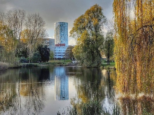
This is a run on canal-side paths and parks that form a sort of outer perimeter belt loop around the historic center of Groningen. The full route is 16 km, but can be done in sections or shortened. Use our mapped route as a guideline. There are lovely views of the water, Groningen, and the green of numerous parks.
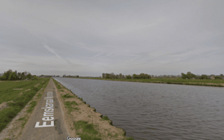
Starting at the closest point to downtown at the southern end of the Noorderplantsoen (park), run along the mainly west side canal (Reitdiep) path for 6 km to the northern tip. Turn RIGHT onto the unpaved Sprikkenburg path for 3.7 km. The path curls slightly inland to cross the N370 highway, and then our route passes through a two lovely parks — Molukkenplantsoen & Pioenpark — for 2 km. The final 3 km is on paved paths /roads alongside the Hunzehaven & Spilsuizen canals.
Shorter Options: Choose a section! Yo can also shorten the route by ~4 km by cutting back through to the start from West-Indische buurt. Use the wide Bedumerweg road, and then the nicer Noorderplantsoen park.
Longer Options: See our Inner Groningen loop.
This is a run on canal-side paths and parks that form a sort of outer perimeter belt loop around the historic center of Groningen. The full route is 16 km, but can be done in sections or shortened. Use our mapped route as a guideline. There are lovely views of the water, Groningen, and the green of numerous parks.
Starting at the closest point to downtown at the southern end of the Noorderplantsoen (park), run along the mainly west side canal (Reitdiep) path for 6 km to the northern tip. Turn RIGHT onto the unpaved Sprikkenburg path for 3.7 km. The path curls slightly inland to cross the N370 highway, and then our route passes through a two lovely parks — Molukkenplantsoen & Pioenpark — for 2 km. The final 3 km is on paved paths /roads alongside the Hunzehaven & Spilsuizen canals.
Shorter Options: Choose a section! Yo can also shorten the route by ~4 km by cutting back through to the start from West-Indische buurt. Use the wide Bedumerweg road, and then the nicer Noorderplantsoen park.
Longer Options: See our Inner Groningen loop.


Review or Comment on This Route/Share a Photo!
Share your feedback on this route and see that of other Great Runs users. Click on the image icon to upload a photo. And please let us know if there are notes or changes we should incorporate!