There are some wonderful running options in Fremont, which is located in Alameda County. Enjoy quick lake loops in Central Park, east flat running on the Alameda Creek Trail, and scenic trails around marshes/wetlands in Quarry Lakes and Coyote Hills Regional Park.
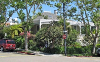
Fremont Central Park. CC: King of Hearts
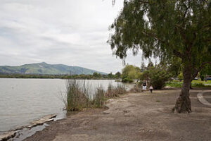
Central Park. Lovely park in Alameda’s central district with sports facilities, a water park, and a 2-mile loop around Lake Elizabeth. ROUTE MAP
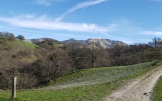
Alameda Creek Trail. These trails run along the banks of Alameda Creek from the mouth of Niles Canyon westward to San Francisco Bay. On the south side, the trail is paved and runs for 12 miles. On the north side, the trail is unpaved and runs for 12.4 miles. There are views of the [narrow and dry] creek. PRO TIP: A favorite Marathon training run is the Alameda Creek Trail loop & Quarry Lakes. TRAIL MAP
Add on with the 3.5 mile loop around Quarry Lakes. And go for a post-run dip! TRAIL MAP
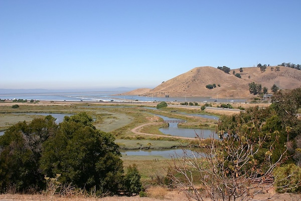
Add on with Coyote Hills Regional Park, at the western end of the Alameda Creek Trail.
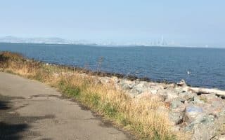
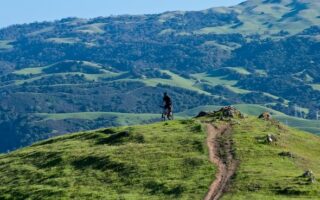
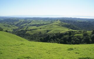
Coyote Hills Regional Park. The most scenic running in the area. The park comprises 1,266 acres of marshland and rolling grassland-covered hills along the eastern shore of San Francisco Bay. Scenic trails and great views. Most popular for running is the 3.5 mile Bayview Trail. There’s a Visitor Center and other facilities. Note: Admission fee required. Park can get popular. TRAIL MAP
There are some wonderful running options in Fremont, which is located in Alameda County. Enjoy quick lake loops in Central Park, east flat running on the Alameda Creek Trail, and scenic trails around marshes/wetlands in Quarry Lakes and Coyote Hills Regional Park.
Fremont Central Park. CC: King of Hearts
Central Park. Lovely park in Alameda’s central district with sports facilities, a water park, and a 2-mile loop around Lake Elizabeth. ROUTE MAP
Alameda Creek Trail. These trails run along the banks of Alameda Creek from the mouth of Niles Canyon westward to San Francisco Bay. On the south side, the trail is paved and runs for 12 miles. On the north side, the trail is unpaved and runs for 12.4 miles. There are views of the [narrow and dry] creek. PRO TIP: A favorite Marathon training run is the Alameda Creek Trail loop & Quarry Lakes. TRAIL MAP
Add on with the 3.5 mile loop around Quarry Lakes. And go for a post-run dip! TRAIL MAP
Add on with Coyote Hills Regional Park, at the western end of the Alameda Creek Trail.
Coyote Hills Regional Park. The most scenic running in the area. The park comprises 1,266 acres of marshland and rolling grassland-covered hills along the eastern shore of San Francisco Bay. Scenic trails and great views. Most popular for running is the 3.5 mile Bayview Trail. There’s a Visitor Center and other facilities. Note: Admission fee required. Park can get popular. TRAIL MAP
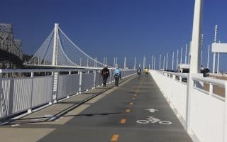
It's NOT possible to run all the way from San Francisco to Oakland, but this newly opened path from Emeryville to Yerba Buena Island is 4 miles of running glory. Great views of the Bay, bridges, and skylines. Separate bike and pedestrian lanes.
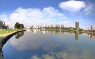
Popular 3.2 mile path around the lake is a great running option near downtown Oakland. Lovely gardens in Lakeside Park in the north and the Oakland Museum of California in the south. For extra cardio, run the stairs of the Cleveland Cascade.
One of the loveliest neighborhoods in the East Bay, with quiet, tree-lined residential streets and attractive homes. Include Piedmont Park and nearby streets, Dimond Park for trail running and Mountain View Cemetery for hilly paths and great views.
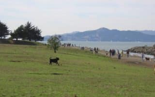
Nearly 12 miles of flat, waterside running. Most of it is lovely, with great views. Best sections are around César Chávez Park in Berkeley and Point Isabel to Marina Bay. We feature a detailed map and table with section distances.
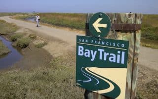
One of the longest continuous stretches of shoreline running along the Bay Trail. It's 7 miles from San Leandro Marina to the San Mateo Bridge, with great water views, salt marshes, and sloughs.
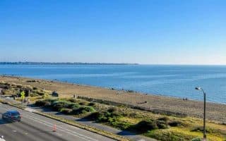
An easy, flat beachside run near Oakland Airport. Crown Memorial State Beach is a wonderfully restored 2.5 mile beach, with a bike/pedestrian path. Continue along Shore Line Dr. for a 3+ mile route. Good beach and water views the whole way.
One of our favorite runs in the East Bay, and right next to Oakland International Airport! 6-mile dedicated path around the island, with great views to the water, Bay Bridge, and San Francisco in the distance. Good add-ons options.
Wonderful running in this area, 2 miles west of downtown Berkeley. A series of three parks and 8+ miles waterside trails along shores, tidal marshes, and beaches, with views out to SF Bay, the Berkeley Yacht Harbor, and South Sailing Basin.
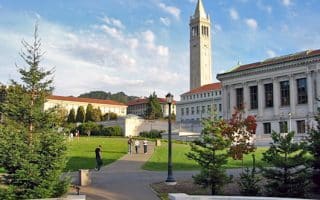
Excellent running on the numerous roads and paths of the university. Can easily put together 4-5 miles on the main campus, seeing key spots and landmark buildings. Just to the east, head up to the Botanical Garden, or enjoy the Fire Trails for some trail running.
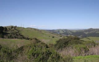
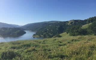
A great running option just a couple of miles east of Berkeley. There's Lake Anza, a botanical garden, wonderful wildflowers, and extensive trails. We recommend the paved 4 mile Nimitz Way Trail, with great views of San Pablo reservoir, SF bay and Mt. Diablo.
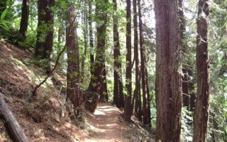
Wonderful trail running in 1,580 acre park, a few miles east of Oakland. Options include a paved path through redwoods, an 8.2 bike loop trail, and numerous more challenging options. Many trails shaded, which is good for a hot day.
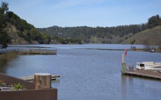
Extensive park east of Oakland, with 70+ miles of trails. A favorite for runners is the 3.5 miles of paved trail along the south and east shores of the lake. There are several other more extensive, challenging loops available. Adjoins Redwood Regional Park.
Good running options in Pleasanton include the Arroyo Mocho & Centennial/Alamo Canal multi-use trails, and extensive trail running options in Shadow Cliffs Regional Recreation Area & numerous open spaces west of I-680.
Best running options in Livermore are the Arroyo Mocho Multi-Use Trail, easy trail running in Sycamore Grove Park, the E Shore Trail in Del Valle Regional Park, and some lovely, quiet roads passing vineyards.
Best running options in San Ramon are: the Iron Horse Regional Trail -- a paved rail-trail that runs between Pleasanton & Concord; and scenic trail running at Sycamore Valley Open Space, Las Trampas Wilderness, and Bishop Ranch.
Good off-road running options in Walnut Creek are the Iron Horse Regional Trail and the Contra Costa Canal Trail. There's also wonderful trail running in Briones Regional Park, and the adjacent Shell Ridge & Diablo Foothills open spaces.
Share your feedback on this route and see that of other Great Runs users. Click on the image icon to upload a photo. And please let us know if there are notes or changes we should incorporate!

Review or Comment on This Route/Share a Photo!
Share your feedback on this route and see that of other Great Runs users. Click on the image icon to upload a photo. And please let us know if there are notes or changes we should incorporate!