San Ramon is a city of 80,000 in the East Bay suburbs. The best options for running in San Ramon are the Iron Horse Regional Trail, and trail running in several open spaces in the hills outside town. See also our running options for nearby cities: Pleasanton, Livermore, & Walnut Creek.
Multi-Use Trails
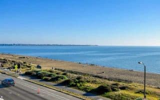
Iron Horse Regional Trail. This paved multi-use trail is the best longer distance off-road running option in San Ramon. The rail trail runs for nearly 30 miles between Pleasanton and Concord, passing through two counties and nine communities. The heart of the trail runs through the center of San Ramon, roughly paralleling I-680. The landscape is a mix: residential, parks, open spaces, and some industrial sections. This TRAIL MAP has lots of information access, parking, and mileage distances.
Trail Running
There are numerous open spaces in the hills in San Ramon that offer scenic, hilly trail running.
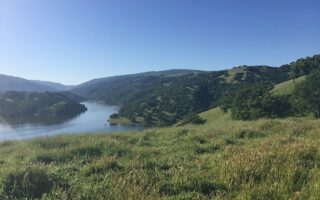
Sycamore Valley Open Space. Scenic, hilly trail running in this 600+ acre space that occupies two major ridges located within a region of rolling hills and valleys south of Mt. Diablo. Elevations range from about 600 to 1,000 feet. There are sections north and south of Camino Tassajara, and a park at the west end. TRAIL MAP
Bishop Ranch Open Space. This 806-acre park open space is just south of San Ramon on the west side of I-680. The smaller of the ‘open space’ areas in San Ramon, with ~2-3 miles of trails. TRAIL MAP
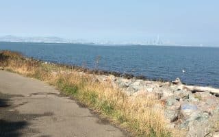
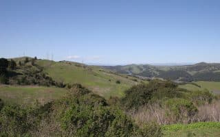
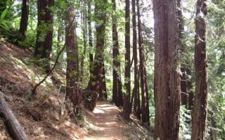
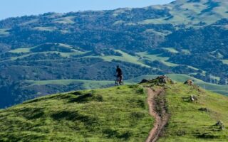
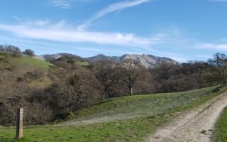
Las Trampas Wilderness Regional Preserve. This 5,800-acre preserve is our favorite trail running option in the San Ramon area. Located north of town on the west side of I-680. There’s a large variety of trails, ranging from easy to challenging trail running. There are some fantastic views. The easiest for running are located near the Bollinger Entrance: Bollinger Creek Loop Trail and the Rocky Ridge View Trail. TRAIL MAP
San Ramon is a city of 80,000 in the East Bay suburbs. The best options for running in San Ramon are the Iron Horse Regional Trail, and trail running in several open spaces in the hills outside town. See also our running options for nearby cities: Pleasanton, Livermore, & Walnut Creek.
Multi-Use Trails
Iron Horse Regional Trail. This paved multi-use trail is the best longer distance off-road running option in San Ramon. The rail trail runs for nearly 30 miles between Pleasanton and Concord, passing through two counties and nine communities. The heart of the trail runs through the center of San Ramon, roughly paralleling I-680. The landscape is a mix: residential, parks, open spaces, and some industrial sections. This TRAIL MAP has lots of information access, parking, and mileage distances.
Trail Running
There are numerous open spaces in the hills in San Ramon that offer scenic, hilly trail running.
Sycamore Valley Open Space. Scenic, hilly trail running in this 600+ acre space that occupies two major ridges located within a region of rolling hills and valleys south of Mt. Diablo. Elevations range from about 600 to 1,000 feet. There are sections north and south of Camino Tassajara, and a park at the west end. TRAIL MAP
Bishop Ranch Open Space. This 806-acre park open space is just south of San Ramon on the west side of I-680. The smaller of the ‘open space’ areas in San Ramon, with ~2-3 miles of trails. TRAIL MAP
Las Trampas Wilderness Regional Preserve. This 5,800-acre preserve is our favorite trail running option in the San Ramon area. Located north of town on the west side of I-680. There’s a large variety of trails, ranging from easy to challenging trail running. There are some fantastic views. The easiest for running are located near the Bollinger Entrance: Bollinger Creek Loop Trail and the Rocky Ridge View Trail. TRAIL MAP


Review or Comment on This Route/Share a Photo!
Share your feedback on this route and see that of other Great Runs users. Click on the image icon to upload a photo. And please let us know if there are notes or changes we should incorporate!