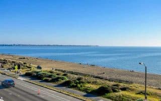
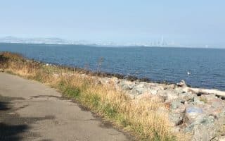
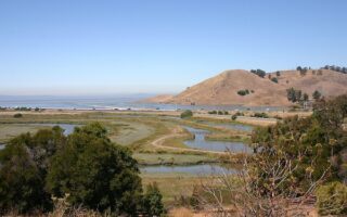
Walnut Creek is a city of 780,000 in the East Bay suburbs, located 16 miles east of Oakland. There are some good options for running in Walnut Creek, including several longer distance multi-use trails, scenic open spaces in the surrounding hills. Our guide includes Concord and Martinez up to the Carquinez Strait, which includes scenic running at Radke Martinez Regional Shoreline Park.
Multi-Use Trails
Iron Horse Regional Trail. The Walnut Creek section of this paved, 30-mile multi-use trail runs to the east of I-680. From Walnut Creek, head north for up to 7 mile to Concord or south toward Alamo & San Ramon. The landscape is a mix: residential, parks, open spaces, and some industrial sections. TRAIL MAP
Contra Costa Canal Trail. This paved, horseshoe shaped trail meanders along the Contra Costa Canal. The trail intercepts a number of local parks in Pleasant Hill, Walnut Creek, and Concord. Using Heather Farm Park as an anchor, head northeast for up to 6 miles past the Lime Ridge Preserve to Concord, where the trail ends near Willow Pass Community Park, or northwest for up to 7 miles to Muir Rd., just past the Contra Costa Golf Club. TRAIL MAP
Briones-to-Mt. Diablo Trail. A short trail but a climb! Just west of Walnut Creek, this trail runs south from Geary Rd., through Larkey Park to Briones Regional Park, climbing 500 feet over 2.1 miles. The first half is paved. At Geary Rd., connection to the Contra Costa Canal Trail. ROUTE MAP
Trail Running
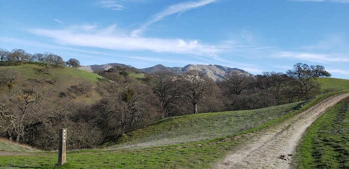
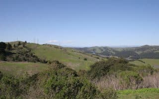
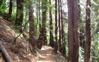
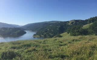
Briones Regional Park. Wonderful trail running in this 6,200-acre park in the Alhambra Valley northwest of Walnut Creek. Many miles of trials traversing rolling, grassy hills and secluded, shady canyons, Considering its proximity to major population areas, there can be an almost wilderness feel. The Lafayette Staging area is closest to Walnut Creek. The park stretches north to Martinez. TRAIL MAP
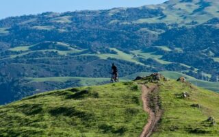
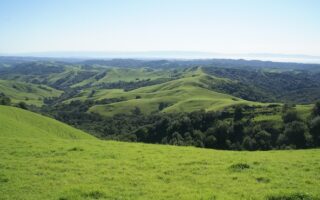
Shell Ridge Open Space & Diablo Foothills Regional Park. These adjacent areas offer miles of scenic trail running in the foothills of Mount Diablo. The 1,060 acres of Diablo Foothills feature scenic trails through rolling grasslands, with great views of San Francisco Bay. TRAIL MAP The 1,400-acre Shell Ridge Open Space features 31 miles of trails along ridge tops, creek ways, and hillsides.
Mount Diablo State Park is a major destination for hiking, mountain biking, and trail running. Trails here are generally quite challenging.
Walnut Creek is a city of 780,000 in the East Bay suburbs, located 16 miles east of Oakland. There are some good options for running in Walnut Creek, including several longer distance multi-use trails, scenic open spaces in the surrounding hills. Our guide includes Concord and Martinez up to the Carquinez Strait, which includes scenic running at Radke Martinez Regional Shoreline Park.
Multi-Use Trails
Iron Horse Regional Trail. The Walnut Creek section of this paved, 30-mile multi-use trail runs to the east of I-680. From Walnut Creek, head north for up to 7 mile to Concord or south toward Alamo & San Ramon. The landscape is a mix: residential, parks, open spaces, and some industrial sections. TRAIL MAP
Contra Costa Canal Trail. This paved, horseshoe shaped trail meanders along the Contra Costa Canal. The trail intercepts a number of local parks in Pleasant Hill, Walnut Creek, and Concord. Using Heather Farm Park as an anchor, head northeast for up to 6 miles past the Lime Ridge Preserve to Concord, where the trail ends near Willow Pass Community Park, or northwest for up to 7 miles to Muir Rd., just past the Contra Costa Golf Club. TRAIL MAP
Briones-to-Mt. Diablo Trail. A short trail but a climb! Just west of Walnut Creek, this trail runs south from Geary Rd., through Larkey Park to Briones Regional Park, climbing 500 feet over 2.1 miles. The first half is paved. At Geary Rd., connection to the Contra Costa Canal Trail. ROUTE MAP
Trail Running
Briones Regional Park. Wonderful trail running in this 6,200-acre park in the Alhambra Valley northwest of Walnut Creek. Many miles of trials traversing rolling, grassy hills and secluded, shady canyons, Considering its proximity to major population areas, there can be an almost wilderness feel. The Lafayette Staging area is closest to Walnut Creek. The park stretches north to Martinez. TRAIL MAP
Shell Ridge Open Space & Diablo Foothills Regional Park. These adjacent areas offer miles of scenic trail running in the foothills of Mount Diablo. The 1,060 acres of Diablo Foothills feature scenic trails through rolling grasslands, with great views of San Francisco Bay. TRAIL MAP The 1,400-acre Shell Ridge Open Space features 31 miles of trails along ridge tops, creek ways, and hillsides.
Mount Diablo State Park is a major destination for hiking, mountain biking, and trail running. Trails here are generally quite challenging.


Review or Comment on This Route/Share a Photo!
Share your feedback on this route and see that of other Great Runs users. Click on the image icon to upload a photo. And please let us know if there are notes or changes we should incorporate!