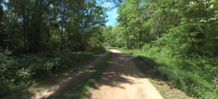
The North Oconee River Greenway is the centerpiece of running in Athens. The mainly paved multi-use path follows the North Oconee River for ~6 miles, from the Sandy Creek Nature Center south to the College Station Rd. across from the University of Georgia campus. The scenery is a mix of open and wooded terrain, with some glimpses of the river — especially in winter. It’s a good shade option on a hot day!
Starting at the Sandy Creek Nature Center, head south. There are a couple miles of wooded trails at the Nature Center if you’d like to add. At mile 1.7, there’s a brief on-road section and then the trail follows the west side of the river for 1.2 miles. The trail passes just east of downtown (Broad St. access) at about the midway point. You’re also just east of the UGA campus for the southern half of the trail. At Mile 3, intersect with the Firefly Trail. The southern ~2 miles is a mix of wooded recreation areas and some eastern sections of the UGA infrastructure.
Add-Ons: Additional trails at Sandy Creek Nature Center, or pick up the southern end of Cook’s Trail into Sandy Creek Park; Firefly Trail (paved multi-use path that heads east for 2.5 miles toward Athens-Ben Epps Airport); UGA Campus (just west of the Greenway). There’s also a 1/2 mile spur of the Greenway along MLK Pkwy and a 3/4 mile spur along Athens Perimeter.


Review or Comment on This Route/Share a Photo!
Share your feedback on this route and see that of other Great Runs users. Click on the image icon to upload a photo. And please let us know if there are notes or changes we should incorporate!