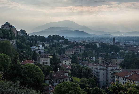
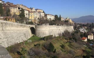
Those looking for a run in Bergamo will want to sample some of the trails in the 4,700 acre Parco dei Colli di Bergamo. Technically, the city of Bergamo is located within the park, but the heart of the park’s trails are located in the hills just north of the city. It’s an extensive, park, with many km of trails, ranging from open views and panoramas to wooded terrain to hill climbs. It’s hilly terrain, as the park ranges from 244m to 1144m. There’s something for everyone here, from easier running on a cycle path to more challenging routes that are popular for hiking. Your best bet is to pick up a map of the park. This TRAIL MAP provides a good overview, and this web site has a good overview of some of the trail options. The trails are numbered, with helps with navigation. Note that most of the trails are hilly. For the easier running, look for the routes on the website that say ‘cycle-pedestrian route’. More moderate are ‘trails in the hills’ and very challenging are ‘trails in the mountains’. A few recommendations (see the trail map for details):
- Bike Path (Pisto Ciclopedonale del Parco). This runs for ~6 km between via Castagneta and Paladina.
- Colle di Ranica Ring-route. Trail 606. 2.9 km, 42m gain. Good panorama and easy footing.
- Gaito (Torre Boldone) – San Rocco (Ponteranica). Trail 407. 2.2 km, 23m gain. One of the nicer, easier trails in the woods.
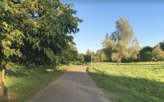
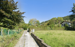
- Ciclostazione dei Colli – Sombreno or Madonna della Castagna. 8km out and back, fairly flat. This bike/pedestrian route is one of the easiest runs in the park, following a mainly dirt path with good footing and not too hilly. Much of the route is on the Via al Mulino.
Those looking for a run in Bergamo will want to sample some of the trails in the 4,700 acre Parco dei Colli di Bergamo. Technically, the city of Bergamo is located within the park, but the heart of the park’s trails are located in the hills just north of the city. It’s an extensive, park, with many km of trails, ranging from open views and panoramas to wooded terrain to hill climbs. It’s hilly terrain, as the park ranges from 244m to 1144m. There’s something for everyone here, from easier running on a cycle path to more challenging routes that are popular for hiking. Your best bet is to pick up a map of the park. This TRAIL MAP provides a good overview, and this web site has a good overview of some of the trail options. The trails are numbered, with helps with navigation. Note that most of the trails are hilly. For the easier running, look for the routes on the website that say ‘cycle-pedestrian route’. More moderate are ‘trails in the hills’ and very challenging are ‘trails in the mountains’. A few recommendations (see the trail map for details):
- Bike Path (Pisto Ciclopedonale del Parco). This runs for ~6 km between via Castagneta and Paladina.
- Colle di Ranica Ring-route. Trail 606. 2.9 km, 42m gain. Good panorama and easy footing.
- Gaito (Torre Boldone) – San Rocco (Ponteranica). Trail 407. 2.2 km, 23m gain. One of the nicer, easier trails in the woods.
- Ciclostazione dei Colli – Sombreno or Madonna della Castagna. 8km out and back, fairly flat. This bike/pedestrian route is one of the easiest runs in the park, following a mainly dirt path with good footing and not too hilly. Much of the route is on the Via al Mulino.

Review or Comment on This Route/Share a Photo!
Share your feedback on this route and see that of other Great Runs users. Click on the image icon to upload a photo. And please let us know if there are notes or changes we should incorporate!