
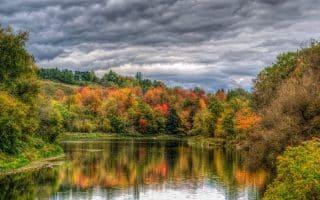
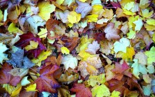
Fall in Vermont is like no other. The rolling green mountainsides are transformed into a vibrant red, yellow, and orange wonderland, where the hills quite literally come alive with leaf peepers eager for their own glimpse of this autumnal view. From more than 100 Great Runs running routes in Vermont, we’ve chosen our favorites for fall. Click here for a list of all Vermont routes. Those tagged with the ‘foliage‘ category are especially wonderful in fall.
When is the Peak Foliage in Vermont?
Foliage peaks anywhere from late September to mid-October — earliest in northern Vermont and where there is more elevation. This fall foliage map is a very helpful resource. Use the slider bar to see peak forecasts by region. There are numerous other annual resources for more specific foliage forecasts, by region.
How Did We Choose This List?
The Great Runs list of the 20 Best Fall Foliage Runs in Vermont is not a ranked list, but rather a selection of routes across the state, with particular attention to popular locations and trails/roads with great leaf views. Any roads we selected are safe for running, and the trails we choose are for the everyday runner — not technical or challenging trail running.
Burlington Area
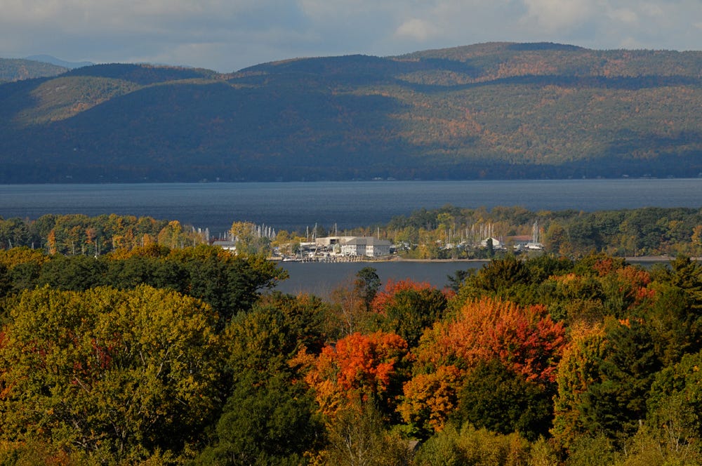
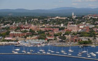
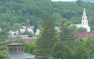
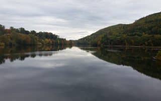
Burlington: Island Line Trail. This gorgeous waterfront trail is the signature running spot in Burlington, stringing together several shoreline parks, with great views of Lake Champlain and the Adirondacks. A Unique marble causeway over the lake at the northern end is unique and has great views. A seasonal bike ferry run by Local Motion is located at the end of the causeway and brings travelers over to South Hero. Full Route…
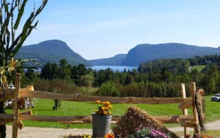
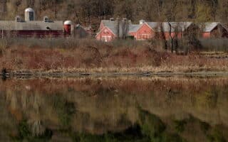
Shelburne: Shelburne Farms. A 1400-acre working farm 7 miles south of Burlington, Shelburne Farms is a National Historic Landmark with stunning waterfront views. For runners, there are more than 10 miles of walking trails that are open year-round. There are wonderful open views. Note: Admission might be required. FULL ROUTE…
Williston: Blue Trail, Catamount Outdoor Family Center. With over 20 miles of trails and loops ranging from 5k to 15k, the Catamount Outdoor Family Center is ideal for any skill level. The property is situated on two hills, making way for panoramic views of the Green Mountains and the Winooski River Valley in the East and the Adirondacks and Lake Champlain in the West. Local Tip: Stop at Adams Apple Orchard on Old Stage Road in Williston for an apple cider slushy on the way home! FULL ROUTE…
Northern Vermont Area
Richford: North Branch Loop, Missiquoi Valley Rail Trail,
You can’t visit Vermont without seeing some cows! Choose a section of this rail trail that runs for 26 miles between St. Albans and Richford, winding northeast to Richford, providing direct access to old Vermont Dairy country. The route passes through Richford’s village center, over some moderate hills, and follows along the river. The gentle terrain makes running a breeze while enjoying postcard images of rural farms, leaf-strewn woods, and rolling fields. Full information on trail
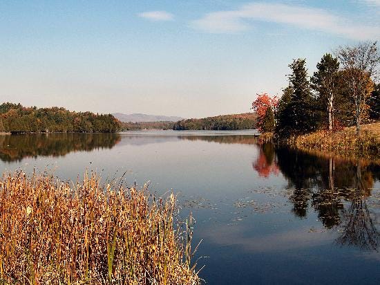
Lake Willoughby: Rt. 5A along the east side of Lake Willoughby is gorgeous for running, with lake views and beautiful colors in fall. It’s 5.1 miles of rolling hills between Lake Willoughby North Beach and Lake Willoughby South Beach. The best lake views are at the southern end. Full Route…
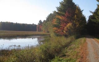
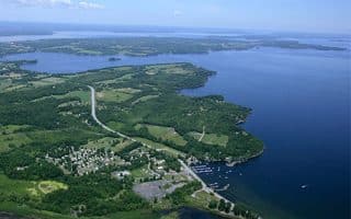
Newport Bike Path. A lovely, flat, nearly all off-road run in Newport, a small Northeast Kingdom city located on the southern shore of beautiful Lake Memphramagog. Beautiful lake & mountain views, farm fields, and 3.8 mile Beebe Spur Rail Trail that leads to the Canadian border. Full route…
Craftsbury: Hosmer Pond. The Craftsbury Outdoor center is a legendary center for X-C skiing, mountain biking, sailing, rowing…and running! The Center is home to the highly rated Craftsbury Running Camp. There are many km of trails at the center, some flat, others hilly, some open, others wooded. We’ve put together a route that starts at the Center and is a dirt road tour of three ponds. There are many other trails for running. FULL ROUTE...
Stowe/Waterbury Area
Stowe is one of the more visited areas in Vermont. It’s beautiful in all seasons!
Stowe: Stowe Recreation Path. This is a popular paved trail that winds its way along but away from the Mountain Road in Stowe, meandering along West Branch River, over numerous purpose-built bridges, past beautiful farms and through some enchanting wooded sections. Up to 5.4 miles one-way. Full Route…
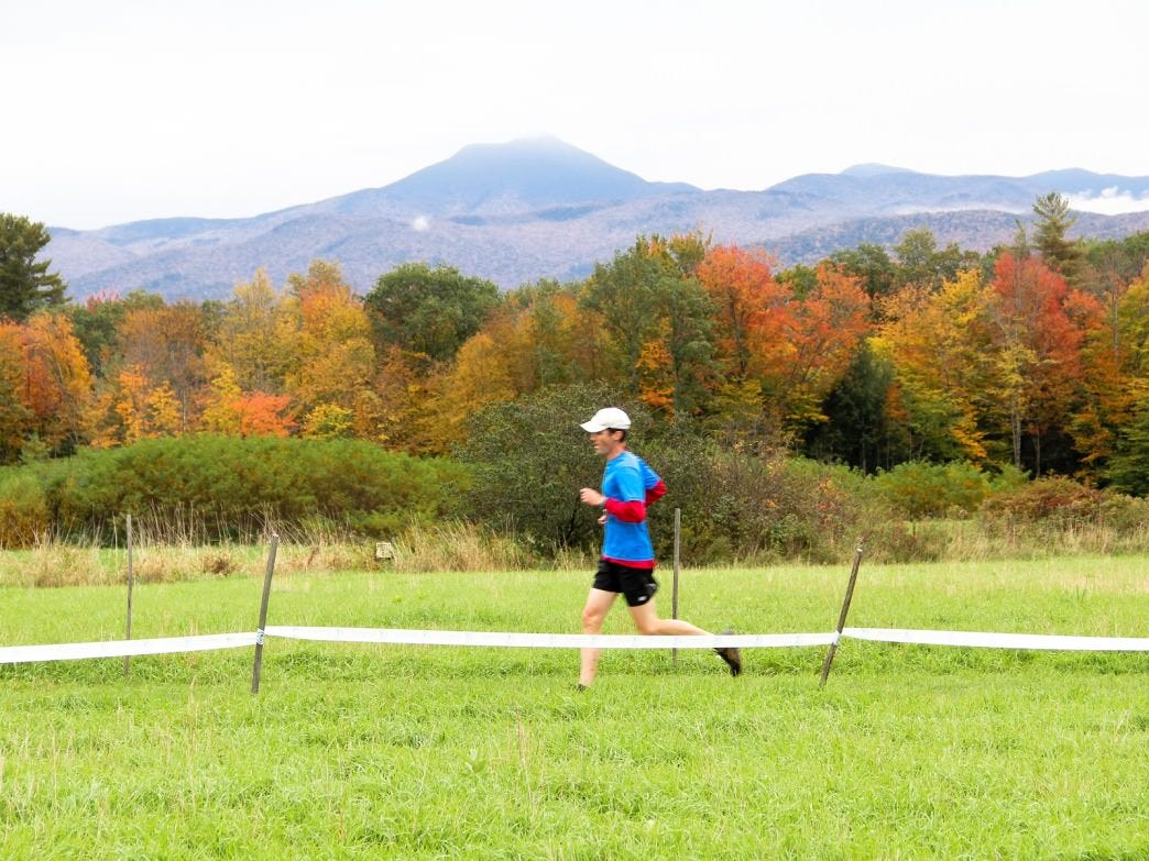
Stowe: Trapp Family Lodge Trails. A famous Vermont landmark, owned by the Trapp family of Sound and Music fame. The lodge is set about 1,000 feet up, with great views of mountains all around. Famous as a X-C skiing center in the winter, Trapps features 30km+ of trails and many other backcountry opportunities. In fall, the trails are a mountain biking, trail running, and biking haven, with gorgeous views and colors.
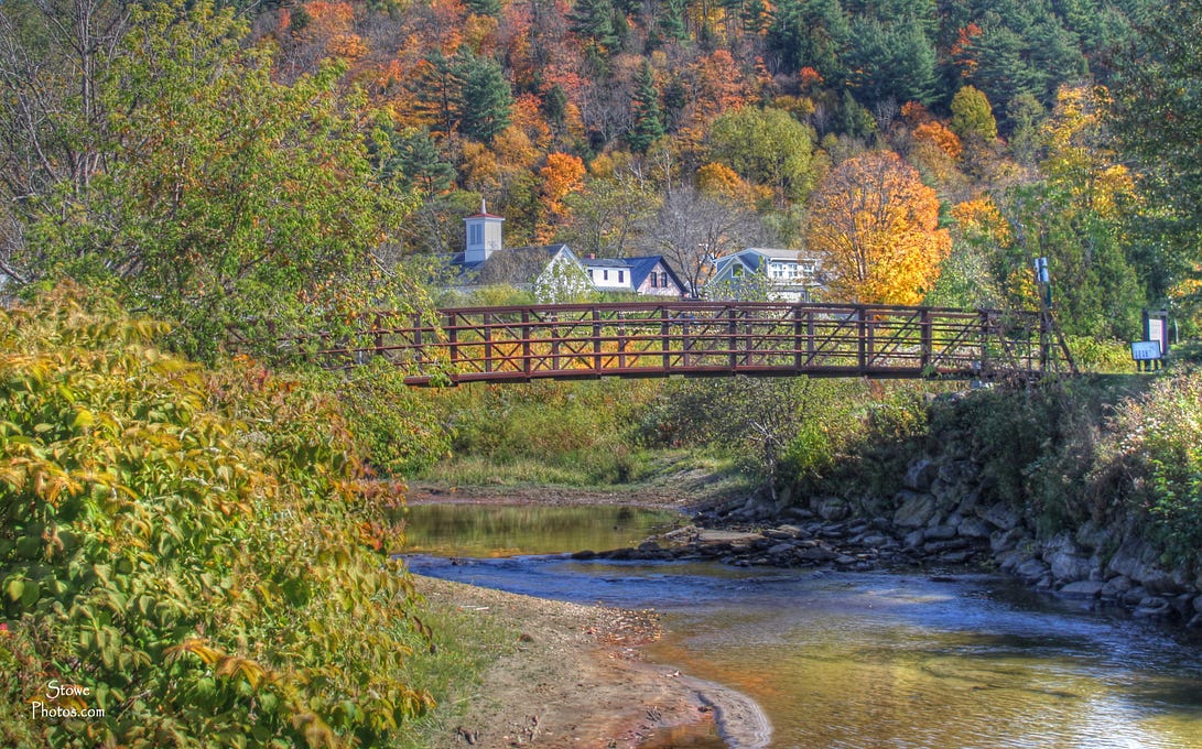
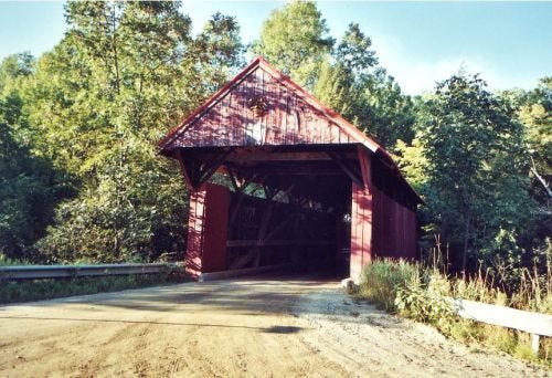
Stowe: Covered Bridge Run & Mud City Loop. We’ve put together two beautiful loops on Stowe’s back roads that make for some beautiful fall running. A combination of farms, meadows, woods, and covered bridges. Stowe Routes…
Lamoille Valley Rail Trail: Morrisville to Cambridge. This Gorgeous multi-use trail that runs for 15.8 miles between Morrisville and Cambridge. Flat, smooth gravel surface with gorgeous mountain views, alternating between woods and open farm fields. Full route…
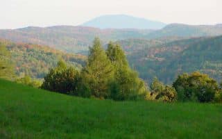
Groton State Forest Area. East of Barre/Montpelier, there are quiet roads around this 26,000-acre forest, and around the Cabot area. Some trails in the forest as well. A nice option in fall, Route information.
Central Vermont Area
Middlebury Running. Middlebury is a beautiful college campus in an idyllic college town. There is wonderful running around the campus and in the surrounding area. We have routes for The Trail Around Middlebury (TAM), the Jackson Trail, and the Middlebury College Trails. Full routes…
Rutland: Carriage Road Trail. The Carriage Trail is the site of the annual Leaf Chase 10K, making it a prime autumnal destination. It is located in Pine Hill Park, a revitalized alpine ski area turned into a beautiful 16-mile system of public trails. The Carriage Trail is marked with royal blue blazes. This route is a perfect mix of challenging slopes and easy, flat rambles. Route Information…
Southern Vermont Area
Woodstock/Billings Farm Tour. This loop is a tour of the charming town of Woodstock, which is a popular visitors’ destination not far from the New Hampshire border. Our route starts at the Billings Farm & Museum, billed as a gateway to Vermont’s rural heritage and one of the finest operating dairy farms in America. You’ll pass by the Ottauquchee River and through the center of town, which has a very pretty main street with quaint shops and restaurants. Once outside the town, enjoy lovely back roads with farmland, foliage, and a few hills. Full route… Another great fall run Woodstock is Marsh-Billings-Rockefeller National Park [map overview]. A 2.5 mile out-and-back leads to a beautiful clearing where you can view the Ottauquechee River Valley, the Billings Farm and Museum, and Mount Tom. For a more challenging run, the Mount Peg Summit Hike [map found here] is definitely worth the initial climb…but it evens out after a bit!
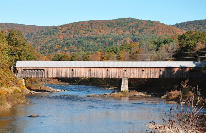
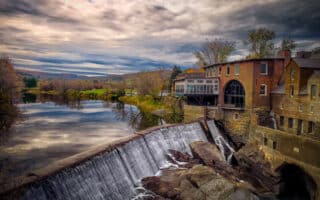
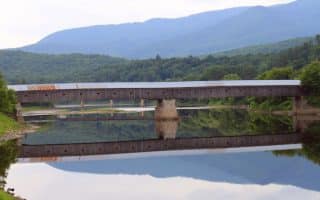
Windsor: Covered Bridge and Brewery Run. Other than the signing of Vermont’s constitution, this tiny town on the Connecticut River near the Vermont/New Hampshire border is notable for the long covered bridge that spans the river, and the home of New England’s beloved Harpoon Brewery. These staples of Windsor combine to form the course of Harpoon’s Octoberfest Road Race, a scenic tour of this Eastern Vermont township. The race takes place during prime leaf viewing in early October, but you can do a modified version of the course in any season. If you want to cross the bridge, be very careful. It’s wide enough for two cars, but there is no sidewalk so plan your crossing for a time of minimal traffic. Full route…
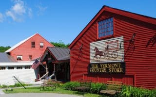
Weston Town Center. Weston is an impossibly cute town in south central Vermont. With a barn red country store, a classical playhouse, mill buildings, and a picturesque central gazebo, it’s architecture and charm rival Gilmore Girls’ fictional New England hamlet of Stars Hollow. Route 100, on which the town is located, is an awesome scenic drive for leaf peeping, but the sheer beauty of Weston will make you want to get out and do a quick run. This area is fairly rural, so it’s hard to map a specific route given all the back roads, but a run up and down the main strip will cure your craving for rural Vermont beauty. Full route…
Bennington: Woodford State Park. The highest elevation campground in Vermont makes Woodford State Park the perfect location for catching unparalleled views of the rich foliage. Just a short drive from Bennington, this trail encircles the Adams Reservoir. This is an amazing place for viewing wildlife too, as it borders the George Aiken Wilderness Area. Full route…
Brattleboro: West River Trail. A lovely trail long the West River with continuous views of the vibrant, golden Vermont hills. There’s an upper section and a lower section. Full Route…
Manchester: Equinox Preservation Trust. A primo spot in southern Vermont for foliage viewing and running! The Trust features 914 acres of woodlands with trails ranging from easy to challenging. For scenery but a true challenge, the Blue Summit Trail winds to the top of Equinox Mountain. Full route…

Review or Comment on This Route/Share a Photo!
Share your feedback on this route and see that of other Great Runs users. Click on the image icon to upload a photo. And please let us know if there are notes or changes we should incorporate!