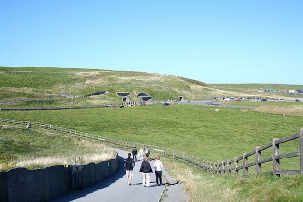
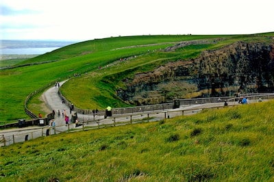
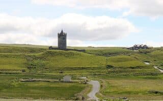
Running the Cliffs of Moher path will make for a memorable running experience. The Cliffs of Moher tower over the rugged west Clare coast and feature a series of pathways atop the cliffs, with spectacular vistas over the Atlantic Ocean and the Aran Islands. Among the thousands of miles of clifftop paths in Ireland, this one is among the most runnable: good surface, and not too hilly! The combination paved and gravel path runs for nearly 7 miles, from near Doonagore Castle in the north to the Moher Tower at Hag’s Head in the south. The surface is good and there are great views the whole way. There’s really only one major hill — at the northern end, a 440-foot rise between miles 1 and 3, average grade 3.8% — and a couple of narrow sections. Major sites are O’Brien’s Tower and Hag’s Head.
CC: Joseph Mischyshyn
A good option is to start at the Visitor Center (parking, facilities), and run south for 5 km to Hag’s Head, making for a relatively flat, nearly 6 mile out and back run on a good surface. From the Visitor Center north to Doolin is 8 km.
Note: the area is open and exposed — can be windy & wet!
Scroll Down For Route Maps
Essentials
6.9 miles (11 km) one-way
895 feet (273m) one-way, north to south -- most of the hillss are between miles 1 and 3
Visitor Center is a good spot to start. North end: near Doonagore Castle; South End: Hag's Head
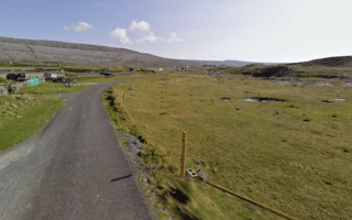
A nice running alternative in the Cliffs of Moher area. From Doolin, choose a section of the Burren Way -- either a coastal section or an inland path passing through numerous farms and small settlements.
Our recommendations for the safest and most scenic roads for running in the Cliffs of Moher area. Lots of nice side roads off the R477 that are scenic country lanes passing through the Burren and area farms and settlements.
Share your feedback on this route and see that of other Great Runs users. Click on the image icon to upload a photo. And please let us know if there are notes or changes we should incorporate!
Subscribe
0 Comments
Oldest
Newest
Inline Feedbacks
View all comments
Essentials
6.9 miles (11 km) one-way
895 feet (273m) one-way, north to south -- most of the hillss are between miles 1 and 3
Visitor Center is a good spot to start. North end: near Doonagore Castle; South End: Hag's Head
Review or Comment on This Route/Share a Photo!
Share your feedback on this route and see that of other Great Runs users. Click on the image icon to upload a photo. And please let us know if there are notes or changes we should incorporate!