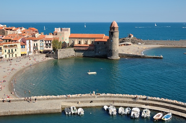
This route in Coulliore is one of the most varied and scenic runs along the Vermilion Coast, combining a historic castle, lighthouse, and waterside road. Coulliore is a Mediterranean coastal town known for the medieval Château Royal de Collioure, Notre-Dame-des-Anges Church, and hilltop Fort Saint Elme.
Our main route is 5.5 km. Start in the area of the Royal Castle of Collioure (Château royal de Collioure) and head north for 1.2 km along the the waterfront path. There are great views of the water on one side and the castle walls on the other (note: lit at night). You’ll reach the Église Notre-Dame-des-Anges — a spectacular waterfront church — and lighthouse at the end of a narrow, stone-surfaced jetty path.
Collioure Jetty. Google Street View
Retrace your steps, and then head south for 1.6 km on the waterfront road (Rte de Port-Vendres). The road climbs 30m, and features nice views of the water from above, and of the well-known windmill (Moulin de Coullioure). . There’s a good sidewalk. We turn around at the Plage des Batteries, where the road turns inland.
Toward the south end you can do a ~0.6 km loop around the scenic Jardin Pams.
Run to Fort Saint Elme
If you’d like to get the heart rate up, take the road/path to the hilltop Fort Saint Elme, the star-shaped fortress that dates to 1552. From the Rte de Port-Vendres, take the Cami del Port de Sant Telm, which passes by the Moulin (windmill) and then climbs 147m over 1.3 km to the Fort. You’ll be rewarded with great views. Note: Hilly!
Scroll Down For Route Maps
Essentials
5.5 km (3.4 miles); Fort Saint Elme add-on is 1.3 km (one-way)
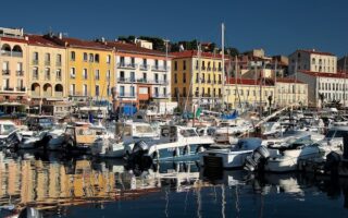
Scenic waterfront run in Port-Vendres, a typical Mediterranean fishing port on the Côte Vermeille near the spanish border. The 6.5 km route follows the scenic marina, and then a waterfront road out to a unique metallic lighthouse. Can combine with our Collioure route.
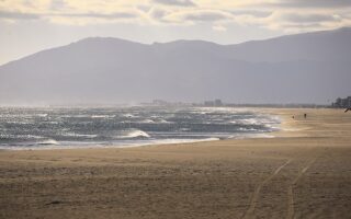
Argelès-sur-Mer is a bustling coastal town located 25 km south of Perpignan, known for its beautiful beaches. The 3.5 km waterfront promenade (Promenade du Front de Mer) features great beach & water views. Add with a jaunt out to the lighthouse.
Terrific running in Saint-Cyprien, a coastal town known for its wide, sandy beach. Run a 5 km waterfront promenade (Baladoir de Saint-Cyprien plage), and then another 3 km on scenic paths around the port/marina, with nice views of the water, boats, & waterfront homes.
Canet-en-Roussillon is the closest coastal area to Perpingnan. There's a scenic 3.3 km promenade alongside the wide, sandy beach. Add on with the paved jetty path out to the lighthouse. Festive scene, nice beach & water views.
A nice run in Le Barcarès, a small coastal town on the Mediterranean east of Perpignan. Up to 8 km one-way, combining waterfront promenades, a marina, and a pine forest.
Share your feedback on this route and see that of other Great Runs users. Click on the image icon to upload a photo. And please let us know if there are notes or changes we should incorporate!
Subscribe
0 Comments
Oldest
Newest
Inline Feedbacks
View all comments
Essentials
5.5 km (3.4 miles); Fort Saint Elme add-on is 1.3 km (one-way)

Review or Comment on This Route/Share a Photo!
Share your feedback on this route and see that of other Great Runs users. Click on the image icon to upload a photo. And please let us know if there are notes or changes we should incorporate!