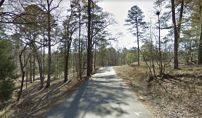
Flat Rock Park in northeast Columbus offers a variety of options for runners. There’s a paved park perimeter road that loops for 2.2 miles around the park’s perimeter. Good for some laps! The terrain is mainly a combination of open and wooded. The park also has some interior wooded trails and fields that are good for trail running. Be sure to check out the rocky area around Flat Rock Creek. These trails are also popular with mountain bikers, so keep an eye out!
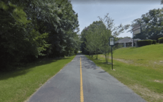
Longer Run: the Fall Line Trace multi-use path skirts the southern end of Flat Rock Park, and heads for 2 miles to Midland or 9 miles to uptown Columbus.
Flat Rock Park in northeast Columbus offers a variety of options for runners. There’s a paved park perimeter road that loops for 2.2 miles around the park’s perimeter. Good for some laps! The terrain is mainly a combination of open and wooded. The park also has some interior wooded trails and fields that are good for trail running. Be sure to check out the rocky area around Flat Rock Creek. These trails are also popular with mountain bikers, so keep an eye out!
Longer Run: the Fall Line Trace multi-use path skirts the southern end of Flat Rock Park, and heads for 2 miles to Midland or 9 miles to uptown Columbus.


Review or Comment on This Route/Share a Photo!
Share your feedback on this route and see that of other Great Runs users. Click on the image icon to upload a photo. And please let us know if there are notes or changes we should incorporate!