Amager is Denmark’s most densely populated island, revered for its sleek architecture, water sports & beaches. We’ve mapped two good waterfront routes on Amager.
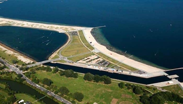
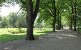
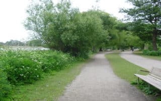
East Side: Amager Strandpark. This area is along the promenade of a 4 km sandy man-made beach on an island, with a lagoon, and several opportunities for swimming & water sports. Start at the Amager Strand metro stop. Cross a small pedestrian bridge over to the island. Take a left to run along the paved promenade, to the tip of the island, about 1 mile. The Amager Hegoland is a public swimming area. Return along the boardwalk, continuing past the pedestrian bridge to Amager Strandpark, where the beach-side promenade begins. Continue along here for about 1 km, then cross a bridge over the water and turn right, making the return to the start by keeping the Tiøren park on your left and canal on your right. A nice detour is Kastrup Sea Baths, a public swimming pool. The final km is along the Amager Strandvej, which as a separated path for running/walking.
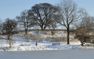
West Side: Kalvebod Fælled &Vestlige fugletårn. On the west side of Amager, there’s very scenic running in the Kalvebod Fælled nature preserve. A highlight is the nearly 11 km of scenic waterfront running along the bay separating Amager & Zealand islands. The path, called Vestlige fugletårn in parts starts just west of the Royal Golf Center, and heads south for several km to a numerous scenic spots and a bird watching area. ROUTE MAP
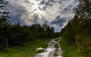
There are also several km of interior paths around the wetlands of the nature preserve. Create your own route here! You can connect to those paths from the western waterfront route at Byskoven, Øen i Birkedam, and at the southern end of the path around Ullerupdiget.
Amager is Denmark’s most densely populated island, revered for its sleek architecture, water sports & beaches. We’ve mapped two good waterfront routes on Amager.
East Side: Amager Strandpark. This area is along the promenade of a 4 km sandy man-made beach on an island, with a lagoon, and several opportunities for swimming & water sports. Start at the Amager Strand metro stop. Cross a small pedestrian bridge over to the island. Take a left to run along the paved promenade, to the tip of the island, about 1 mile. The Amager Hegoland is a public swimming area. Return along the boardwalk, continuing past the pedestrian bridge to Amager Strandpark, where the beach-side promenade begins. Continue along here for about 1 km, then cross a bridge over the water and turn right, making the return to the start by keeping the Tiøren park on your left and canal on your right. A nice detour is Kastrup Sea Baths, a public swimming pool. The final km is along the Amager Strandvej, which as a separated path for running/walking.
West Side: Kalvebod Fælled &Vestlige fugletårn. On the west side of Amager, there’s very scenic running in the Kalvebod Fælled nature preserve. A highlight is the nearly 11 km of scenic waterfront running along the bay separating Amager & Zealand islands. The path, called Vestlige fugletårn in parts starts just west of the Royal Golf Center, and heads south for several km to a numerous scenic spots and a bird watching area. ROUTE MAP
There are also several km of interior paths around the wetlands of the nature preserve. Create your own route here! You can connect to those paths from the western waterfront route at Byskoven, Øen i Birkedam, and at the southern end of the path around Ullerupdiget.
Scroll Down For Route Maps
Essentials
Amager Strandpark is 6 km (3.8 miles); Western end waterfront path is up to 11 km one-way
Flat
Strandpark: Amager Strand St. Metro Station; for West end paths, choose a start point.
Our Copenhagen 'runseeing' tour of Copenhagen's key sights: the main shopping district, along the old harbor, past the royal palace, through the old fort, several parks and palace gardens, and the university neighborhood.
One of the most popular places for running in Copenhagen. 4 miles of running along the water on dedicated paths, centrally located. Easy to vary with bridge crossings and parks nearby.
A fantastic waterfront and fortress combo run. Enjoy the Nyhavn, the 17th-century waterfront, canal and entertainment district with its colorful townhouses, and then the 2.5k loop around the wonderfully preserved Kastellet.
A 7k tour of Copenhagen's centrally located parks, connected by bridges and the Lakes trail. Includes Østre Anlæg, Fredens Park, Amor Park, and Fælledparken. Add on by doing more of the Lakes path.
Two gorgeous and adjoining parks, about 4km from the central city. There are landscaped grounds, great lawns, palaces, cisterns, lakes, and winding, wooded paths. Can easily put together a few km of running in these parks.
Centrally located park, with great paths for walking and running. It's about 3.5k around the perimeter paths. Great to combine with Lakes paths, and the Østre Anlæg park just to the south.
This is a great run in two adjoining neighborhoods, just over the bridge from Nyhavn. Enjoy running the ramparts, along the water and into the funky Freetown Christiana neighborhood, and around the Opera House.
Former military site is now a park, with 25+ km of trials around woods, meadows, wetlands, and small lakes. There's also a 10 km paved path along Køge Bay. Amager Fælled is also home to a weekly Parkrun.
A series of three lakes 6 miles north of Copenhagen, easily reachable by S-Bahn. Wonderful combination of water views and wooded trails. A run around all the lakes is 5.5 miles.
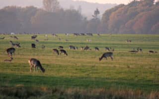
A forest park & UNESCO World Heritage Site 15km from Copenhagen, easily reachable by train. There are 1,000 acres of trails with ancient oak trees, and large populations of red and fallow deer.
In the southwestern part of Copenhagen, 20+ km of scenic paths near the Arken Museum and the Kalvebod Fælled Nature Preserve. Paths feature grasslands and some great water views.
Share your feedback on this route and see that of other Great Runs users. Click on the image icon to upload a photo. And please let us know if there are notes or changes we should incorporate!
Subscribe
0 Comments
Oldest
Newest
Inline Feedbacks
View all comments
Essentials
Amager Strandpark is 6 km (3.8 miles); Western end waterfront path is up to 11 km one-way
Flat
Strandpark: Amager Strand St. Metro Station; for West end paths, choose a start point.


Review or Comment on This Route/Share a Photo!
Share your feedback on this route and see that of other Great Runs users. Click on the image icon to upload a photo. And please let us know if there are notes or changes we should incorporate!