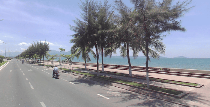
The road along Da Nang Bay is a great spot for a long, scenic run in Da Nang. A paved path parallels Nguyễn Tất Thành road for nearly 9 km, curling around the bay. There are great views of the water, with mountains in the distance. The relatively new path is palm-lined in sections. A beach lines the bay and is also runnable — but not quite as much so as My Khe Beach.
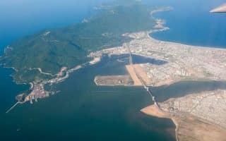
The easternmost section of the path and the area closest to central Da Nang starts in the Thanh Khê District, just north of the airport. One can run up to 8.8 km northwest to the end of the bay/Nguyễn Tất Thành road. The widest, most runnable beach section is Nam Ô Beach, toward the northwestern end of the route.
The road along Da Nang Bay is a great spot for a long, scenic run in Da Nang. A paved path parallels Nguyễn Tất Thành road for nearly 9 km, curling around the bay. There are great views of the water, with mountains in the distance. The relatively new path is palm-lined in sections. A beach lines the bay and is also runnable — but not quite as much so as My Khe Beach.
The easternmost section of the path and the area closest to central Da Nang starts in the Thanh Khê District, just north of the airport. One can run up to 8.8 km northwest to the end of the bay/Nguyễn Tất Thành road. The widest, most runnable beach section is Nam Ô Beach, toward the northwestern end of the route.


Review or Comment on This Route/Share a Photo!
Share your feedback on this route and see that of other Great Runs users. Click on the image icon to upload a photo. And please let us know if there are notes or changes we should incorporate!