North Devon is a coastal area of southwest England, known for its dramatic cliffs, wild seas and sandy beaches. This post has recommendations on some of the best places to run North Devon, with a focus on the Barnstaple area — the largest town in North Devon, located at the River Taw’s lowest crossing point before the Bristol Channel.
Multi-Use Paths: There are two good options
Barnstaple north to Braunton. The first 3-4 miles of the part paved, part gravel path from Barnstaple are the most scenic, running on the north side of the River Taw through some nice countryside. ROUTE MAP
Barnstaple south to Meeth. Part of the longer distance Tarka Cycle Trail, following the the old Bideford railway line. We’ve mapped 26 miles from Barnstaple. The path follows the Torridge River (but not right alongside it) for 9 miles to Bideford, and 11.3 miles to Lancross. The path is paved and relatively flat for the first 18 miles to the B3227 in Langtree, then becomes hillier, gravel, and more rugged to Meeth, with a couple of brief on-road sections. ROUTE MAPPATH INFO
Bideford. A pleasant 2.5-mile includes a waterfront path on the west side of the River Torridge, from the Old Bideford Bridge north to the Torridge Bridge, and a loop around Victoria Park. Connect to the Tarka Cycle Trail on the east side using the Old Bideford Bridge, and run on the path north toward Barnstaple or south toward Meeth. ROUTE MAP
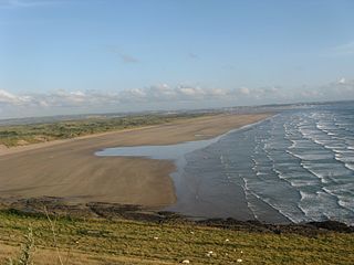
Saunton Sands Beach. CC: GDelhey
Beach Running: 3-mile long beach Saunton Sands Beach (car park at north end) and 2-mile long Greysands Beach (access from Westward Ho) are great for running. Wide, with firm sand. Combine Saunton Sands with Croyde Rd. and Greysands with the Westward Ho to Cornborough Cliff section of the S W Coast Path.
Road Run: Croyde Road. A gorgeous road for running, with spectacular views. Note: No shoulder. Combine with Saunton Sands Beach! Good access: Down End Car Park.
South West Coast Path – Hartland Peninsula. There are some spectacular sections of the South West Coast Path on the Hartland Peninsula. It’s a popular hiking/walking destination, featuring beautiful clifftop paths. Many of the sections are challenging — trail runners will love!
Easier Section: The 1.5 mile route between Westward Ho and Cornborough Cliff. Combine with the 2-mile Greysands Beach — great for running! INFO
North Devon is a coastal area of southwest England, known for its dramatic cliffs, wild seas and sandy beaches. This post has recommendations on some of the best places to run North Devon, with a focus on the Barnstaple area — the largest town in North Devon, located at the River Taw’s lowest crossing point before the Bristol Channel.
Multi-Use Paths: There are two good options
Barnstaple north to Braunton. The first 3-4 miles of the part paved, part gravel path from Barnstaple are the most scenic, running on the north side of the River Taw through some nice countryside. ROUTE MAP
Barnstaple south to Meeth. Part of the longer distance Tarka Cycle Trail, following the the old Bideford railway line. We’ve mapped 26 miles from Barnstaple. The path follows the Torridge River (but not right alongside it) for 9 miles to Bideford, and 11.3 miles to Lancross. The path is paved and relatively flat for the first 18 miles to the B3227 in Langtree, then becomes hillier, gravel, and more rugged to Meeth, with a couple of brief on-road sections. ROUTE MAPPATH INFO
Bideford. A pleasant 2.5-mile includes a waterfront path on the west side of the River Torridge, from the Old Bideford Bridge north to the Torridge Bridge, and a loop around Victoria Park. Connect to the Tarka Cycle Trail on the east side using the Old Bideford Bridge, and run on the path north toward Barnstaple or south toward Meeth. ROUTE MAP
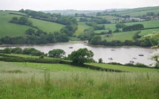
Saunton Sands Beach. CC: GDelhey
Beach Running: 3-mile long beach Saunton Sands Beach (car park at north end) and 2-mile long Greysands Beach (access from Westward Ho) are great for running. Wide, with firm sand. Combine Saunton Sands with Croyde Rd. and Greysands with the Westward Ho to Cornborough Cliff section of the S W Coast Path.
Road Run: Croyde Road. A gorgeous road for running, with spectacular views. Note: No shoulder. Combine with Saunton Sands Beach! Good access: Down End Car Park.
South West Coast Path – Hartland Peninsula. There are some spectacular sections of the South West Coast Path on the Hartland Peninsula. It’s a popular hiking/walking destination, featuring beautiful clifftop paths. Many of the sections are challenging — trail runners will love!
Easier Section: The 1.5 mile route between Westward Ho and Cornborough Cliff. Combine with the 2-mile Greysands Beach — great for running! INFO
Scroll Down For Route Maps
Essentials
Depends on route chosen
The two bike paths are flat (except the 8 miles between Langtree and Meeth)
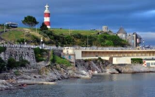
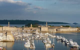
A 'runseeing' tour of Plymouth, featuring the main sites of Devon's largest city. Includes the Greenery, Hoe Park, the marina area, Mayflower Steps, and the Barbican district. Can be combined with our west Plymouth route for a longer run.
An exploration of the Devonport area in west Plymouth, including Royal William Yard, Mayflower Marina, Mount Wise Park, and Devonport Park. There's also a running track. Can combine with our main Plymouth route, ~1 mile east.
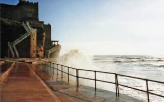
A true destination run only a 7-minute ferry ride from Plymouth. Landscaped gardens, open parkland woodland paths, gorgeous sections of S W Coast Path in this 865-acre historic coast park Something for all runners!
Sidmouth is a tourist resort and a gateway to the Jurassic Coast World Heritage Site. The best place to run is a route combining the Esplanade to Peak Hill, and then a jaunt along The Byes, a lovely park leading to Margaret's Meadow.
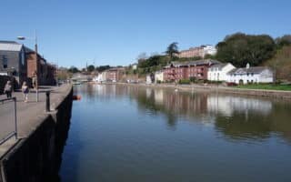
Two good running options in this port town at the mouth of the River Exe: a 3.7-mile waterfront path around the Marina and along the Channel east to Orcombe Point; and a 3.5-mile off-road cycle path headed east to Budleigh.
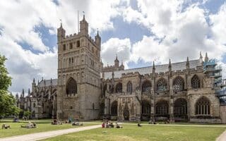
This 'runseeing' tour of ancient Roman city of Exeter hits all the major sites: Fore St., Cathedral, Castle, several small parks, and a section of paths on the River Exe. For longer, there are additional paths along the river headed south toward Topsham.
There are some pleasant paths along the River Exe, which flows south into the English Channel. One can run up to 8.2 miles, including 2.5 miles along the Exeter Ship Canal in Topsham. Fun option: do the longer run one-way and return via train!
In this seaside resort town nicknamed The English Riviera, there's terrific running around the marina, a couple of small central parks, and the 5+ mile waterfront path south to Paigngton and more.
There's some terrific running in this seaside town on the 'English Riviera', featuring several small parks and a lovely a lovely waterfront path that goes for ~6 miles between Goodrington Beach, just south of Paington north to Torquay.
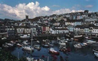
The best place to run in Brixham is a series of paths along the water. From town, head north to the Brixham Battery or south toward Berry Head, where there are some great views at the Lighthouse. Additional options on the S W coast path.
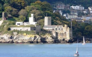
In Dartmouth, some waterfront running on both sides of the estuary, including optional climb to Dartmnouth Castle. The National Trust Greenway is a destination run, with gorgeous paths around the grounds of Agatha Christie's summer home.
The South Devon AONB is a vast natural area including rugged coastal stretches, farmland & quaint villages. See some of our running recs from among the 200 miles of right of way and 60 miles of Coast Path. There's an excellent website & interactive map.
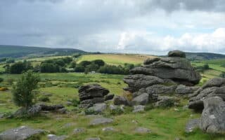
Running the 'moors' of Dartmoor National Park, especially on a classically bleak day, is a singular running experience. Choosing from among the list of walks, or some of the bridleways and byways recommended for cycling, are great options for running.
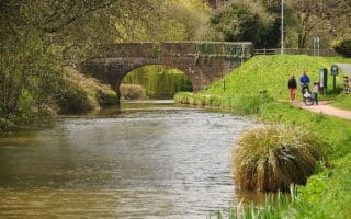
The 11.25 mile canal towpath in Grand Western Canal Country Park is a great running option in Tiverton -- the main commercial and administrative centre of Mid Devon. Flat, easy, and all off-road. Additional running options using the 'walks' in the Park.
Share your feedback on this route and see that of other Great Runs users. Click on the image icon to upload a photo. And please let us know if there are notes or changes we should incorporate!
Subscribe
0 Comments
Oldest
Newest
Inline Feedbacks
View all comments
Essentials
Depends on route chosen
The two bike paths are flat (except the 8 miles between Langtree and Meeth)


Review or Comment on This Route/Share a Photo!
Share your feedback on this route and see that of other Great Runs users. Click on the image icon to upload a photo. And please let us know if there are notes or changes we should incorporate!