Georgetown is a historic D.C. neighborhood, featuring Federal-style architecture, Georgetown University, and many shops and restaurants. The National Park Service includes Georgetown in its coverage of the C&O Canal Trail. Georgetown stretches from the Potomac inland to the Woodland area, and between the University & Rock Creek Parkway. There are some wonderful options for running in Georgetown, from paths along the Potomac, the C&O Canal, parks, and neighborhood streets with historic homes. We’ve mapped out several routes, which can be mix & matched in various ways.
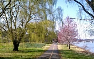
Crescent Crescent Trail: This 7-mile paved multi-use trail heads west from Georgetown Waterfront Park. The first 1 mile is along the Potomac, then the next 2 miles are along the north side of the C&O Canal. At the 3-mile park, you can continue west along the C&O Canal Trail (south side of the canal) or curl north for another 4 miles through the mainly wooded Little Falls Park to the trail’s end at Woodmont Ave. in Bethesda. Can run one-way and take the Metro back! ROUTE MAP
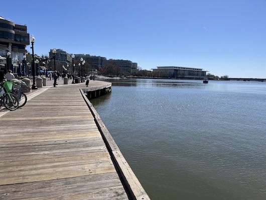
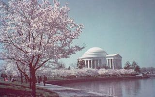
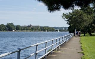
Potomac River East to National Mall. This is a very scenic run along the Potomac. From the festive Georgetown Waterfront Park (kayak rentals!), head east along the paved multi-use path, passing the Watergate Complex, & Kennedy Center, continuing past the Lincoln Memorial Beach Volleyball courts. It’s 1.5 miles from Georgetown to the back of the Lincoln Memorial, with great water views the whole way. Here’ you can connect to the National Mall/Tidal Basin route, or continue over the Arlington Bridge and connect to our route to Arlington National Cemetery. It’s possible to do a 3.5-mile loop using the Mount Vernon Trail on the south side of the Potomac, crossing back over the Key Bridge back to Georgetown, but it does involve a tricky/confusing connection to the Mount Vernon Trail. ROUTE MAP
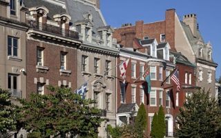
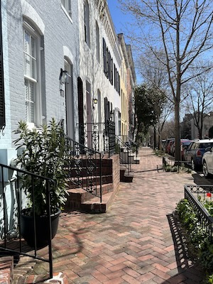 Georgetown ‘Runseeing’ Tour. This is a ‘create your own run’ tour of Georgetown, using our mapped route as a guideline. Georgetown is a lovely neighborhood for running, with tree-shaded, quiet streets and meticulously-preserved Federalist style houses. The area lies between Georgetown University and Rock Creek Parkway. It’s ~1 mile along the east-west streets M through Q. (M St. & Wisconsin Ave. NW are the more commercial streets), and ~0.5 miles north-south on 28th-35h St. Using our mapped route as a guideline, start at the famous Exorcist Steps, run north through the gorgeous campus of Georgetown University (beautiful lawns and historic buildings. Campus Map). Option to head west to the running track at Duke Ellington Track & Field. Then head east along Reservoir Rd. to Book Hill (Georgetown Library), continue east on P St. or Q St., passing Dumbarton House, and then return via any of the streets N through Q. Add on with additional streets. ROUTE MAP
- At the east end, can connect with Rock Creek Trail and our Embassy Row Tour.

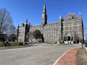
Georgetown University. Mark Lowenstein
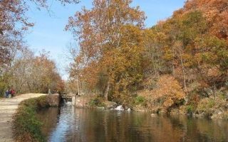
Glover Archibold Trail. This is a nice wooded run on a gravel trail headed north from Georgetown. Just 0.5 miles west of the Francis Scott Key Memorial Bridge, the Glover Archibold Trail runs for 3 miles north into the posh Cathedral Heights/Cleveland Park neighborhood (note: steady climb headed north). Do an out & back. LOOP OPTION: Take Nebraska Ave. for 0.5 miles south to the American University campus. Run through the main quad on campus (running track at Reeves Athletic Complex), and connect with the Battery Kemble Trail through Battery Kemble Park/Pallisades Park. Run south toward the river/canal, crossing to Fletcher’s Cove on the south side of the canal, and run for 1.7 miles back to the start point. 7.7 miles total. ROUTE MAP
- Note: A Parkrun happens every Saturday 9am in Fletcher’s Cove, the part of the path 2 miles north of Georgetown. See our D.C. map for more information.


Review or Comment on This Route/Share a Photo!
Share your feedback on this route and see that of other Great Runs users. Click on the image icon to upload a photo. And please let us know if there are notes or changes we should incorporate!