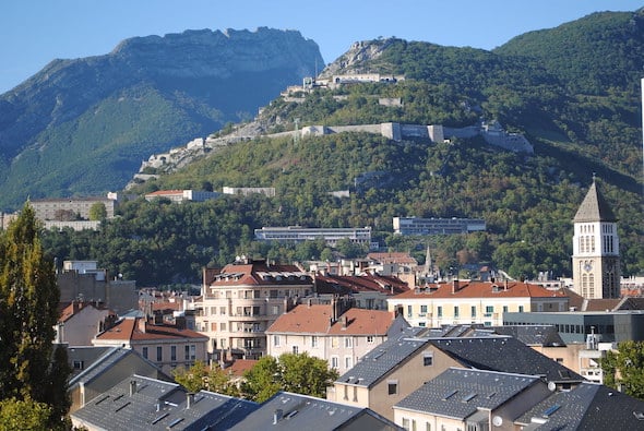
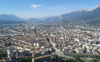
If you’d like to get the thighs burning while ‘storming’ a hill-top fort with great views, the run/hike to the Fort de la Bastille is for you! The Bastille is a 19th-century military fort with a watch tower, dungeon & panoramic views. It’s one of Grenoble’s iconic sights, and is easily accessible from the center — on foot or via the bubble-shaped Téléphérique. If you want to do the ascent, you’re in for a 300m climb with some stairs and grades of up to 14%. Another option is to to take the Téléphérique up and enjoy the paths around the Bastille, and run down. There are several options for running up to the Bastille from downtown.
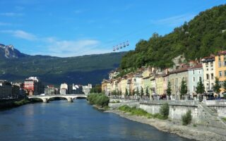
Loop Run Road. We’ve mapped a loop of this main road (narrow, no shoulder), and then the panoramic Chemin de la Bastille down, then crossing the bridge to run along the Isère River path back.
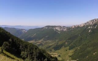
Off-Road Route. The switchback trail starts across the Pont St. Laurent, using stairs around the Fontaine de Lion/Musée dauphinois, and then a path to the fort. We continue on the fairly flat path from the fort to the Mandrin Caves for 0.5 km. Retrace your steps back, or use one of the other options down.
Jardin de Dauphines/Parc Guy Pape. This popular walk/hike through the park does not get you to the Fort, but it nevertheless has great views. It’s a 1.6 km (100m gain) loop. You could do this and then access Rue Maurice Gignoux to combine this with a Fort run.
Add-Ons: Once at the fort, there’s an extensive network of trails, but this is challenging trail running territory.
If you’d like to get the thighs burning while ‘storming’ a hill-top fort with great views, the run/hike to the Fort de la Bastille is for you! The Bastille is a 19th-century military fort with a watch tower, dungeon & panoramic views. It’s one of Grenoble’s iconic sights, and is easily accessible from the center — on foot or via the bubble-shaped Téléphérique. If you want to do the ascent, you’re in for a 300m climb with some stairs and grades of up to 14%. Another option is to to take the Téléphérique up and enjoy the paths around the Bastille, and run down. There are several options for running up to the Bastille from downtown.
Loop Run Road. We’ve mapped a loop of this main road (narrow, no shoulder), and then the panoramic Chemin de la Bastille down, then crossing the bridge to run along the Isère River path back.
Off-Road Route. The switchback trail starts across the Pont St. Laurent, using stairs around the Fontaine de Lion/Musée dauphinois, and then a path to the fort. We continue on the fairly flat path from the fort to the Mandrin Caves for 0.5 km. Retrace your steps back, or use one of the other options down.
Jardin de Dauphines/Parc Guy Pape. This popular walk/hike through the park does not get you to the Fort, but it nevertheless has great views. It’s a 1.6 km (100m gain) loop. You could do this and then access Rue Maurice Gignoux to combine this with a Fort run.
Add-Ons: Once at the fort, there’s an extensive network of trails, but this is challenging trail running territory.


Review or Comment on This Route/Share a Photo!
Share your feedback on this route and see that of other Great Runs users. Click on the image icon to upload a photo. And please let us know if there are notes or changes we should incorporate!