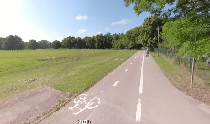
In the southeastern part of Klaipėda, there’s a series of pedestrian paths passing through sort of a linear park area, also connecting several schools. It’s up to ~4 km north-south on a combination of walking and cycle paths. One of the highlights is the small, green Draugystės parkas. Just north of there is a running track.
At the north end, the paths start just south of Baltijos pr. at the Klaipedos Martyno Mazvydo pagrindine mokykla school. Continue south as far as Jūrininkų pr. You can also make it a loop by heading back north on the cycle path paralleling Minijos g., then heading back east along Kalnupės g.


Review or Comment on This Route/Share a Photo!
Share your feedback on this route and see that of other Great Runs users. Click on the image icon to upload a photo. And please let us know if there are notes or changes we should incorporate!