Hiking and trail running are popular ways to enjoy the scenic landscape of Lake Garda. While there are many trails to choose from around the lake, we’ve picked out a few of the best and most runnable options.
Busatte Tempesta. Creative Commons Benreis
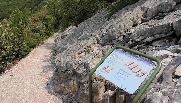
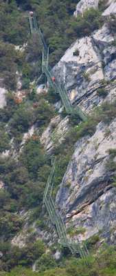
Busate Tempesta: Located just east of Riva del Garda. These gentle dirt paths eventually lead to 387 steep metal stairs with stunning views of the lake. Use caution if running the stairs, especially in wet weather. 5 km out and back. TRAIL INFO.
Rocca di Manerba. Creative CommonsMonte Brionne. Google Street View
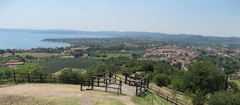
Rocca di Manerba: The area surrounding the Rocca di Manerba fortress has many smooth gravel paths, while narrow and slightly rocky trails wind along the coast from the Manerba ferry terminal to the Riserva Naturale Orientata della Rocca e del Sasso. We’ve mapped a 5km loop that also includes some country roads. ROUTE MAP.
Monte Brione: This option is reserved for serious trail runners who want some hill work and to get the lungs going. Wide stairs lead from Fort Garda to Batteria di Mezzo to the summit of Monte Brione. It’s only about 4 km out and back, but a 275 meter climb. Additional Information. ROUTE MAP.
Hiking and trail running are popular ways to enjoy the scenic landscape of Lake Garda. While there are many trails to choose from around the lake, we’ve picked out a few of the best and most runnable options.
Busatte Tempesta. Creative Commons Benreis
Busate Tempesta: Located just east of Riva del Garda. These gentle dirt paths eventually lead to 387 steep metal stairs with stunning views of the lake. Use caution if running the stairs, especially in wet weather. 5 km out and back. TRAIL INFO.
Rocca di Manerba. Creative CommonsMonte Brionne. Google Street View
Rocca di Manerba: The area surrounding the Rocca di Manerba fortress has many smooth gravel paths, while narrow and slightly rocky trails wind along the coast from the Manerba ferry terminal to the Riserva Naturale Orientata della Rocca e del Sasso. We’ve mapped a 5km loop that also includes some country roads. ROUTE MAP.
Monte Brione: This option is reserved for serious trail runners who want some hill work and to get the lungs going. Wide stairs lead from Fort Garda to Batteria di Mezzo to the summit of Monte Brione. It’s only about 4 km out and back, but a 275 meter climb. Additional Information. ROUTE MAP.
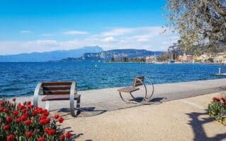
A series of waterfront paths and promenades dot the towns around Lake Garda, featuring stunning water and mountain views. We've mapped 13 of them, totaling ~75 km. Eventually these lakeside walkways will be connected by the Garda by Bike Path.
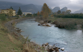
The Sarca River flows into the northern end of Lake Garda between Linfano and Torbole. A paved multi-use path runs along the river for 8 km to Ceniga. Some beautiful mountain views.
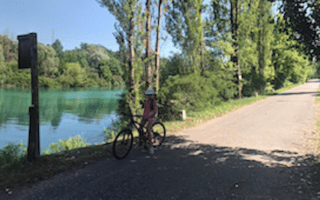
The Mincio River meets the south end of Lake Garda at Peschiera del Garda. Runners can go from Port Brescia south along the gravel Ciclovia Mantova-Peschiera multi-use path for up to 42 km to Mantua. Make it a one-way marathon!
Share your feedback on this route and see that of other Great Runs users. Click on the image icon to upload a photo. And please let us know if there are notes or changes we should incorporate!
Review or Comment on This Route/Share a Photo!
Share your feedback on this route and see that of other Great Runs users. Click on the image icon to upload a photo. And please let us know if there are notes or changes we should incorporate!