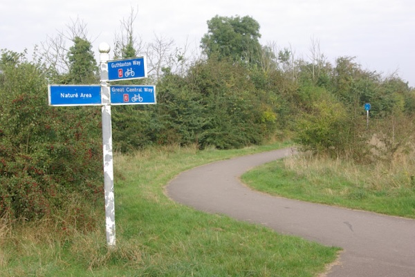
The Great Central Way is a paved multi-use path that follows an old rail line from the City Centre south to Glen Parma in the Soar Valley. It’s not always the most scenic run, but it’s a good opportunity to clock some easy, flat off-road miles. The Great Central Way can also be used to mix & match with other running routes in Leicester. Note: No street lighting south of the Soar Valley Bridge.
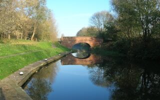
The path starts at King Richards Rd. on the west side of the River Soar. Head south, passing through Bede Park. In this area, the path has trees on either side. At ~1.5 miles, the trail passes through Riverside Park/Aylestone Meadows, a scenic spot with additional trails. Cross Soar Valley Way, to the trail’s end at Needham Rd.
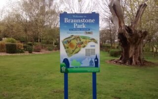
Add-Ons: Connect to additional trails in Aylestone Meadows, and at the south end, a footpath along the Grand Union Canal headed east.
The Great Central Way is a paved multi-use path that follows an old rail line from the City Centre south to Glen Parma in the Soar Valley. It’s not always the most scenic run, but it’s a good opportunity to clock some easy, flat off-road miles. The Great Central Way can also be used to mix & match with other running routes in Leicester. Note: No street lighting south of the Soar Valley Bridge.
The path starts at King Richards Rd. on the west side of the River Soar. Head south, passing through Bede Park. In this area, the path has trees on either side. At ~1.5 miles, the trail passes through Riverside Park/Aylestone Meadows, a scenic spot with additional trails. Cross Soar Valley Way, to the trail’s end at Needham Rd.
Add-Ons: Connect to additional trails in Aylestone Meadows, and at the south end, a footpath along the Grand Union Canal headed east.

Review or Comment on This Route/Share a Photo!
Share your feedback on this route and see that of other Great Runs users. Click on the image icon to upload a photo. And please let us know if there are notes or changes we should incorporate!