Leicester’s waterways — the River Soar & Grand Union Canal — feature miles of paths along them that are lovely for running. Here, we feature 6 miles of river/canal paths divided into two sections from the city center: north to Watermeade, including Abbey Park; and south to Aylestone. There are many opportunities to mix & match and combine with additional trails in the riverside parks.
Central Section: North to Watermeade
Starting from St. Augustine Rd. and headed north, we’ve mapped 3.5 miles of waterside paths north to Watermeade Way. It starts as a narrow paved path along the Soar for 0.5 miles through the old industrial area of Black Friars. Then, continue along the west bank of the Grand Union Canal, skirting the edge of Abbey Park, for 1.2 miles to Langton Way, where you’ll cross over to the River Soar path, where you’ll alternate between the east and west banks for 1.5 miles to Watermeade. This section is pleasantly green, passing by the National Space Center, through Ellis Meadows. North of the historic Belgrave Bridge, the path is fairly narrow.
Abbey Park, with bridge over River Soar, Leicester by Tim Heaton
Abbey Park
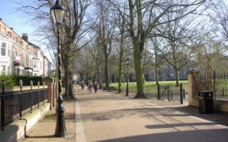
Abbey Park is Leicester’s most significant Victorian Park. The riverside park features lovely paths passing meadows, floral displays, and Augustinian monastery ruins. A loop is ~2.3 miles. Abbey Park is also site a parkrun.
Southern Section to Aylestone
Google Street View
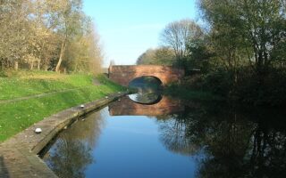
The southern section is 2.5 miles to Aylestone. From St. Augustine Rd., run on the concrete path alongside the west bank of the River Soar, below road grade. There are good river views, and a couple of industrial feeling sections with wall art. The river path continues along the eastern edge of Riverside Park and Aylestone Meadows Reserve. We’ve mapped ** miles to Middleton St., but you can also continue for many miles south on a narrow paved path alongside the river.
Leicester’s waterways — the River Soar & Grand Union Canal — feature miles of paths along them that are lovely for running. Here, we feature 6 miles of river/canal paths divided into two sections from the city center: north to Watermeade, including Abbey Park; and south to Aylestone. There are many opportunities to mix & match and combine with additional trails in the riverside parks.
Central Section: North to Watermeade
Starting from St. Augustine Rd. and headed north, we’ve mapped 3.5 miles of waterside paths north to Watermeade Way. It starts as a narrow paved path along the Soar for 0.5 miles through the old industrial area of Black Friars. Then, continue along the west bank of the Grand Union Canal, skirting the edge of Abbey Park, for 1.2 miles to Langton Way, where you’ll cross over to the River Soar path, where you’ll alternate between the east and west banks for 1.5 miles to Watermeade. This section is pleasantly green, passing by the National Space Center, through Ellis Meadows. North of the historic Belgrave Bridge, the path is fairly narrow.
Abbey Park, with bridge over River Soar, Leicester by Tim Heaton
Abbey Park
Abbey Park is Leicester’s most significant Victorian Park. The riverside park features lovely paths passing meadows, floral displays, and Augustinian monastery ruins. A loop is ~2.3 miles. Abbey Park is also site a parkrun.
Southern Section to Aylestone
Google Street View
The southern section is 2.5 miles to Aylestone. From St. Augustine Rd., run on the concrete path alongside the west bank of the River Soar, below road grade. There are good river views, and a couple of industrial feeling sections with wall art. The river path continues along the eastern edge of Riverside Park and Aylestone Meadows Reserve. We’ve mapped ** miles to Middleton St., but you can also continue for many miles south on a narrow paved path alongside the river.
Scroll Down For Route Maps
Essentials
North Section: 3.5 miles; South Section: 2.5 miles, with more possible. Abbey Park: ~3.5 km loop
Flat
St. Augustine Rd. near the city center is a good start point
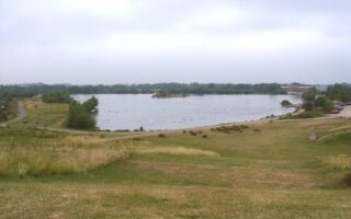
One of our favorite runs in Leicester. Several miles of paths around lakes, wetlands, and meadows in this preserve of that has abundant wildlife and 200 species of birds. Part of the northern section of River Soar paths.
This 'Runseeing' tour of Leicester has a nice variety: key sites in the historic City Centre, mainly on pedestrianized streets; New Walk; Victoria Park & Leicester University; and Leicester Castle & Castle Gardens. Add with Stokeswood Park, Abbey Park, river paths.
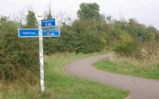
Aylestone Meadows, Leicester's largest nature preserve, has been a recreation destination for more than 100 years. It's a mosaic of pastures, trees, river margins and small ponds, criss-crossed by several miles of paths.
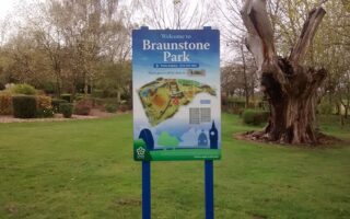
Some nice park running in western Leicester. A highlight is Braunstone Park, a 168-acre open space with formal gardens, 2 lakes, jogging paths with gym equipment. Combine with Western Park. Just west is Western Park Golf Course, a large open space with footpaths.
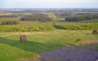
Very scenic running a few miles northwest of Leicester. Bradgate Park features several miles of trails through a rugged, hilly countryside, with an open landscape & great views. There's also a 1.75 mile paved path. Adjacent Swithland Wood features wooded trails.
The Great Central Way is a paved multi-use path that follows an old rail line from the City Centre south to Glen Parma in the Soar Valley. It's not always the most scenic run, but it's a good opportunity to clock some easy, flat off-road miles.
Share your feedback on this route and see that of other Great Runs users. Click on the image icon to upload a photo. And please let us know if there are notes or changes we should incorporate!
Subscribe
0 Comments
Oldest
Newest
Inline Feedbacks
View all comments
Essentials
North Section: 3.5 miles; South Section: 2.5 miles, with more possible. Abbey Park: ~3.5 km loop
Flat
St. Augustine Rd. near the city center is a good start point


Review or Comment on This Route/Share a Photo!
Share your feedback on this route and see that of other Great Runs users. Click on the image icon to upload a photo. And please let us know if there are notes or changes we should incorporate!