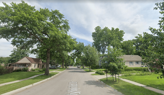
In the eastern part of Lincoln, there are some attractive neighborhoods for running, featuring tree-lined streets and historic homes. There are three distinct ‘areas’ that are in relative proximity — the more ambitious can stitch together a combo route. Using the University of Nebrasaka – Lincoln (UNL): East Campus as an anchor, continue east to University Place, then head south through the East Campus neighborhood, through the cemetery, to Woods Park.
UNL East Campus/University Place. Some nice paths and roads around this campus. Just east of campus is the University Place neighborhood, located along 48th Street between Leighton Avenue and Adams Street. The area has its own historic shopping district and is characterized by homes with wrap around porches near the University’s Old Main.
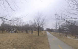
East Campus. Nice neighborhood just south of UNL East Campus from Holdrege to Vine and from 33rd to 48th Street, this neighborhood includes a historic district, commonly referred to as “Professors Row”, and McAdams Park, which borders the Mo-Pac Bicycle Trail.
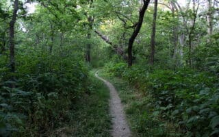
Woods Park. Just south of O St., S. 33rd Street on the east; generally north and east of Antelope Creek. It includes a number of bungalows built around the 1910s and 1920s. Some nice streets. It’s ~1 mile between University Place & Woods park — you can walk through the historic Wyuka cemetery.
In the eastern part of Lincoln, there are some attractive neighborhoods for running, featuring tree-lined streets and historic homes. There are three distinct ‘areas’ that are in relative proximity — the more ambitious can stitch together a combo route. Using the University of Nebrasaka – Lincoln (UNL): East Campus as an anchor, continue east to University Place, then head south through the East Campus neighborhood, through the cemetery, to Woods Park.
UNL East Campus/University Place. Some nice paths and roads around this campus. Just east of campus is the University Place neighborhood, located along 48th Street between Leighton Avenue and Adams Street. The area has its own historic shopping district and is characterized by homes with wrap around porches near the University’s Old Main.
East Campus. Nice neighborhood just south of UNL East Campus from Holdrege to Vine and from 33rd to 48th Street, this neighborhood includes a historic district, commonly referred to as “Professors Row”, and McAdams Park, which borders the Mo-Pac Bicycle Trail.
Woods Park. Just south of O St., S. 33rd Street on the east; generally north and east of Antelope Creek. It includes a number of bungalows built around the 1910s and 1920s. Some nice streets. It’s ~1 mile between University Place & Woods park — you can walk through the historic Wyuka cemetery.


Review or Comment on This Route/Share a Photo!
Share your feedback on this route and see that of other Great Runs users. Click on the image icon to upload a photo. And please let us know if there are notes or changes we should incorporate!