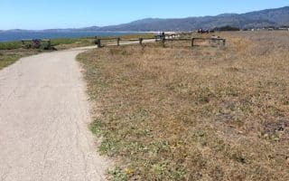
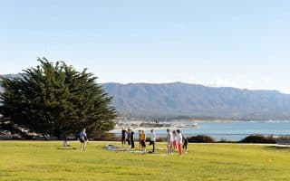
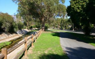
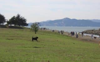
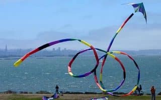
Planned community in Sonoma County with access to miles of spectacular trails and beaches. The signature run is the 3-mile coastal bluff trail, which features spectacular views and a wide, gentle surface.
Worth a detour. Half Moon Bay is an idyllic coastal town about 20 min. off the highway. Home to Mavericks, the famous surfing beach. A 4+ mile coastal trail makes for a fantastic run, with great views to the beach, surf, and cliffs to the north. Cute town, too.
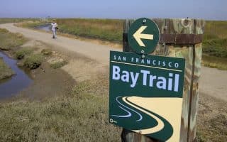
If you get stuck near SFO, don’t despair — there’s great running along the Bay. This spectacular running path follows the East Bay, from Brisbane north of SFO, south to San Mateo and beyond.
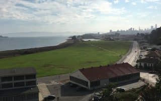
This is a great run easily accessible from the highway and only 7 miles south of SFO. There are jaunts out to a beach, a promenade through a lovely green park, and a quick hike up a hill with redwood trees and good views.
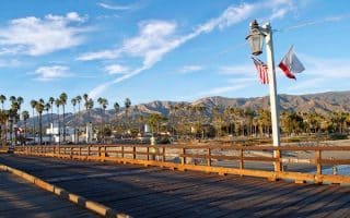
The classic Santa Barbara run, through the most Instagram-worthy spots in the city: Andree Clark Bird Refuge, the Cabrillo bike path, Stearns Wharf Pier, and Butterfly Beach. Lots of options for variety - can add Harbor & Shoreline Dr. for extra 2+ miles.
The route of a popular 5k event in Santa Barbara, along a great section in a central location, highlighting Shoreline Park, and Leadbetter Beach, just north of the Harbor. Join Nite Moves on Wednesdays in summer if you're in town!
For an iconic run along a long stretch of beach, look no further than Arroyo Burro Beach County Park — more commonly known as Hendry’s Beach. Feel like California’s Rocky Balboa while sprinting up the steep steps that connect the beach to the return path.
Few college campuses rival UC Santa Barbara in beauty. Follow this loop around the paved lagoon path, with views of the university, and out to Del Playa Bluffs which cruises the cliffs lining the Pacific Ocean.
Run through stands of scented eucalyptus trees in More Mesa Park, with gorgeous views of the volcanic Channel Islands on this nearly 3 mile loop of coastal Goleta. Beach is a good option, and for a longer run add the Obern Trail Bike Path.
A popular bike path offering a 21-mile loop, much of it along the water. We've mapped a 4 mile one-way route that includes Goleta Beach Park and a great section along Atascadero Creek.
Santa Barbara’s next door neighbor Goleta offers stretches of hard-sand beach, scenic mesa trails, and a butterfly preserve where you can witness thousands of Monarchs wintering in the warm sun.
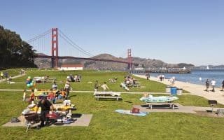
The run along Chrissy Field from Fort Mason to Fort Point is one of the great urban runs of the world. Water views the whole way. Heading north, views of the Golden Gate Bridge and the Marin Headlands, and south, the SF skyline.
There are numerous options to run along the Embarcadero, mainly depending on where you start and how long you want to run for.
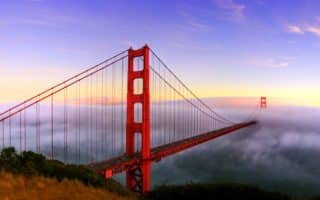
Running across the Bridge is not only encouraged…it’s a tourist attraction. There is a dedicated path for runners/walkers. It's 1.7 miles across the bridge. Spectacular views. Lots of add-on potential.
The entire run from AT&T Park, just 0.8 miles south of the Bay Bridge, all the way to Fort Point and then joining up with the trails that lead to the Golden Gate Bridge, and then over the Bridge to Vista Point is a total of 9.6 miles.
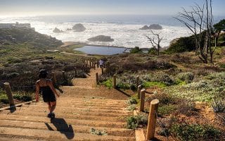
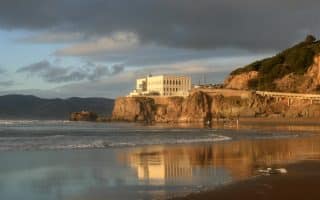
The run between the Golden Gate Bridge and Land’s End is unique: spectacular ocean views, hills, wooded sections, and some beautiful homes.
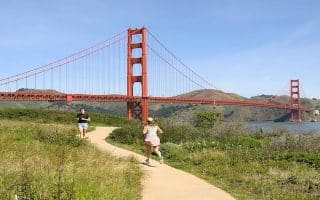
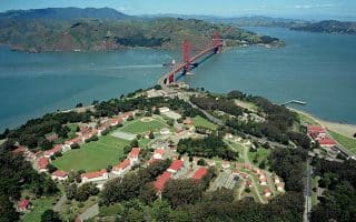
A former military installation, now a gorgeous park with miles of trails for walking and running. There are hills, wooded trails, and scenic vistas out to the Golden Gate Bridge and the Pacific Ocean. Also some great loop options involving Crissy Field.
Another great loop option involving the Presidio, the Golden Gate Bridge, and the Golden Gate Promenade. Take the Presidio Promenade Path through the Presidio, then return along Crissy Field. Great views and variety.
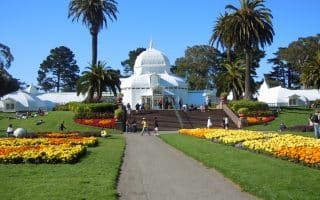
Golden Gate Park is the left coast version of New York’s Central Park. The Park runs from Highway 1 at the ocean to the west, to the Haight-Ashbury area to the east.
On the west side of the Golden Gate Bridge is the Sunset/Ocean Beach area. It is very different in look, feel, and even climate than the Marina/Golden Gate area.
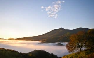
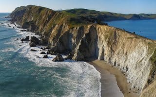
Three unbelievable runs. Marin Headlands/GG National Recreation area is challenging & hilly running just over the GG Bridge. Mt. Tam has a switchback fire road to the summit. And Point Reyes has spectacular trails and running options.
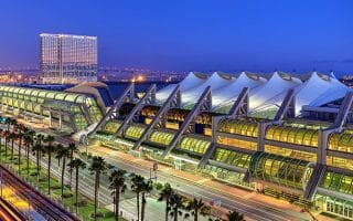
One of the best convention center/airport runs in the world. All on the waterfront, and near downtown, baseball stadium, Gaslight area, convention center, airport.
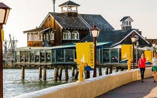
Another great running option in the airport/convention center/downtown area. Harbor Island, Seaport Village, waterfront park. All along the water, numerous distance options.
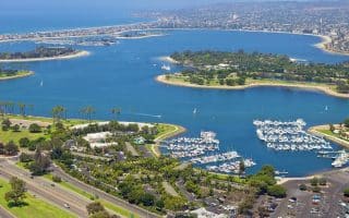
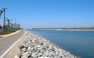
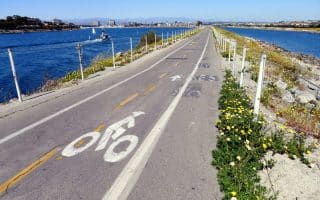
A 46,000 acre aquatic playground. We’ve mapped a well-known 12-mile loop, almost all of it on well-marked off-road paths, with water views, lovely parks, beaches, bridges, and an island.
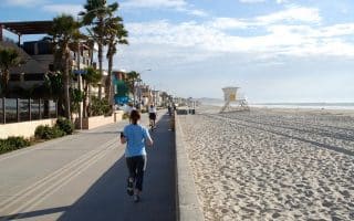
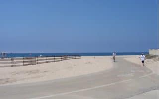
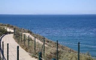
San Diego’s fabulous beaches are part of the city’s fabric. The signature run is the Oceanfront Boardwalk, a 3.5 mile paved path from North Pacific Beach to South Mission Beach.
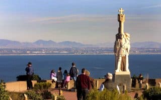
At the tip of Point Loma, with fantastic views of the water, San Diego downtown & harbor, and Coronado Island. Also includes the 2.2-mile RT Bayside Trail, down to the water.
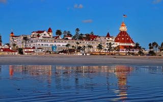
A destination in San Diego since the Hotel Del Coronado was built in 1900. Numerous running options, much of it on off-road paths, all open and with great ocean views.
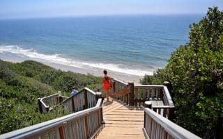
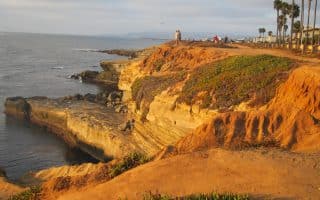
Sunset Cliffs in Ocean Beach is a great place to run in San Diego, staying high on windy cliffs with great views. A real treat at sunset. At the end of the road, hike down the cliffs onto the beach.
A beautiful and affluent seaside community 13 miles north of San Diego. Wonderful oceanside roads and trails, and a hilly residential community with gorgeous homes and views.
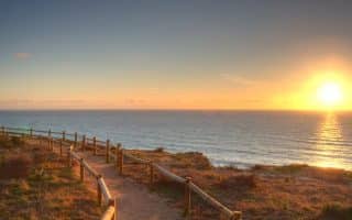
A beautiful State Preserve of 2,000 acres, 5 miles north of San Diego, incorporating the rare Torrey pine. Run-nable hillside hiking trails with great ocean views. Also great running on the beach here.
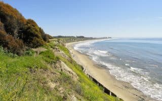
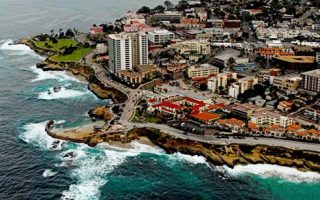
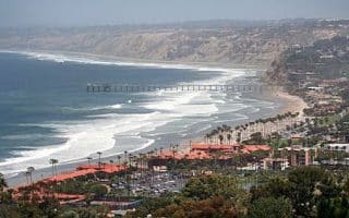
The 5 miles from La Jolla Shores to Torrey Pines is one of the ultimate beach runs. Big wide beach, towering cliffs overhead, crashing waves, seamless firm sand, sunsets….it doesn’t get better than this.
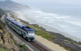
A unique running opportunity. Take the Coaster train north from Solana Beach and then running back on the Coast Highway. One can go as far as Oceanside, which is 16 miles. Bike lane along the road, ocean views the whole way.
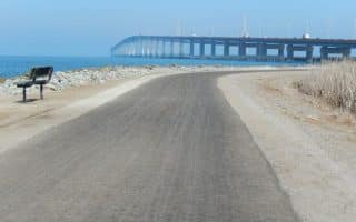
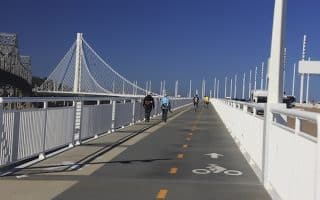
It's NOT possible to run all the way from San Francisco to Oakland, but this newly opened path from Emeryville to Yerba Buena Island is 4 miles of running glory. Great views of the Bay, bridges, and skylines. Separate bike and pedestrian lanes.
Nearly 12 miles of flat, waterside running. Most of it is lovely, with great views. Best sections are around César Chávez Park in Berkeley and Point Isabel to Marina Bay. We feature a detailed map and table with section distances.
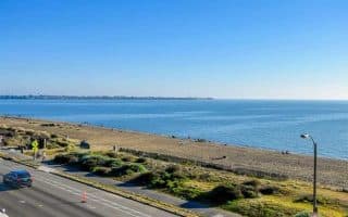
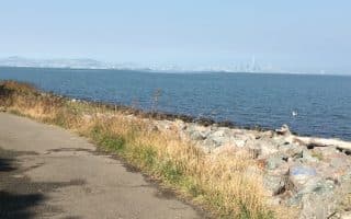
One of the longest continuous stretches of shoreline running along the Bay Trail. It's 7 miles from San Leandro Marina to the San Mateo Bridge, with great water views, salt marshes, and sloughs.
An easy, flat beachside run near Oakland Airport. Crown Memorial State Beach is a wonderfully restored 2.5 mile beach, with a bike/pedestrian path. Continue along Shore Line Dr. for a 3+ mile route. Good beach and water views the whole way.
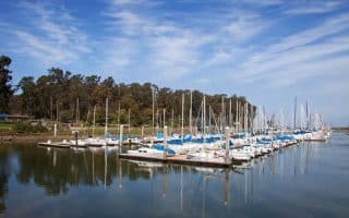
One of my favorite runs in the East Bay. Nearly 6 mile dedicated path around the island, with great views to the water, Bay Bridge, and San Francisco in the distance. Good add-ons to the north or south along the Bay Trail.
Wonderful running in this area, 2 miles west of downtown Berkeley. A series of three parks and 8+ miles waterside trails along shores, tidal marshes, and beaches, with views out to SF Bay, the Berkeley Yacht Harbor, and South Sailing Basin.
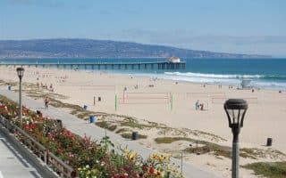
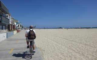
This is another famous L.A. beach run. Starting at Santa Monica Pier, this dedicated paved path goes 3.3 miles to Venice Beach, ending at Washington Blvd. Includes Muscle Beach, the famed outdoor basketball courts, and Venice Skatepark.
Manhattan Beach to Redondo Beach and back is one of the iconic L.A. beach runs. The highlight is “The Strand”, which pokes out for nearly 1 mile, affording great views.
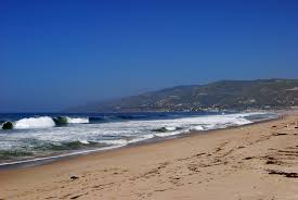
A great beach for running in Malibu. It’s about 1.5 miles one way along the Beach Access Road, or on the beach, which has fairly packed sand. Can be combined with jaunts up into the canyon trails.
The 1.6 mile path along Pallisades Park, above the beach, is a real treat: a beautiful, palm-lined greenway with lots of star-gazing and views of the Santa Monica Pier. There are steps down to the beach, too
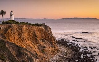
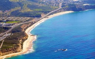
The Palos Verdes Peninsula offers significant opportunities for running. There are some great roads with incredible ocean views, and a huge network of trails, some suitable for running, others more rugged.
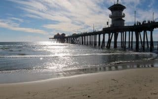
Wide, paved bike path that goes 10.5 miles from Huntington Beach to Newport Beach. In parts, the trail is literally right next to the beach. Popular and festive on a nice day. We've included a map and table with segment distances.
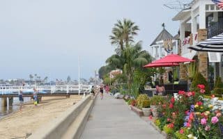
A wonderful 2.5 mile dedicated pedestrian path, with great harbor views. Reachable by bridge, or quick ferry ride from the Balboa Peninsula. For a longer run, hop the ferry and do the 2.9 mile Newport Balboa bike trail.
30-mile recreational trail along the Santa Ana River between Huntington Beach and Riverside. Paths on both sides of the water. Several parks and other landmarks along the way.
One of the most spectacular runs in southern California. A series of headlands and cliffs overlooking Dana Point and Strands Beach, with great views. One can put together a terrific run, with parks, trails, and paths along the harbor and marina.
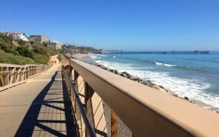
Terrific trail along side San Clemente Beach, paralleling the train tracks. The path runs 2.6 miles one-way, combination paved, sand, boardwalk, and dirt.
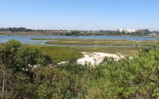
Nature preserve connecting the Upper Newport Bay and Newport Harbor is a popular 10.5 mile loop. It's paved and relatively flat. Numerous access points and options to make it shorter. South part is prettiest.
Wonderful 3 mile paved trail on the Balboa Peninsula, with great water views. Fun jaunts out to Newport Beach Pier and Balboa Pier. Combined, with piers, it's 7 miles total. Good add-on opportunities.
Run a beach and a canyon all in one run! Fantastic state park has a 2.5+ mile paved coastal trail and 10+ miles of backcountry trails in Moro Canyon. You can enjoy the promenade, with great views, or do a more strenuous trail run with 2,000 feet elevation gain!
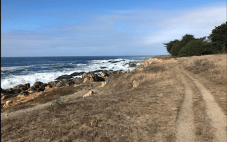
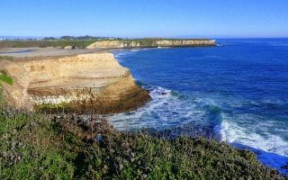
Santa Cruz is one of the don't miss running destinations in California. The top spots for running in the city are the bike path along West Cliff Drive and the seaside trails of the Wilder Ranch State Park.
The San Luis Obispo area, though not as popular among tourists as its surrounding cities, is a fantastic destination for a beach run. The favored route follows the 6 mile course of the Brian Waterbury Memorial Rock to Pier Run.
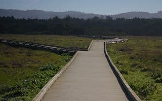
If you are near San Francisco, one of the most memorable detours you can take is up to Point Reyes, the National Seashore just north of the bay. The best trail for glimpses of the sea is the Coast Trail.
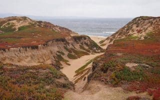
Mackerricher State Park is one of the last opportunities for a long coastal run in Mendocino before northern California blends into Oregon. The highlight is the five mile Haul Road Trail, a former coastal route stretching from Fort Bragg to Inglenook.
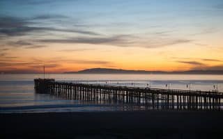
The long boardwalk of the Ventura trail is an ideal spot for a longer distance coast run without all that sand. The section between Surfer’s Point and Marina Park is probably the most popular.
The Monterey Bay Coastal Recreation Trail, which spans the coast of Monterey between Pacific Grove and Castroville, is a beautiful 18 mile former railway, which is now a two lane path leading to some of the most notable tourist attractions in the area.
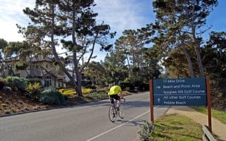
11 mile seaside road between Carmel and Monterey. Wonderful views. It's possible to run along the entire road, but the section with the widest shoulder and great views is 4 miles between Cypress Point and Asilomar.
For a quick access beach run just outside Carmel, look no further than Asilomar State Beach, a local favorite for a roughly two mile out and back with amazing coastal views.
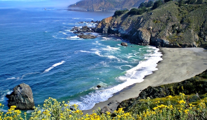
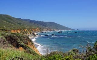
Big Sur is one of the most spectacular gems of the California Coast, and the views are at their best from the Panorama Trail in Andrew Molera State Park, 22 miles south of Carmel.
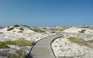
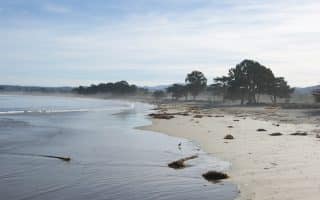
State Park has a 1,500 foot trail to 4 miles of ocean beach with beautiful views of Monterey Bay. Gorgeous dunes. Several miles of roads and trails in the park that are good for running and cycling. The beach is also runnable.
If you favor running on sand, the uninterrupted stretch of beach between Del Monte Beach and Moss Landing is a great route for a roughly 2.5 mile out and back on nothing but gently graded pristine white sands.
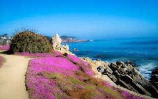
Scenic Road, which runs the length of the coast just above Carmel Beach, is a nicely paved route for running with gorgeous views of the ocean and the high-end homes lining the water.
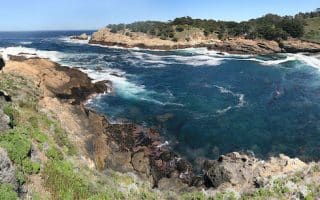
Point Lobos is a popular spot for good reason — it’s one of the most scenic public locations along the length of Big Sur. The Perimeter Loop, which covers about 4.5 miles of the park’s most scenic trails, is in great condition for running.
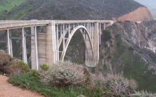
The Old Coast Road is a beautiful dirt track which covers about 10 miles from Andrew Molera State Park in the south to what is now the Bixby Bridge. Fantastic views. Hilly. It's a great alternative to Rt. 1, which is not safe for running.
1,000 acre state park is heart of Big Sur.Wonderful trail running, with excellent variety, from coastal forest to oceanside views. Currently, the best open trail is Buzzard’s Roost Trail, a moderate three miles loop from the Cabrillo Highway.
This is interesting area if near the Los Angeles Airport, combining a unique and scenic trail along Ballona Creek and wetlands, and a run along the beach in Playa Del Ray. Numerous options for more miles along the creek or the beach.