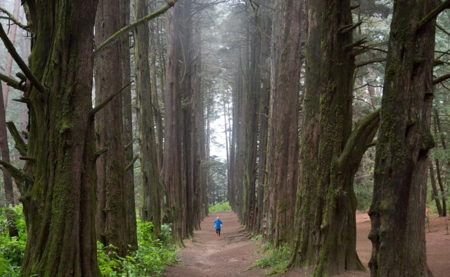
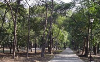
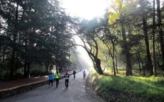
El Ocotal is a forest in the Cuajimalpa delegation in Mexico City with many trails for running or hiking. Just 30 minutes from the center of Mexico City, the best time to visit El Ocotal is on the weekends, when it is bustling with runners and walkers who want to escape to nature. Ocotal means “ocotes strewn ground” and showcases native tree species such as fir, ash and pine. There is one running circuit of about 2.15 miles. There is not parking available here, but you can park the car on the narrow street that provides access and in some farms that operate as public parking.
Features:
Essentials
- 2.15 mile loop
- Park entrance
- Parking along side street near park
Current Weather & Forecast

Mexico City, MX
7:59 am,
Jul 13, 2026
L: 15°
H: 15°
Daily ForecastHourly Forecast
Today
3:00 pm
21° / 31°°C
0 mm
0%
9 mph
54 %
1018 mb
0 mm/h
Tomorrow
3:00 pm
17° / 33°°C
1 mm
100%
12 mph
85 %
1020 mb
0 mm/h
Wednesday
3:00 pm
17° / 28°°C
1 mm
100%
9 mph
91 %
1021 mb
0 mm/h
Thursday
3:00 pm
18° / 31°°C
0.24 mm
24%
7 mph
84 %
1021 mb
0 mm/h
Friday
3:00 pm
20° / 34°°C
0.35 mm
35%
14 mph
75 %
1017 mb
0 mm/h
Today
9:00 am
29° / 31°°C
0 mm
0%
9 mph
39 %
1018 mb
0 mm/h
Today
12:00 pm
28° / 29°°C
0 mm
0%
8 mph
41 %
1018 mb
0 mm/h
Today
3:00 pm
21° / 24°°C
0 mm
0%
5 mph
54 %
1018 mb
0 mm/h
Today
6:00 pm
18° / 18°°C
0 mm
0%
3 mph
73 %
1019 mb
0 mm/h
Today
9:00 pm
17° / 17°°C
0 mm
0%
2 mph
79 %
1018 mb
0 mm/h
Tomorrow
12:00 am
22° / 22°°C
0.06 mm
6%
0 mph
62 %
1019 mb
0 mm/h
Tomorrow
3:00 am
25° / 25°°C
0.86 mm
86%
5 mph
65 %
1020 mb
0 mm/h
Other Routes in Mexico City, Mexico
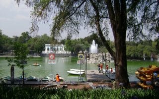
“Bosque de Chapultepec” (Chapultepec Forest) is the largest city park in the Western Hemisphere and is often referred to as Mexico City’s "lungs". We've mapped out a 3.6 mile park loop, and 5k loops of El Sope and Minor Lake.

Centrally located park located in the trendy Condesa neighborhood providing an urban oasis for runners. A loop of the trails and paths is about 1 km, so you'll have to do some laps.
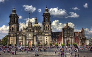
This is a 10k mile tour of some of Mexico City's most important and historic sites, starting from the Zócalo metro station. NOTE that on Sundays, Reforma Avenue is closed to traffic until mid-day — a special bonus for runners!
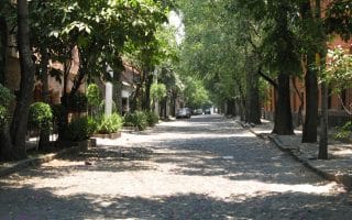
A 3 mile tour of Coyoacán, a quaint neighborhood is known for its cobblestones and bohemian flavor. Includes some parks, pretty residential streets, and sites including Templo de San Juan Bautista and the Frida Kahlo Museum.
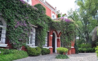
A stunningly beautiful neighborhood of cobblestone streets, Colonial-Era homes, and several worthwhile museums south of the city center. Mexico City’s Secretary of Tourism named the San Angel neighborhood a Barrio Magico (Magic Neighborhood).

Canal Cuemanco, in the eastern part of the city, was the venue for rowing competitions in the 1968 olympic games. The paved 5K path around the canal makes a great place to run away from Colonia Centro. Great views of volcanoes and mountains.
The Bosque de Aragón is a park located in the Gustavo A. Madero, near the International Airport of Mexico City. There is a 2.5 km paved path surrounding a fountain and a second 5 km dirt path around the perimeter of the park.


A new and wonderful addition to the Mexico City running scene. A major ecological restoration project, now one of the largest urban parks in the world. Many km of trails, open & around wetlands, over 12,000 publicly accessible acres.
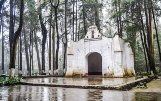
The Forest of Tlalpan is one of the best known locations among runners, athletes, and nature lovers who live south of Mexico City. Five different running tracks and lots of natural beauty make this forest an ideal place for exercise. Accessible by public transport.
Many of the more bucolic neighborhoods and residential areas of Mexico City are in gated communities, but this is a selection of some attractive, accessible neighborhoods for running.
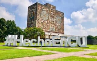
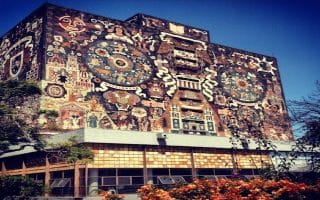
UNAM is the largest university in Latin America, and boasts one of the largest campuses in the world. This public campus, and the surrounding “University City,” make for a great run. We've mapped a 12 km loop, but good options to create your own.
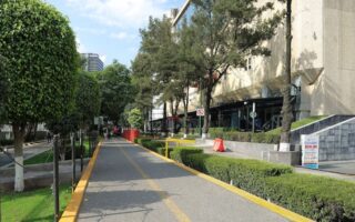
This lengthy, paved multi-use path offers offers many km of off-road running for those in the southern neighborhoods of Mexico City.

Some nice running options in neighborhood parks: Parque Bicentenario (San Lorenzo); Alameda Oriente: (near the airport); La Mexican (Lomas de Santa Fe); Embarcadero Tezozomoc (Prados del Rosario).
Mexico City is a relatively huge urban sprawl, but that doesn’t make it impossible to get out of the city and enjoy some trail running.
User Ratings
Leave A Review or Comment
Review or Comment on This Route/Share a Photo!
Share your feedback on this route and see that of other Great Runs users. Click on the image icon to upload a photo. And please let us know if there are notes or changes we should incorporate!