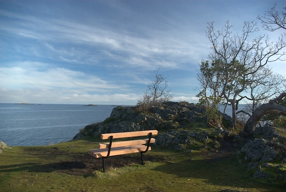
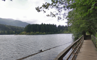
There are two terrific coastal running opportunities in Nanaimo, which we’ve divided into two separate routes: this one in the northern part of Nanaimo, highlighting Pipers Lagoon Park & Neck Point Park; and a southern one, showcasing the Harbourfront Walkway and the marina area.
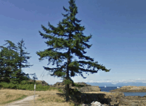
Neck Point Park. Google Street View
This route is a 6.6 km out & back, 50% on park paths and 50% on road. Start with a 1 km loop of Pipers Lagoon Park (gravel trails), a seaside park with winding trails and and a terrific lookout at B. Monahan Point. Then continue north on the quiet Place Rd./Polaris Rd. for 1 km and then along busier Hammond Bay Rd. (shoulder, no sidewalk) for 0.8 km. Then, do a ~2.3 km loop on the gravel trails around the beachfront Neck Point Park. The east side is more open, with water views, and the west side is more wooded.
For the return, we suggest Hammond Bay Rd. to Overlook Drive.
There are two terrific coastal running opportunities in Nanaimo, which we’ve divided into two separate routes: this one in the northern part of Nanaimo, highlighting Pipers Lagoon Park & Neck Point Park; and a southern one, showcasing the Harbourfront Walkway and the marina area.
Neck Point Park. Google Street View
This route is a 6.6 km out & back, 50% on park paths and 50% on road. Start with a 1 km loop of Pipers Lagoon Park (gravel trails), a seaside park with winding trails and and a terrific lookout at B. Monahan Point. Then continue north on the quiet Place Rd./Polaris Rd. for 1 km and then along busier Hammond Bay Rd. (shoulder, no sidewalk) for 0.8 km. Then, do a ~2.3 km loop on the gravel trails around the beachfront Neck Point Park. The east side is more open, with water views, and the west side is more wooded.
For the return, we suggest Hammond Bay Rd. to Overlook Drive.
Scroll Down For Route Maps
Essentials
6.6 km (4.1 miles) out & back
85m (280 feet)
Pipers Lagoon Park
Parking lots at Pipers Lagoon Park & Neck Point Park
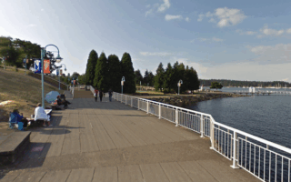
One of our two coastal routes in Nanaimo, this one showcases the Harbourfront Walkway along the Harbour, marina, and around Maffeo Sutton Park. It's 4.5 km one-way, great water views, ending at the Ferry Terminal.
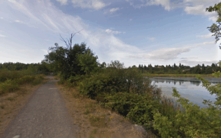
A fun 7.2 km loop combining three adjacent parks: Bowen Park, Buttertubs Marsh Park, and Third Street Park. Nice variety of landscape, including woods, marshes, fields, and a running track.
The 5.5 km Westwood Lake Trail loop is one of the most popular runs in Nanaimo. Westwood Lake Park is located in the foothills of Mt. Benson. It's a firm gravel trail, wooded with some lake views. Additional trails in the park.
At 19 km, the Parkway Trail is longest paved multi-use trail on Vancouver Island, and a good way to clock some miles! Not the most scenic, as it mainly parallels the Parkway Highway.
Take the 10-minute ferry to enjoy the 22 miles of trails on Saysutshun. Fairly easy running on mainly wooded trails, with some nice lookout points. Most popular for running is the 8 km Coastal Trail perimeter loop.
Share your feedback on this route and see that of other Great Runs users. Click on the image icon to upload a photo. And please let us know if there are notes or changes we should incorporate!
Subscribe
0 Comments
Oldest
Newest
Inline Feedbacks
View all comments
Essentials
6.6 km (4.1 miles) out & back
85m (280 feet)
Pipers Lagoon Park
Parking lots at Pipers Lagoon Park & Neck Point Park

Review or Comment on This Route/Share a Photo!
Share your feedback on this route and see that of other Great Runs users. Click on the image icon to upload a photo. And please let us know if there are notes or changes we should incorporate!