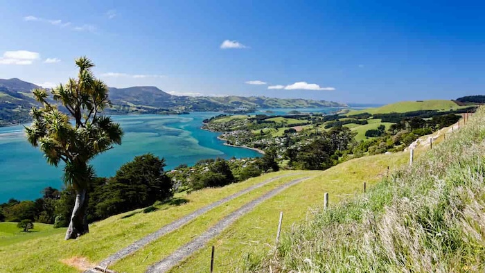
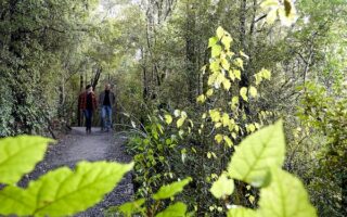
A run on the Otago Peninsula is a spiritual experience. Located on the southern edge of Dunedin Harbour, the peninsula is part of the crater wall of a large, long-extinct volcano. A network if hilly roads and trails wind around sheep farms, high cliffs, coastal settlements, and beaches. You can see sea lions and penguins. There are some wonderful running options, ranging from quiet, rolling paved & dirt roads to trails (tracks) of moderate to challenging difficulty. This brochure has detailed information on the options. This site has more details on the individual tracks.
These are our recommendations for some of the easier, scenic roads for running on the Otago Peninsula. Highcliff Rd. is the main road traversing the island. It can be busier and there is no shoulder/sidewalk.
- Sandymount Rd. 4.6 km one-way. Quiet rolling hill dirt road off Highcliff winding through farms and over hills. 199m gain one-way headed south.
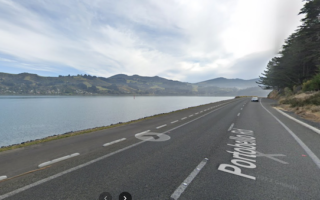
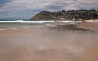
- Hoopers Inlet Rd. Similar to Sandymount Rd. Scenic but flatter. From Sandymount, it’s 1.3 km down to Hoopers Inlet, then the road follows the water for 4.6 km, and continues as Allans Beach Rd. for another 2.5 km around the inlet. The road then continues for 1 km to Allans Beach. MAP This is one of the flatter running options on the peninsula.
- Papanui Inlet Rd. 2.5 scenic km along the water. Combine with Hoopers Inlet with ~1 km connections via Sheppard Rd. or Cape Saunders Rd.
- Karetai Rd. Beautiful road passing by farms with high-up views to the water. For a scenic, hilly 5.6 km out & back, park at the Highcliff View Point and run 0.4 km along Highcliff Rd., then head south on Karetai Rd. to a gorgeous viewpoint at the end. MAP
A run on the Otago Peninsula is a spiritual experience. Located on the southern edge of Dunedin Harbour, the peninsula is part of the crater wall of a large, long-extinct volcano. A network if hilly roads and trails wind around sheep farms, high cliffs, coastal settlements, and beaches. You can see sea lions and penguins. There are some wonderful running options, ranging from quiet, rolling paved & dirt roads to trails (tracks) of moderate to challenging difficulty. This brochure has detailed information on the options. This site has more details on the individual tracks.
These are our recommendations for some of the easier, scenic roads for running on the Otago Peninsula. Highcliff Rd. is the main road traversing the island. It can be busier and there is no shoulder/sidewalk.
- Sandymount Rd. 4.6 km one-way. Quiet rolling hill dirt road off Highcliff winding through farms and over hills. 199m gain one-way headed south.
- Hoopers Inlet Rd. Similar to Sandymount Rd. Scenic but flatter. From Sandymount, it’s 1.3 km down to Hoopers Inlet, then the road follows the water for 4.6 km, and continues as Allans Beach Rd. for another 2.5 km around the inlet. The road then continues for 1 km to Allans Beach. MAP This is one of the flatter running options on the peninsula.
- Papanui Inlet Rd. 2.5 scenic km along the water. Combine with Hoopers Inlet with ~1 km connections via Sheppard Rd. or Cape Saunders Rd.
- Karetai Rd. Beautiful road passing by farms with high-up views to the water. For a scenic, hilly 5.6 km out & back, park at the Highcliff View Point and run 0.4 km along Highcliff Rd., then head south on Karetai Rd. to a gorgeous viewpoint at the end. MAP

Review or Comment on This Route/Share a Photo!
Share your feedback on this route and see that of other Great Runs users. Click on the image icon to upload a photo. And please let us know if there are notes or changes we should incorporate!