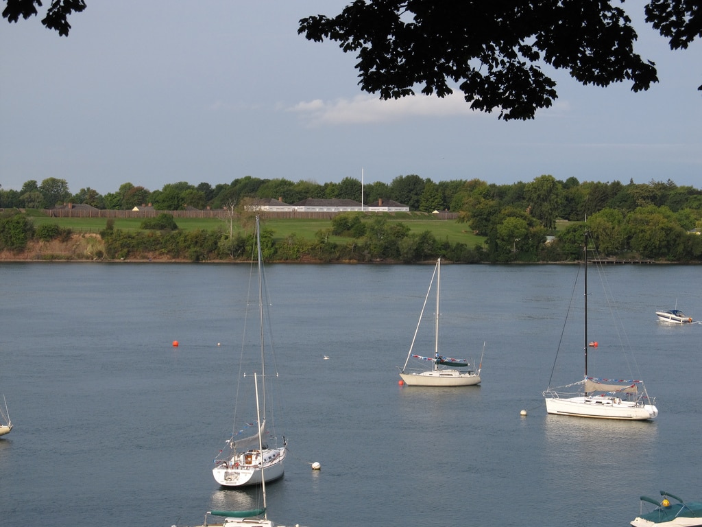
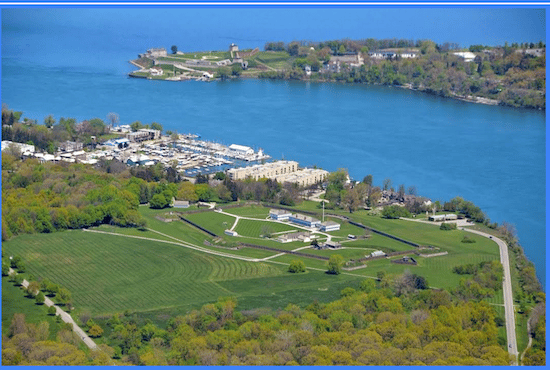
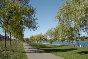
 Located on Lake Ontario, Niagara-on-the-Lake is known for its Shaw summer theater festival, wineries, historic town, and historical sites. In a slightly over 10 km run, one can get a pretty good tour of the town’s highlights. A good place to start is at the Fort George National Historic Site, a reconstructed military landmark from the War of 1812. A 4 km tour of the trails passes by other landmarks at this site, including Butler’s Barracks and The Commons. After this tour, take Ricardo St./Front St./Simcoe St., heading northwest, passing Queen’s Royal Park and the golf course. The road becomes the flower-filled, tree-lined Queen St., which is graced by 19th century historic homes. Continue onto Niagara Blvd. passing Mississauga Beach. For the final 2.5 km, run along the residential streets of Historic Old Town, cutting a diagonal back to the start. You can choose from any number of streets here, but a good straight shot is Vincent Ave. to the Circle and then William St. Below are some other options for running in Niagara-on-the-Lake.
Add-Ons/Other Options
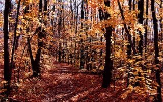
Residential streets of Historic Old Town. Create your own route along the quiet, tree-lined in the area between Mary St. (Highway 87) and Queen St.
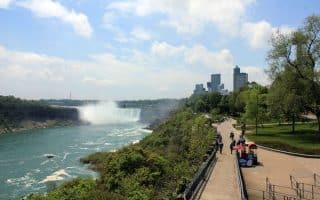
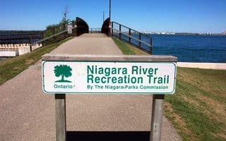
Niagara River Recreational Trail is a multi-use oath that starts at Fort George, and heads south for 20 km to Niagara Falls. Route information & map.
‘Winery’ Roads. A series of ‘line roads’ run between Rt. 55 and the Niagara Parkway. These are flat, open roads with little traffic, passing by wineries and farmland. Open terrain. Each of Line 1, Line 2, or Line 3 roads is 4-5 km. Great spot to do some speed work or interval training! Note: No shoulder.
Located on Lake Ontario, Niagara-on-the-Lake is known for its Shaw summer theater festival, wineries, historic town, and historical sites. In a slightly over 10 km run, one can get a pretty good tour of the town’s highlights. A good place to start is at the Fort George National Historic Site, a reconstructed military landmark from the War of 1812. A 4 km tour of the trails passes by other landmarks at this site, including Butler’s Barracks and The Commons. After this tour, take Ricardo St./Front St./Simcoe St., heading northwest, passing Queen’s Royal Park and the golf course. The road becomes the flower-filled, tree-lined Queen St., which is graced by 19th century historic homes. Continue onto Niagara Blvd. passing Mississauga Beach. For the final 2.5 km, run along the residential streets of Historic Old Town, cutting a diagonal back to the start. You can choose from any number of streets here, but a good straight shot is Vincent Ave. to the Circle and then William St. Below are some other options for running in Niagara-on-the-Lake.
Add-Ons/Other Options
Residential streets of Historic Old Town. Create your own route along the quiet, tree-lined in the area between Mary St. (Highway 87) and Queen St.
Niagara River Recreational Trail is a multi-use oath that starts at Fort George, and heads south for 20 km to Niagara Falls. Route information & map.
‘Winery’ Roads. A series of ‘line roads’ run between Rt. 55 and the Niagara Parkway. These are flat, open roads with little traffic, passing by wineries and farmland. Open terrain. Each of Line 1, Line 2, or Line 3 roads is 4-5 km. Great spot to do some speed work or interval training! Note: No shoulder.

Review or Comment on This Route/Share a Photo!
Share your feedback on this route and see that of other Great Runs users. Click on the image icon to upload a photo. And please let us know if there are notes or changes we should incorporate!