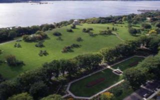
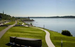
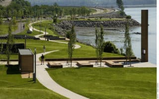
This is a wonderful bike and pedestrian path along the St. Charles River, with great water views along most of the way, and several Quebec sites and parks. Since the path is along both sides of the river, it’s possible to construct various loop options, using the numerous bridges.
We start at the beginning of the path, although one can also get to it from other spots, such as Quebec Old City, 1-2 km away. Key distances, on the Parliament side (km/mi, bridge=’Pont’), from the start:
- 0.6/0.35: Dorchester Bridge (Pont)
- 1.2/0.75: Rue de La Croix Rouge, near Site des sports d’hiver de la Pointe-aux-Lièvres
- 2.1/1.3: Rue de Pointe-aux-Lièvres
- 2.7/1.7: Parc Victoria & Pedestrian Bridge to other side
- 3/7/2.3: Rue Marie de L’Incarnation
- 4.2/2.7: Parc Scott/Pont Scott
There are some great running detour and add-on options. The Site des sports d’hiver de la Pointe-aux-Lièvres is a XC skiing and skating destination in winter. Parc Victoria has some nice extra trails, and skating in winter. On the opposite side, Cartier-Brébeuf National Historic Site park is a park with a bike path, honoring the wintering of explorer Jacques Cartier & his crew.


Review or Comment on This Route/Share a Photo!
Share your feedback on this route and see that of other Great Runs users. Click on the image icon to upload a photo. And please let us know if there are notes or changes we should incorporate!