The path along the River Foyle is the signature run in Derry. In the heart of the city, the paved multi-use path is known as the Quay Trail, and runs along the west embankment of the river for up to 6.3 miles. There are great views of the river most of the way, plus other city sights.
The north end of the path starts at the Quay Docks, and continues south through the heart of the city. It’s 1.25 miles to the Peace Bridge, and 1.75 miles to the Craigavon Bridge. South of there, the trail becomes more pastoral — and there are no other bridge crossings. The south end is at Ballougry Rd.
Note that a path also runs along the east embankment from the Craigavon Bridge south for 1 mile.
Add-Ons: Enjoy the Quay Trail, and cross over the Peace Bridge. where a path runs along the east embankment of the river for 2 miles, through St. Columb’s Park.
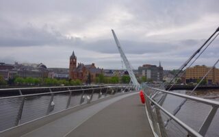
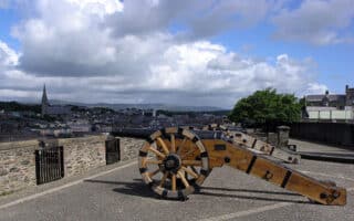


Review or Comment on This Route/Share a Photo!
Share your feedback on this route and see that of other Great Runs users. Click on the image icon to upload a photo. And please let us know if there are notes or changes we should incorporate!