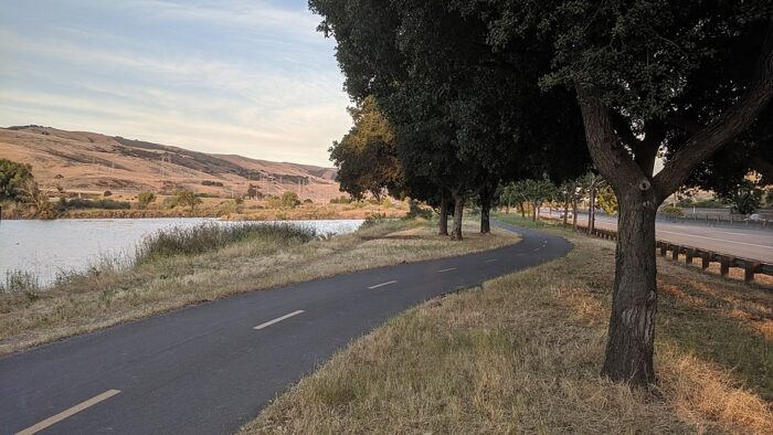
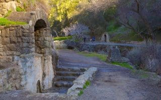
Just south of downtown San Jose, the Coyote Creek Trail offers a good option for a longer, off-road run. The multi-use path runs for 18.5 miles along Coyote Creek from Tully Ave. (4 miles south of downtown) south to Anderson Lake County Park in Morgan Hill. The surface is a mix of paved and gravel. It passes through a variety of terrain, with lots of open space and some woodland. Note: gradual uphill, headed south.
The north end of the trail is at Tully Rd. Follow the trail along Coyote Creek, which is between Monterey Rd. and Highway 101. Here are some favorite sections, headed south:
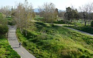
- The first 2 miles is through a golf course
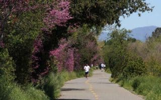
- Miles 2.4-3.7 are through lovely Hellyer County Park, which has additional trails and a short loop around Cottonwood Lake.
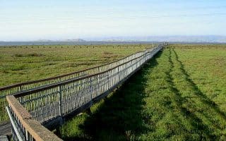
- Miles 8.3-11.3 are through a series of parks, including some nice wetlands at Metcalf Park
- Mile 12: Access to the Coyote Ridge Open Space Preserve (see below). Use the spur trail just north of Bailey Ave. and then Bailey Ave. (wide and busy, but there is a sidewalk).
- Miles 12.0-13.5 skirt the west side of the Coyote Creek Golf Club
- Miles 14-16 are through another wetlands area
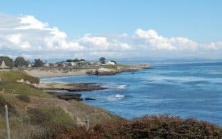
The south terminus is at Anderson Lake County Park, a 4,275-acre park around Santa Clara’s largest reservoir. There are miles of additional trails here. TRAIL MAP
Coyote Ridge Open Space Preserve (Máyyan ‘Ooyákma). Opened to the public in August 2023, this 1,859-acre preserve in southern Santa Clara County offers 5 miles of trails, including 3.9 miles as part of the Bay Area Ridge Trail. The area is known for its rare serpentine grasslands and diverse wildlife, providing a unique running experience. From the Coyote Creek Trail, use the spur trail just north of Bailey Ave. TRAIL MAP
Just south of downtown San Jose, the Coyote Creek Trail offers a good option for a longer, off-road run. The multi-use path runs for 18.5 miles along Coyote Creek from Tully Ave. (4 miles south of downtown) south to Anderson Lake County Park in Morgan Hill. The surface is a mix of paved and gravel. It passes through a variety of terrain, with lots of open space and some woodland. Note: gradual uphill, headed south.
The north end of the trail is at Tully Rd. Follow the trail along Coyote Creek, which is between Monterey Rd. and Highway 101. Here are some favorite sections, headed south:
- The first 2 miles is through a golf course
- Miles 2.4-3.7 are through lovely Hellyer County Park, which has additional trails and a short loop around Cottonwood Lake.
- Miles 8.3-11.3 are through a series of parks, including some nice wetlands at Metcalf Park
- Mile 12: Access to the Coyote Ridge Open Space Preserve (see below). Use the spur trail just north of Bailey Ave. and then Bailey Ave. (wide and busy, but there is a sidewalk).
- Miles 12.0-13.5 skirt the west side of the Coyote Creek Golf Club
- Miles 14-16 are through another wetlands area
The south terminus is at Anderson Lake County Park, a 4,275-acre park around Santa Clara’s largest reservoir. There are miles of additional trails here. TRAIL MAP
Coyote Ridge Open Space Preserve (Máyyan ‘Ooyákma). Opened to the public in August 2023, this 1,859-acre preserve in southern Santa Clara County offers 5 miles of trails, including 3.9 miles as part of the Bay Area Ridge Trail. The area is known for its rare serpentine grasslands and diverse wildlife, providing a unique running experience. From the Coyote Creek Trail, use the spur trail just north of Bailey Ave. TRAIL MAP

Review or Comment on This Route/Share a Photo!
Share your feedback on this route and see that of other Great Runs users. Click on the image icon to upload a photo. And please let us know if there are notes or changes we should incorporate!