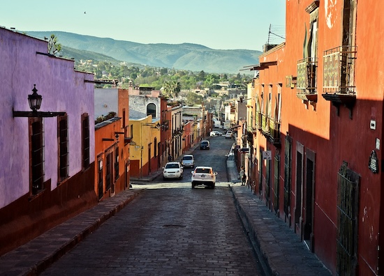
Get up early to beat the heat and crowds, and take a run in the Zona Centro — San Miguel de Allende’s historic center! This 43 hectare area is a UNESCO designated site, with roads lined with colonial-era homes and churches. The area is not fully pedestrianized, but it is mainly a walking area. We’ve mapped a route that does a loop of the historic center and down to Parque Benito Juárez. Use it as a guideline to create your own route! Note: the streets are cobblestone (use caution when wet!) and the sidewalks are narrow!
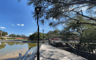
Parque Benito Juárez. Google Street View
Start at the main square, Jardín Allende, which is a bustling square with good views of the pink Parroquia deSan Miguel Arcángel gothic cathedral. Do a loop around the center, defined by C. Qebrada/C. C. Núñez west to east, and Calz de la Luz/Parque Juárez north-south. The route includes a loop around small, pleasant Parque Benito Juárez, with its nice paths and plants. Use C. Barranca or Salida Real a Querétaro for the downhill return. Note that the streets heading north or south of the center are hilly, and there are stairs.
Other Good Streets for Running: Ancha de San Antonio is a wide that goes south from the center for a long stretch and has some of the best sidewalks.
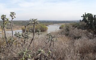
Add-On: Can combine with the Charco del Ingenio (botanitcal garden) route, which is ~2 km east of the center (and a 130m climb to get there!).
Get up early to beat the heat and crowds, and take a run in the Zona Centro — San Miguel de Allende’s historic center! This 43 hectare area is a UNESCO designated site, with roads lined with colonial-era homes and churches. The area is not fully pedestrianized, but it is mainly a walking area. We’ve mapped a route that does a loop of the historic center and down to Parque Benito Juárez. Use it as a guideline to create your own route! Note: the streets are cobblestone (use caution when wet!) and the sidewalks are narrow!
Parque Benito Juárez. Google Street View
Start at the main square, Jardín Allende, which is a bustling square with good views of the pink Parroquia deSan Miguel Arcángel gothic cathedral. Do a loop around the center, defined by C. Qebrada/C. C. Núñez west to east, and Calz de la Luz/Parque Juárez north-south. The route includes a loop around small, pleasant Parque Benito Juárez, with its nice paths and plants. Use C. Barranca or Salida Real a Querétaro for the downhill return. Note that the streets heading north or south of the center are hilly, and there are stairs.
Other Good Streets for Running: Ancha de San Antonio is a wide that goes south from the center for a long stretch and has some of the best sidewalks.
Add-On: Can combine with the Charco del Ingenio (botanitcal garden) route, which is ~2 km east of the center (and a 130m climb to get there!).
Located just 2 km from the historic center, Charco del Ingenio is the best place to run in San Miguel de Allende. There's a good network of trails around the cacti and other native plants. The terrain is fairly open & hilly, and there are easier & more rugged trails.
There are a few small parks in San Miguel de Allende that are decent for running: Parque Juárez, Parque Municipal Zeferino Gutiérrez, & Modulo COMUDE San Miguel de Allende. There's a good running track at Unidad Deportiva.
Share your feedback on this route and see that of other Great Runs users. Click on the image icon to upload a photo. And please let us know if there are notes or changes we should incorporate!


Review or Comment on This Route/Share a Photo!
Share your feedback on this route and see that of other Great Runs users. Click on the image icon to upload a photo. And please let us know if there are notes or changes we should incorporate!