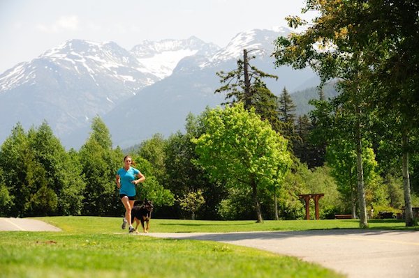
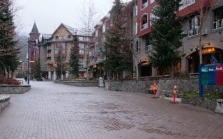
The 40 km Valley Trail serves the multiple purposes of being a great trail for running, access to other great spots for running, and an off-road option for getting around Whistler by foot or bike. The trail is mainly paved, and there are some sections that are on the road. Much of the Valley Trail runs parallel to Highway 99, from its southern end at Bayly Park/Function Junction (8 km from the Village), north to Green Lake (7 km from the Village). The trail also connects to popular spots such as Lost Lake, Alta Lake, and the golf course. This map provides a good overview of the Valley Trail. The trail is well way-marked and there are numerous spurs coming off the trail. Bonus: some sections are lit and maintained in winter.
Some of the most scenic sections of the Valley Trail are (distances one-way):
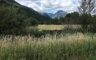
Green Lake. Tourism Whistler/Mike Crane
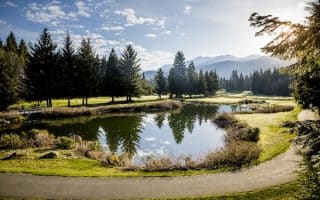
A spur looping around the Whistler Golf Course. ~4.7 km
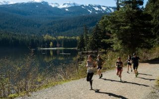
Between Rainbow Park and Meadow Park, combination of wooded and open, gorgeous through Golden Dreams Conservation area. Away from the road, and quite flat. ~3.7 km
Between Alta Lake Park and Alpha Lake Park, on the West Side of Highway 99. ~3 km
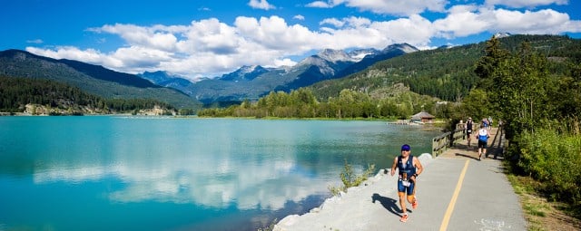
Section along Green Lake, with great water views (in winter, run on shoulder). ~4 km
The 40 km Valley Trail serves the multiple purposes of being a great trail for running, access to other great spots for running, and an off-road option for getting around Whistler by foot or bike. The trail is mainly paved, and there are some sections that are on the road. Much of the Valley Trail runs parallel to Highway 99, from its southern end at Bayly Park/Function Junction (8 km from the Village), north to Green Lake (7 km from the Village). The trail also connects to popular spots such as Lost Lake, Alta Lake, and the golf course. This map provides a good overview of the Valley Trail. The trail is well way-marked and there are numerous spurs coming off the trail. Bonus: some sections are lit and maintained in winter.
Some of the most scenic sections of the Valley Trail are (distances one-way):
Green Lake. Tourism Whistler/Mike Crane
A spur looping around the Whistler Golf Course. ~4.7 km
Between Rainbow Park and Meadow Park, combination of wooded and open, gorgeous through Golden Dreams Conservation area. Away from the road, and quite flat. ~3.7 km
Between Alta Lake Park and Alpha Lake Park, on the West Side of Highway 99. ~3 km
Section along Green Lake, with great water views (in winter, run on shoulder). ~4 km
Scroll Down For Route Maps
Essentials
Overall trail is 40 km (24 miles), through numerous spurs
Depends on section chosen, but offers some of the flatter running opportunities in the area
Depends on section chosen, but Whistler Village a good anchor point
Outdoor recreation mecca at the north end of Howe Sound in the Sea to Sky Corridor. Favorite runs are Oceanfront Loop, Spit/Estuary Trail, Squamish River Trail, Sea to Sky Connector Trail. And a wealth of trail running options.
One of the most popular spots to run in Whistler. This wide, gravel trail around the lake is ~2 km, with occasional water views. From Whistler Village, it's a 5.8 km route. Bonus: lit at night!
The section of the Valley Trail that forms a 4.7 km loop around the Golf Course is another popular and easily accessible run in the Whistler area. Right across from Whistler Village. Open and pretty, with great add-on opportunities.
Outside of Highway 99, there aren't a lot of roads in this area. For those who want a break from the trails or some variety, here are our recommendations for some of the quieter roads for running in the Village and area neighborhoods.
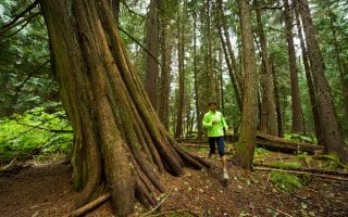
Our recommendations for some of the best easy-to-moderate trail running in the valley, all within a few km of Whistler Village. Interpretive Forest/Cheakamus River, Emerald Forest, XC trails in the Lost Lake area, & more.
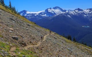
Take a lift up to the alpine to enjoy spectacular trail running opportunities on Whistler-Blackomb. We've compiled some recommendations for easy-to-moderate routes among the 50+ km of gorgeous hiking trails.
Lovely town 30 km north of Whistler, popular for outdoor activities. Our favorite run is along Pemberton Meadows Rd. -- quiet, open, and flat, with great farm, river and mountain views. Some great trail running options too.
Share your feedback on this route and see that of other Great Runs users. Click on the image icon to upload a photo. And please let us know if there are notes or changes we should incorporate!
Subscribe
0 Comments
Oldest
Newest
Inline Feedbacks
View all comments
Essentials
Overall trail is 40 km (24 miles), through numerous spurs
Depends on section chosen, but offers some of the flatter running opportunities in the area
Depends on section chosen, but Whistler Village a good anchor point

Review or Comment on This Route/Share a Photo!
Share your feedback on this route and see that of other Great Runs users. Click on the image icon to upload a photo. And please let us know if there are notes or changes we should incorporate!