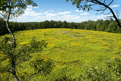
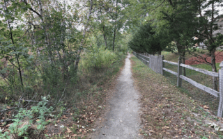
The recently preserved parcel of Sibley Farm can be combined with the trails of Burncoat Pond for some easy to moderate trail running. The area is located in Spencer, 11 miles west of Worcester. Create your own route on the 8 miles of trails through fields, meadows, forests, ponds, and wetlands. The best option for a longer, continuous run is the section of the Midstate Trail that runs through the area. The Sibley Trail, which connects the northern and southern parking areas, is 1.5 miles. Parts of this area are administered by the Mass. Audubon Society.
Courtsey: commongroundlt.org
Features:
Scroll Down For Route Maps
Essentials
- 8 miles of trails in the two areas
- Parking area
- Parking off Greenville Rd. at Burncoat Pond, or Polar Spring Rd. & Main St.
Current Weather & Forecast

Worcester, US
1:53 am,
Jul 14, 2026
L: 19°
H: 21°
Daily ForecastHourly Forecast
Today
5:00 pm
19° / 21°°C
0 mm
0%
16 mph
19 %
1008 mb
0 mm/h
Tomorrow
5:00 pm
28° / 41°°C
0 mm
0%
14 mph
30 %
1008 mb
0 mm/h
Thursday
5:00 pm
28° / 40°°C
0 mm
0%
17 mph
24 %
1008 mb
0 mm/h
Friday
5:00 pm
29° / 41°°C
0 mm
0%
17 mph
24 %
1006 mb
0 mm/h
Saturday
5:00 pm
29° / 43°°C
0 mm
0%
13 mph
26 %
1006 mb
0 mm/h
Today
2:00 am
32° / 32°°C
0 mm
0%
10 mph
19 %
1008 mb
0 mm/h
Today
5:00 am
34° / 37°°C
0 mm
0%
13 mph
17 %
1008 mb
0 mm/h
Today
8:00 am
38° / 40°°C
0 mm
0%
14 mph
13 %
1006 mb
0 mm/h
Today
11:00 am
40° / 40°°C
0 mm
0%
16 mph
9 %
1004 mb
0 mm/h
Today
2:00 pm
34° / 34°°C
0 mm
0%
12 mph
10 %
1006 mb
0 mm/h
Today
5:00 pm
31° / 31°°C
0 mm
0%
8 mph
14 %
1007 mb
0 mm/h
Today
8:00 pm
29° / 29°°C
0 mm
0%
5 mph
19 %
1006 mb
0 mm/h
Other Routes in Worcester, MA
Worcester's most notable park is a good spot for a hilly run. We've mapped a 3.2 mile loop around the park on the main loop road. There are also several miles of trail running on the East Side Trail, which can combine with our Lake Quinsigamond route.
Lake Ave. along Lake Quinsigamond features some nice sections for running, with lake views. There are also some sections that aren't as attractive and that lack a sidewalk/shoulder. Additional trail running options on the East Side Trail.
Our favorite all-around run in Worcester, combining three parks, a great hill, the campus of WPI, and a nice residential area. Beaver Brook Park, Newton Hill, Elm Park are the highlights.
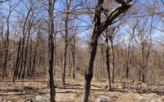
Series of trails run by the Mass. Audubon Society. There are 5 miles of easy to moderate trails that are good for trail running, and a visitor center. We recommend combining the Cardinal Trail, Brookside Trail, and Power Line Trail for a run of 3-4 miles.
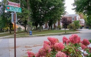
Create your own route in the historic sections of Worcester, featuring tree-lined streets with some nice older homes. There are two sections: west of downtown toward Newton Hill and near WPI, and east of I-290 in the Union Hill and Vernon Hill areas.

One can stitch together a decent run in the College Hill section of Worcester, combining the campus of the College of the Holy Cross and the paths of Cookson Field. Nice views from the top of the hill.
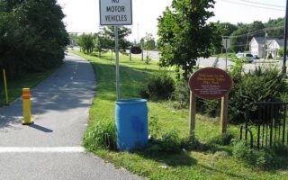
One of the better options for an off-road run in Worcester. Paved multi-use path runs for 2.6 miles, starting off N Main St. in Millbury. Not the most attractive, as it runs alongside busy roads. Part of a planned longer path between Worcester and Providence.
Stitch together several miles of trails around Cook's Pond, Cook's Woods, and the Cascades Trail System. These are hiking trails that are good for trail running.
User Ratings
Leave A Review or Comment
Review or Comment on This Route/Share a Photo!
Share your feedback on this route and see that of other Great Runs users. Click on the image icon to upload a photo. And please let us know if there are notes or changes we should incorporate!