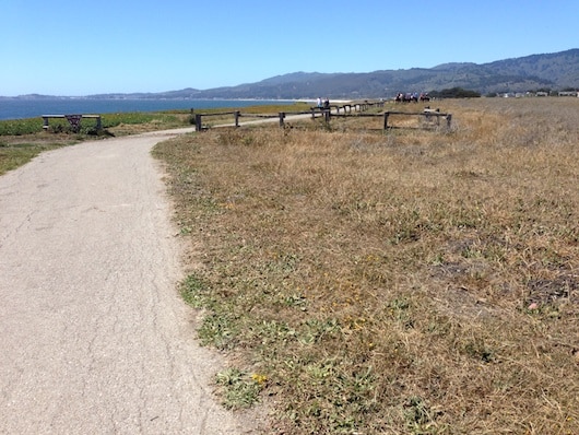
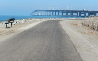
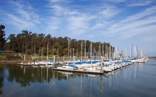
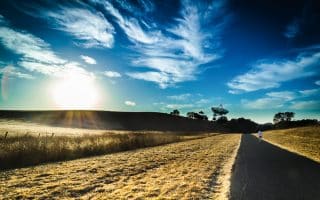
Call this a destination run — but if you have a free afternoon or evening, it’s worth the 20 minute drive off west of the highway to enjoy a run and a meal in Half Moon Bay. This is a gorgeous coastal town, home to the famous surfing beach called Mavericks. The run that’s worth the detour is the Coastal Trail, which runs some eight miles between Half Moon Bay State Beach and Pillar Point Harbor. The trail north of the State Beach is more rugged. The coastal trail runs above the beach, with great views to crashing surf and the cliffs to the north. It’s a combination of paved and soft surface. The trail passes several beaches, heading south. The full route is 4.2 miles one-way, but can easily be shortened — just turn around!
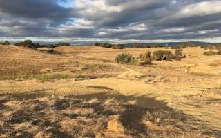
For a challenge, and variety, there are some roads heading up into the hills, east of Rt.1: Do a quick loop on Higgins Canyon Rd., or head up Purisima Creek Rd.
Beach Running: The beaches in this area tend to have soft, white sand.
Before or after your run, if you have time, check out the town and Main St., which is filled with fun shops and great restaurants.
You need a car to get to HMB, but it’s a quick 20-minute drive down Rt. 92, which is well-signed from the highway.
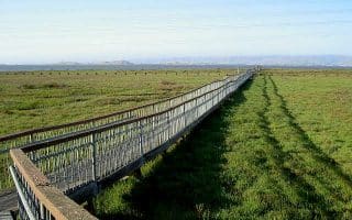
Call this a destination run — but if you have a free afternoon or evening, it’s worth the 20 minute drive off west of the highway to enjoy a run and a meal in Half Moon Bay. This is a gorgeous coastal town, home to the famous surfing beach called Mavericks. The run that’s worth the detour is the Coastal Trail, which runs some eight miles between Half Moon Bay State Beach and Pillar Point Harbor. The trail north of the State Beach is more rugged. The coastal trail runs above the beach, with great views to crashing surf and the cliffs to the north. It’s a combination of paved and soft surface. The trail passes several beaches, heading south. The full route is 4.2 miles one-way, but can easily be shortened — just turn around!
For a challenge, and variety, there are some roads heading up into the hills, east of Rt.1: Do a quick loop on Higgins Canyon Rd., or head up Purisima Creek Rd.
Beach Running: The beaches in this area tend to have soft, white sand.
Before or after your run, if you have time, check out the town and Main St., which is filled with fun shops and great restaurants.
You need a car to get to HMB, but it’s a quick 20-minute drive down Rt. 92, which is well-signed from the highway.
Scroll Down For Route Maps
Essentials
Full trail is 8.2 miles out and back
165 feet
Half Moon Bay State Beach (north); Pillar Point Harbor (south)
This is an overview of running in Silicon Valley, showing how we have laid out the region and providing some highlights as we move from San Francisco Airport to San Jose.
If you get stuck near SFO, don’t despair — there’s great running along the Bay. This spectacular running path follows the East Bay, from Brisbane north of SFO, south to San Mateo and beyond.
This is a great run easily accessible from the highway and only 7 miles south of SFO. There are jaunts out to a beach, a promenade through a lovely green park, and a quick hike up a hill with redwood trees and good views.
10+ miles of scenic running trails along the Bay and around Belmont Slough/Steinberger Slough in Redwood Shores. Wonderful open views of the bay and wetlands, and lots of birds! Can also connect to Bay Trail.
Centrally located park is a treat for running. Interior paths are hilly, winding through groves of trees and ranchland type terrain, while the outer perimeter trails form a flat, 2.3 mile loop around the Wildlife Refuge, skirting the salt marshes.
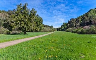
One of the most popular and iconic runs in Silicon Valley. Accessible from the center of Palo Alto and the Stanford Campus, this is a great ~5 mile loop, featuring open pastureland, a small lake, and great views of the Stanford Campus.
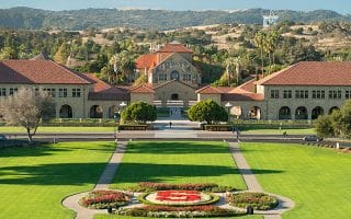
One of the most iconic university campuses in the world also makes for very pleasant running. Our 4.5 mile loop includes all the major campus highlights, with some great add-on options.
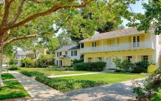
Palo Alto is the ‘center’ of Silicon Valley. A great run is to do a random tour of Palo Alto’s toniest residential streets, which feature gorgeous older homes, beautiful lawns, and lovely shade trees. Use University Ave. as the 'anchor'.
Three adjacent open space areas in Belmont, just east of I-280. Scenic, open, and hilly. Combination of fire roads and more challenging trails. There are map kiosks in each area.
In Redwood City near San Carlos just east of I-280, Pulgas Ridge and Edgewood Park & Preserve are adjacent to each other and offer several miles of scenic, hilly trail running. Combination of open & wooded terrain.
There is a wonderful series of parks, preserves, and running trail options in the hills close to Rt. 280: Rancho San Antonio, Sawyer Camp Recreational Trail, Huddart Park, Wunderlich Park, and more. Can be especially pretty in spring.
On the eastern shore between Palo Alto and San Jose, this remarkable series of trails and parks incorporates a series of undisturbed tidal marshland (Sloughs) called the Baylands. See our detailed description of the three major sections.
Share your feedback on this route and see that of other Great Runs users. Click on the image icon to upload a photo. And please let us know if there are notes or changes we should incorporate!
Subscribe
0 Comments
Oldest
Newest
Inline Feedbacks
View all comments
Essentials
Full trail is 8.2 miles out and back
165 feet
Half Moon Bay State Beach (north); Pillar Point Harbor (south)


Review or Comment on This Route/Share a Photo!
Share your feedback on this route and see that of other Great Runs users. Click on the image icon to upload a photo. And please let us know if there are notes or changes we should incorporate!