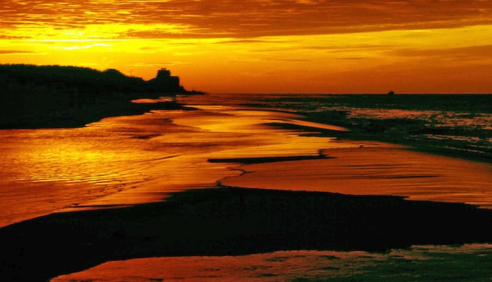
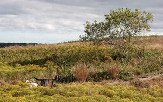
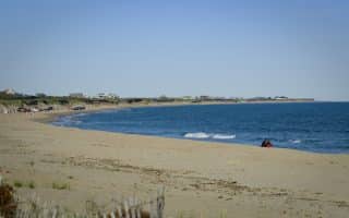
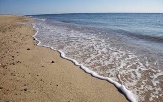
Bike paths, beaches, and brews…what more could you want from a run? One of the newest and prettiest bike paths on Nantucket, the Cisco Bike Path runs along Hummock Pond Road out to Cisco Beach. Cisco Brewers is at the half-way point, about 1.2 miles in. The path starts at the corner of Hummock Pond Road and Milk Street Extension, and runs alongside the road in it’s own lane for about 2.5 miles before ending at Cisco Beach Access Drive. This paved lane runs through a mostly rural, wooded landscape, punctuated by a few impressive homes and several of Bartlett’s Farm’s fields. End your run with a refreshing craft beer, an invigorating swim, or both!
Michael Galvin
Features:
Scroll Down For Route Maps
Essentials
- 2.5 miles (one way), 5 miles out and back
- 27 feet
- Hummock Pond Road and Milk St. Ext
- Hawthorne Lane Bus Stop
Current Weather & Forecast

Nantucket, US
8:27 pm,
Jun 3, 2026
L: 14°
H: 14°
Daily ForecastHourly Forecast
Tomorrow
5:00 pm
14° / 25°°C
0 mm
0%
7 mph
76 %
1024 mb
0 mm/h
Friday
5:00 pm
14° / 22°°C
0 mm
0%
6 mph
91 %
1021 mb
0 mm/h
Saturday
5:00 pm
16° / 20°°C
0.97 mm
97%
2 mph
95 %
1018 mb
0 mm/h
Sunday
5:00 pm
15° / 17°°C
1 mm
100%
5 mph
99 %
1015 mb
0 mm/h
Monday
5:00 pm
14° / 18°°C
1 mm
100%
11 mph
98 %
1014 mb
0 mm/h
Today
11:00 pm
15° / 16°°C
0 mm
0%
3 mph
72 %
1022 mb
0 mm/h
Tomorrow
2:00 am
14° / 15°°C
0 mm
0%
3 mph
76 %
1023 mb
0 mm/h
Tomorrow
5:00 am
15° / 15°°C
0 mm
0%
5 mph
76 %
1023 mb
0 mm/h
Tomorrow
8:00 am
15° / 15°°C
0 mm
0%
5 mph
73 %
1024 mb
0 mm/h
Tomorrow
11:00 am
21° / 21°°C
0 mm
0%
7 mph
55 %
1023 mb
0 mm/h
Tomorrow
2:00 pm
25° / 25°°C
0 mm
0%
7 mph
49 %
1021 mb
0 mm/h
Tomorrow
5:00 pm
22° / 22°°C
0 mm
0%
5 mph
64 %
1020 mb
0 mm/h
Other Routes in Nantucket, MA
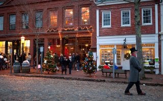
A 3-mile tour of some of the prettiest and most historic streets of Nantucket's Downtown Historic District and the center area. Lots of opportunities to add on. Downtown can get crowded in high season, so best to do that section early.
This route is home to a fun and free 5k which takes place every Tuesday evening from March to September. Starts just north of the Historic District, near Children's Beach. Quintessential Nantucket neighborhoods and pleasant streets for running.
Nantucket Conservation Foundation property located near Madaket in the southwest of the island is a favorite off-road running option. Grassland, shrubland, and pine forest. A long dirt road leads for 2.5 miles to the ocean, or shorter, grassy trail loops.
The 780 acre Sanford Farm property is popular for its scenery, sandy trails, and ocean breezes. We’ve mapped 7 mile and 3.5 mile options.
A nice variation from the center of Nantucket, this to the rougher Surfside beach on the island's south side. It's a good, straightforward nearly 7-mile run, much of it on bike paths. We provide an out and back or loop option.
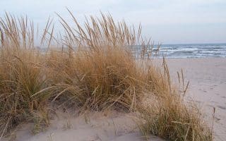
Nantucket’s north shore is largely protected from dramatic ocean currents, which means the sand here is flatter and firmer than most other beaches. You can run west on Jetties Beach for about 1.5 miles.
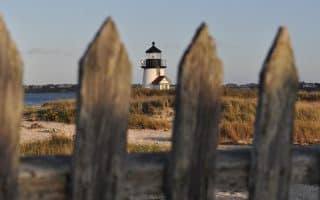
Siasconset, known as ‘Sconset to locals, hugs the high eastern crest of the island, where grand homes look out over even grander ocean views. This 3 mile route leads from downtown ‘Sconset to the Sankaty Light.
There's plenty of beach on Nantucket, but this is one of the most 'runnable'. The 1 mile stretch of Nantucket Beach in the Tom Nevers area of the island is protected and relatively flat, making for a good 2-mile beach run.
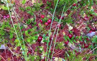
Middle Moors is a celebration of Nantucket’s open space. This 6.5 mile loop runs alongside cranberry bogs, past ponds, and up to Altar Rock — one of the highest points on the island — on dirt roads and trails. Also site of a popular 5k race course.
User Ratings
Leave A Review or Comment
Review or Comment on This Route/Share a Photo!
Share your feedback on this route and see that of other Great Runs users. Click on the image icon to upload a photo. And please let us know if there are notes or changes we should incorporate!