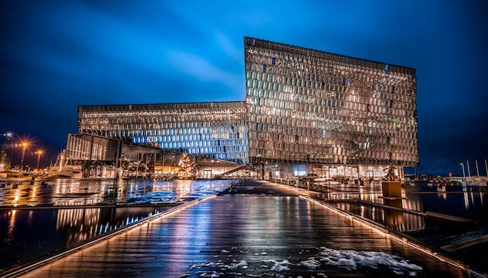
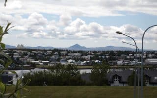
This loop around the center of Reykjavik hits many of the most popular tourist destinations in the city, starting at Tjörnin, the pond at the heart of the city. The Fríkirkjuvegur Bus Stop, on the east side of the park, is a good place to begin. Head to the southeast corner of the park, where the paths spill into the Soleyjargata/Njaroargata intersection. Bear LEFT onto Njaroargata and follow it uphill to Hallgrímskirkja, the largest church in Iceland. At the parish, turn LEFT briefly onto Eiriksgata and turn LEFT again onto Skólavörustígur, a popular shopping area lined with all sorts of stores and kiosks. Skólavörustígur ends on Laugavegur, where you will turn LEFT and then RIGHT onto Ingolfsstraeti to arrive at Arnarholl Park. Cut northwest through the park to see the statue of Norwegian settler Ingólfur Arnarson and cross Highway 41 to the Harpa, a colorful glass plated concert hall. From the Harpa, turn LEFT onto the Sculpture and Shore Walk. Where the concrete path connects with Suourbugt, take a sharp LEFT, and head south past the Volcano House, the Photography Museum, and the Art Museum. Turn RIGHT on Grofin to connect to Vesturgata, then follow it west to Aegisgata and turn LEFT. This will take you past the Cathedral of Christ the King. Follow Tungata east to the archeological remains of the Settlement Exhibition, past the south end of Park Austurvoller, to the Parliament House and Dómkirkjan. Then, head south along the pond to return to your starting point.
Giuseppe Milo
Features:
Categories:
Scroll Down For Route Maps
Essentials
- 5 km (3 miles) loop
- Tjörnin
- Fríkirkjuvegur Bus Stop
Current Weather & Forecast

Reykjavik, IS
10:43 am,
Jun 3, 2026
L: 10°
H: 10°
Daily ForecastHourly Forecast
Today
9:00 pm
15° / 21°°C
1 mm
100%
13 mph
93 %
1005 mb
0 mm/h
Tomorrow
9:00 pm
12° / 20°°C
1 mm
100%
17 mph
94 %
1004 mb
0 mm/h
Friday
9:00 pm
12° / 15°°C
1 mm
100%
15 mph
92 %
1013 mb
0 mm/h
Saturday
9:00 pm
11° / 16°°C
0.2 mm
20%
9 mph
91 %
1017 mb
0 mm/h
Sunday
9:00 pm
12° / 16°°C
1 mm
100%
24 mph
96 %
1018 mb
0 mm/h
Today
12:00 pm
21° / 21°°C
0.29 mm
29%
13 mph
68 %
1005 mb
0 mm/h
Today
3:00 pm
18° / 20°°C
1 mm
100%
7 mph
76 %
1005 mb
0 mm/h
Today
6:00 pm
18° / 19°°C
0.78 mm
78%
10 mph
83 %
1005 mb
0 mm/h
Today
9:00 pm
15° / 15°°C
0 mm
0%
10 mph
93 %
1005 mb
0 mm/h
Tomorrow
12:00 am
12° / 12°°C
0 mm
0%
9 mph
92 %
1004 mb
0 mm/h
Tomorrow
3:00 am
12° / 12°°C
0 mm
0%
13 mph
91 %
1003 mb
0 mm/h
Tomorrow
6:00 am
15° / 15°°C
0 mm
0%
15 mph
88 %
1002 mb
0 mm/h
Other Routes in Reykjavik, Iceland
This 18 km grand tour of Reykjavik is a great overview of the city's best running. Do as a long run or choose a section. Nearly all on off-road paths, some 60% of it along the water. Some overlap with our other Reykjavik routes.
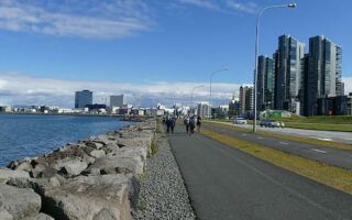
This route around the Reykjavik harbor area is one of the most scenic runs in the city, and it utilizes a pedestrian friendly-path spanning over 5 km (3 miles) along the waterfront.
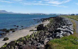
The picturesque jut of the Seltjarnarnes Peninsula is a popular stop for birdwatchers, visitors to the Grótta lighthouse, and sunset seekers, but runners will love the 7.4 km (4.6 mile) loop around this seaside path.

This gorgeous river valley, not far from central Reykjavik, is one of the best kept secrets of the city. Known by locals as the 'Powerade Circle', the 10k route goes around 2 valleys, with the Elliðaá river running through it.
With mild weather and many bike paths, the Fossvogur neighborhood is one of the most popular running spots in Reykjavik. Choose from a 5.6 km route or a longer 11.7 km loop through coastal Kopavogur.
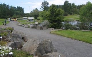
Just east of the city center, the Laugardalur neighborhood boasts a number of scenic paths, including some through the zoo and the the beautiful Grasagarður Botanical Gardens. Our route is 3.5 km (2.15 miles).
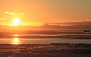
The area surrounding the tiny Reykjavik airport makes for a scenic and breezy 7 km (4.5 mile) run including the Perlan Museum, the University, and Vatnsmyri Swamp.
User Ratings
Leave A Review or Comment
Review or Comment on This Route/Share a Photo!
Share your feedback on this route and see that of other Great Runs users. Click on the image icon to upload a photo. And please let us know if there are notes or changes we should incorporate!