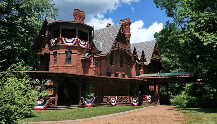
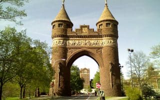
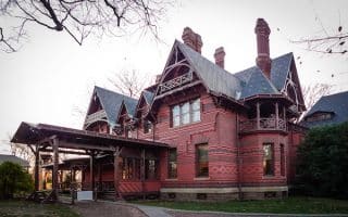
This ~5 mile loop through downtown covers the top sights in Hartford, from political buildings to famous homes. It starts out on Main Street near the Wadsworth Atheneum Museum of Art. From there, head east through Burr Mall, past Alexander Calder’s “Stegosaurus” sculpture. Turn LEFT on Prospect Street and run north past Traveler’s Tower and Constitution Plaza. Turn RIGHT on Bob Steele Street then LEFT on Columbus Boulevard to pass the Connecticut Science Center and Phoenix Plaza. Turn LEFT on Pearl Street and pass the Old State House. Continue west past Bushnell park and follow Asylum Ave through the historic district to Woodland Street. Turn LEFT onto Woodland and run past the Mark Twain house at the corner of Woodland and Farmington. Return west on Farmington until it merges with Asylum. Run through Bushnell Park to catch a glimpse of the Capitol Building, then turn on to Gold Street. You’ll pass the ancient burial ground and the Carl Andre Stone field sculpture before returning to the route start on Main Street.
Categories:
Scroll Down For Route Maps
Essentials
- 4.6 miles
- 226 feet
- Wadsworth Atheneum
- Main Street
Current Weather & Forecast

Hartford, US
9:42 am,
Jun 3, 2026
L: 21°
H: 24°
Daily ForecastHourly Forecast
Today
5:00 pm
21° / 24°°C
0 mm
0%
4 mph
73 %
1015 mb
0 mm/h
Tomorrow
5:00 pm
13° / 19°°C
1 mm
100%
8 mph
100 %
1016 mb
0 mm/h
Friday
5:00 pm
11° / 20°°C
0.72 mm
72%
6 mph
97 %
1018 mb
0 mm/h
Saturday
5:00 pm
11° / 27°°C
0 mm
0%
8 mph
78 %
1023 mb
0 mm/h
Sunday
5:00 pm
11° / 26°°C
0 mm
0%
5 mph
85 %
1026 mb
0 mm/h
Today
11:00 am
18° / 24°°C
0 mm
0%
4 mph
57 %
1014 mb
0 mm/h
Today
2:00 pm
19° / 22°°C
0 mm
0%
3 mph
57 %
1014 mb
0 mm/h
Today
5:00 pm
17° / 17°°C
0 mm
0%
2 mph
73 %
1015 mb
0 mm/h
Today
8:00 pm
17° / 17°°C
0 mm
0%
4 mph
80 %
1013 mb
0 mm/h
Today
11:00 pm
17° / 17°°C
0 mm
0%
4 mph
80 %
1011 mb
0 mm/h
Tomorrow
2:00 am
19° / 19°°C
0 mm
0%
3 mph
73 %
1011 mb
0 mm/h
Tomorrow
5:00 am
19° / 19°°C
1 mm
100%
8 mph
94 %
1013 mb
0 mm/h
Other Routes in Hartford, CT
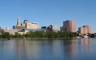
The city of Hartford has embraced it’s frontage on the Connecticut River with over 5 miles of paths and bridges through riverside parks located right downtown. Paths on both sides of the river from the Charter Oak Bridge to Riverside Park.
The lovely walkways encircling a carousel, lily pond, and the Connecticut State Capitol at Bushnell Park are the jewel of downtown. Our route around the perimeter is about 1.25 miles.
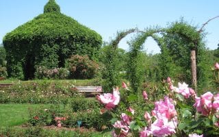
This gorgeous park in West Hartford is known for its elaborate rose gardens, encircled by miles of paved and gravel paths. One loop around the park’s main way is about 1.8 miles. Terrific neighborhood running on streets adjacent to park.
This 6.5 mile run combines the best of Hartford's parks and a section of our Hartford history tour. Bushnell Park, a loop around Elizabeth Park, and the important sites along Asylum Ave. & Farmington Ave., which run between the two parks.
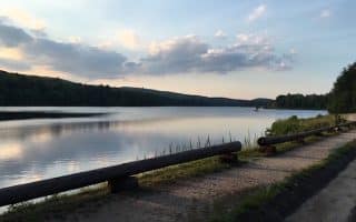
Local runners love these paved and gravel paths around the city’s reservoir system. 3.4 loop around Reservoir 1, 3.6 mile loop around Reservoir 6, with additional trails and wooded paths.
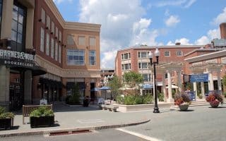
The city of West Hartford is an up and coming suburb, known for its elegant neighborhoods and hip shopping centers. Public improvement projects have recently amped up streets, sidewalks, and lighting, making for a great commercial/residential runs.

Good opportunity for a long off-road run east of Hartford. The dirt/gravel path follows an old rail line through Vernon, Bolton, Coventry, Andover, and Columbia. Mainly wooded. Seamless and well-marked.
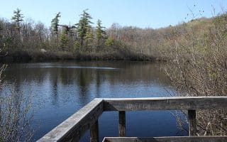
Run a section of the 60+ mile Metacomet Trail in Penwood State Park. This hilly but scenic 6 mile out and back includes views of a lake and a vista from a traprock ledge.
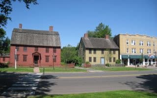
A beautiful run in the state's largest historic district, spanning 2 sq mi and 1,100 buildings dating back to the 17th, 18th and 19th centuries. Old Wethersfield is 5 miles south of Hartford. Create your own route or use our 4.3 mile mapped run.

Scenic, paved multi-use trail follows a historic canal towpath for 4.5 miles between Windsor Locks and Suffield. The path runs along a thin strip of land between the old canal and the Connecticut River. Great water views. NOTE: Closed Nov.15-March 31.
User Ratings
Leave A Review or Comment
Review or Comment on This Route/Share a Photo!
Share your feedback on this route and see that of other Great Runs users. Click on the image icon to upload a photo. And please let us know if there are notes or changes we should incorporate!