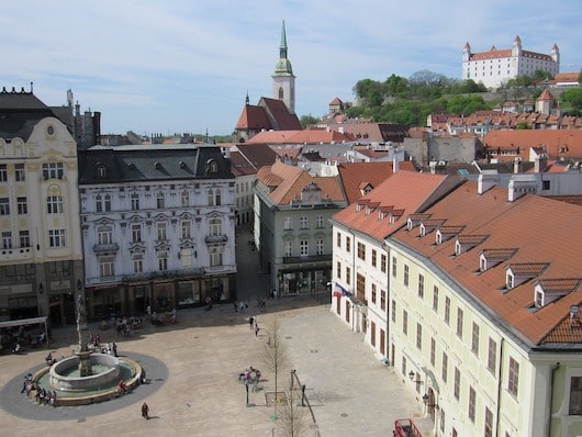
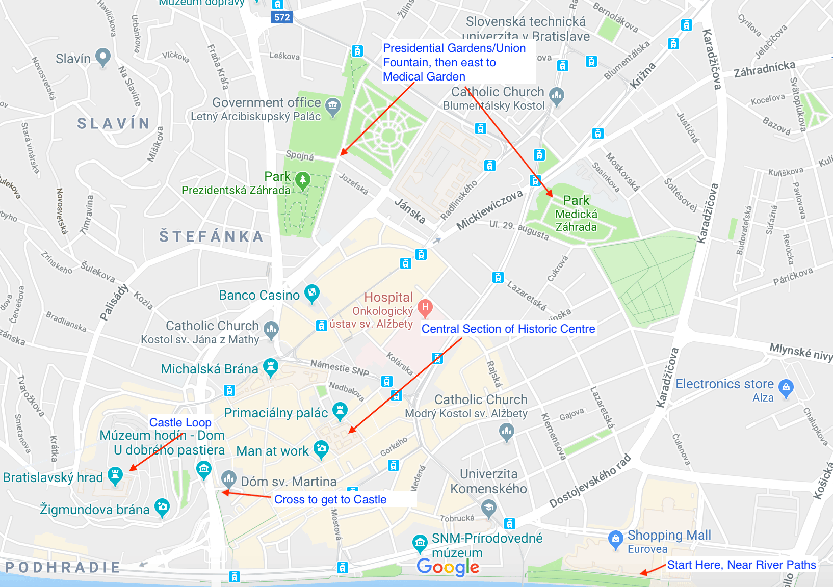
This is a ‘runseeing’ tour of some of the historic highlights of Bratislava. The historic center is on the left bank of the river, bordered by the Castle to the west, Šancová/Rt. 572 to the north, and Karadžičova to the east. The streets of the old city are winding and narrow, so it’s quite difficult to map a specific route for you without many twists and turns. Instead, see our description of an outline route below, our route map, and then a ‘history run’ map produced by visitbratislava that lists the main sites of the old city. The main elements you want to cover in a ‘runseeing’ tour of Bratislava are a stretch along the river’s left bank, a loop around the Castle, the Presidential Garden/ Fountain of Union complex over to the ‘Medical Garden’, and a DIY tour of the maze-like streets of the historic center.
Presidential Garden (Wikimedia)
Recommended Outline route: START at the Socha Milana Rastislava Štefánika landmark, head west to the Slovak National Museum, and continue along the water, crossing the street at the Old Bridge, and do a loop around the Castle, which features great views from its hilltop location. Note: the road to the castle is hilly. Additional path options here, including some fun stairs.
Head north for 0.5 km for a loop around the spectacular paths of the Presidential Garden, grounds of the government offices, and the Fountain of Union. Then head back slightly south to create your own tour of the maze-like streets of the old city, capturing some of the major sites. Michalská is a good north-south anchor toward the river, and Panská is a good east-west anchor.
Scroll Down For Route Maps
Essentials
8-10 km (5-6 miles) depending on sections chosen
Fairly hilly: 80m (260 feet) in our mapped route
Official start is Socha Milana Rastislava Štefánika; Or anywhere convenient.
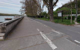
A classic European river run. For a 10k loop, run between the the Apollo and Lafranconi bridges. On the 'left bank', the path is more developed, skirting Bratislava's historic center. The right bank, in Petržalka, alternates between wooded and waterfront paths.
The oldest public park in central Europe. Located on the right bank of the Danube, it's ~2 km along paths and lawns lined by historic trees. For a longer run, combine with riverfront paths on either side of the river.
Popular park located in the city center, with combination of wide gravel paths, more rugged trails, and lots of stairs. Hilly! One can put together a 2-3 km in the park, or combine with Presidential Gardens/historic center for a longer run.
A decent off-road opportunity just north of the city center, in the Nové Mesto area. A paved path around Kuchajda Lake is a 1.5 km loop. Good add-ons include an oval track at Pasienky Stadium and another 1 km loop around Štrkovec Lake just to the south.
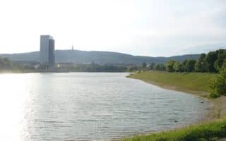
Some good waterside running in the Petržalka area, about 5 km south of the city center. The more developed path is the 2 km around 'Big Draždiak' Lake, with a 3.7 km loop possible including 'Little Draždiak' Lake. Paths along a small river nearby are a good add-on.
There are paths along the Danube heading south for nearly 200 km to Budapest. Popular for cycling, running, and other activities. Access the Danube Dam from the Petržalka area, or for a special section, start at the Danubiana Museum.
Large 'Urban Forest' park just north of the city center. Something for every runner here, from flats to hills, meadows to lakes to forests. There are paved roads, and paths/trails that range from wide to narrow and technical. For a challenge, head up Kamzík.
Great views from the summit of this 439m hill directly above the city. Part of the same larger preserve as the Železná Studnička urban forest. From the summit, good variety of roads and trails for running, from flat to hilly, open or wooded.
Share your feedback on this route and see that of other Great Runs users. Click on the image icon to upload a photo. And please let us know if there are notes or changes we should incorporate!
Subscribe
0 Comments
Oldest
Newest
Inline Feedbacks
View all comments
Essentials
8-10 km (5-6 miles) depending on sections chosen
Fairly hilly: 80m (260 feet) in our mapped route
Official start is Socha Milana Rastislava Štefánika; Or anywhere convenient.


Review or Comment on This Route/Share a Photo!
Share your feedback on this route and see that of other Great Runs users. Click on the image icon to upload a photo. And please let us know if there are notes or changes we should incorporate!