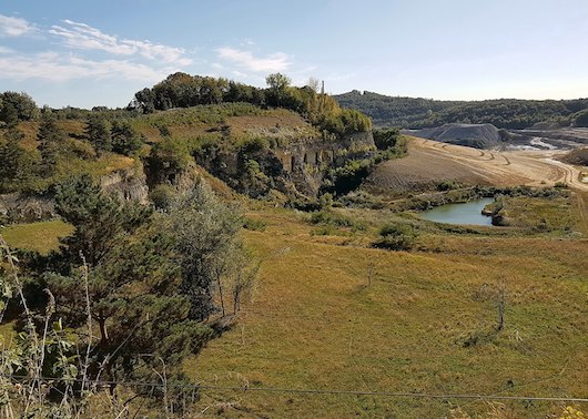
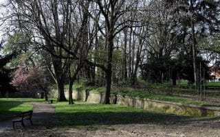
If you look at the hundreds of routes we’ve designed in the Netherlands, very few would be classified as hilly. But here’s one! Mount Saint Peter is a 171m-tall plateau that features the remains of a castle, a monastery, a fort, and other buildings. There’s also a cave under the mountain, which can be visited with a guide.
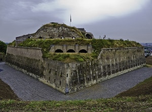
Sint Pieter Fort. Wikimedia Commons.
This is a park-like area with some nice trails for running — and an opportunity to get in some elevation! The mountain/plateau itself is a bit of an industrial site. We recommend a loop starting at the northern part of the area, at the Fort. Run south on the paths/trails paralleling Mergelweg. At Devil’s Cave (Duivelsgrot) at the southern end, you’ll be right near the Belgian border, making a loop to head back north, on the path alongside Maasboulevard, with the Meuse River on the right. You’ll pass the St Pieter pilgrimage place, a museum, and a watersports club. At Villa Park, turn LEFT onto Burgemeester Ceulenstraat, then LEFT on Bergweg and RIGHT on Observantenweg to complete the loop.
If you look at the hundreds of routes we’ve designed in the Netherlands, very few would be classified as hilly. But here’s one! Mount Saint Peter is a 171m-tall plateau that features the remains of a castle, a monastery, a fort, and other buildings. There’s also a cave under the mountain, which can be visited with a guide.
Sint Pieter Fort. Wikimedia Commons.
This is a park-like area with some nice trails for running — and an opportunity to get in some elevation! The mountain/plateau itself is a bit of an industrial site. We recommend a loop starting at the northern part of the area, at the Fort. Run south on the paths/trails paralleling Mergelweg. At Devil’s Cave (Duivelsgrot) at the southern end, you’ll be right near the Belgian border, making a loop to head back north, on the path alongside Maasboulevard, with the Meuse River on the right. You’ll pass the St Pieter pilgrimage place, a museum, and a watersports club. At Villa Park, turn LEFT onto Burgemeester Ceulenstraat, then LEFT on Bergweg and RIGHT on Observantenweg to complete the loop.
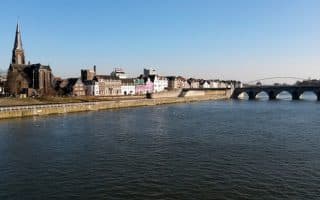
Pleasant riverside running in central Maastricht. It's quite open, with nice views of the water and the historic center, then becoming more pastoral. We've mapped routes on both sides, though the east side paths are longer and more seamless.
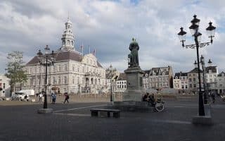
An 8 km 'runseeing' tour of Maastricht. Lots of variety -- historic bridges, waterfront paths, a fort, parks, two rivers, and the Maastricht University campus. Good opportunities to add on.
A nice run through a series of parks bordering the narrow Jerker River, which extends west of Maastricht. The route forms sort of a greenbelt, and includes Stadtpark, the pleasant campus of Maastricht University, Jekerpark, and Waldeckpark.
Share your feedback on this route and see that of other Great Runs users. Click on the image icon to upload a photo. And please let us know if there are notes or changes we should incorporate!

Review or Comment on This Route/Share a Photo!
Share your feedback on this route and see that of other Great Runs users. Click on the image icon to upload a photo. And please let us know if there are notes or changes we should incorporate!