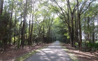
Nocatee is a master planned community that sits inland, between St. Augustine and Jacksonville. This is a very pleasant area for running. The best option is to run on the wide paths of the 5,000 acres of village-like neighborhoods. This fitness trails map has suggestions for numerous loops, with notes on sights along the way. One can put together 10+ miles of off-road, non-overlapping running.
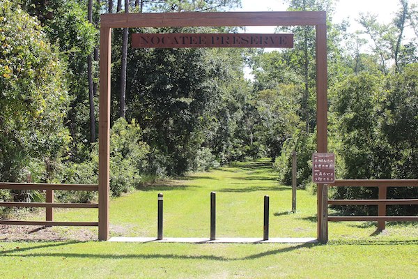
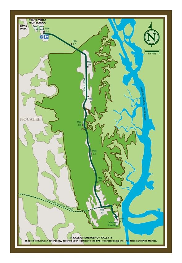
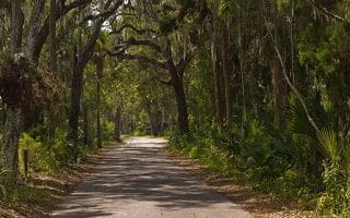
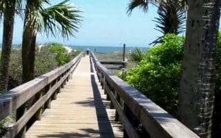
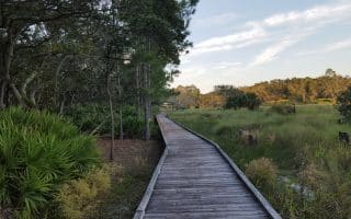
For something more rugged, head over to the Nocatee Preserve, which encompasses 2,400 acres of wildly beautiful land fronting a 3.5-mile stretch of the Intracoastal Waterway known as the Tolomato River. There’s a nature/greenway trail that stretches for 3.5 miles one-way, starting off Davis Park Rd. near the Ponte Vedra High School and heading south. It’s a dirt trail than can be grassy in spots and sandy in spots. Bring bug spray!
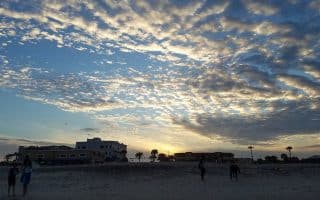
Courtesy: Nocatee.com
Nocatee is a master planned community that sits inland, between St. Augustine and Jacksonville. This is a very pleasant area for running. The best option is to run on the wide paths of the 5,000 acres of village-like neighborhoods. This fitness trails map has suggestions for numerous loops, with notes on sights along the way. One can put together 10+ miles of off-road, non-overlapping running.
For something more rugged, head over to the Nocatee Preserve, which encompasses 2,400 acres of wildly beautiful land fronting a 3.5-mile stretch of the Intracoastal Waterway known as the Tolomato River. There’s a nature/greenway trail that stretches for 3.5 miles one-way, starting off Davis Park Rd. near the Ponte Vedra High School and heading south. It’s a dirt trail than can be grassy in spots and sandy in spots. Bring bug spray!
Scroll Down For Route Maps
Essentials
Numerous loop options on Fitness Trails; Greenway Trail in Nature Preserve is 3.5 miles one-way
For Fitness Trails, see map; Nature Preserve Trailhead is off Davis Park Rd. near the Ponte Vedra High School
Nature Preserve Trailhead is off Davis Park Rd. near the Ponte Vedra High School
The Riverwalk is the running highlight of downtown Jacksonville, with 2 miles of paths on the north bank and 1 mile on the south bank of the St. Johns River, connected by the Main St. Bridge and Acosta Bridge. Stadium loop is 2.5 mile add-on.
Another option for a downtown run, incorporating trendy San Marco Square, an upscale residential district, two bridges, and a section of the Riverwalk Path. Add on or combine with Riverwalk.
The Ortega neighborhood is bordered by the St. Johns River on the East, the Cedar River on the North, and the Ortega river on the West, practically making it an "inland island."
This diverse neighborhood reveals part of Jacksonville’s rich cultural diversity. A great run for hot days as it provides lots of shade & you can find the perfect fit gear at 1st Place Sports while you’re at it!
The Jacksonville-Baldwin Trail is 14.5 miles long and runs from Jacksonville’s westside to the small town of Baldwin. The trail is great for running as the surface is entirely asphalt.
The Theodore Roosevelt Preserve covers 600 acres adjacent to the Fort Caroline National Memorial. The trails offer a lot of elevation, with some of the steepest hills you will find in the area.
Hanna Park is a 450 acre park located oceanfront just north of Atlantic Beach. With cool ocean breezes along the way and a plunge in the surf after your run, this park is ideal for one of the hot days!
One of the best off-road courses in the Jacksonville Area, these are easy trails through terrain ranging from sandhill to lush floodplain swamp and marshes. Blazed loops of 3.9 and 6.1 miles.
The Perfect 10 got its name not for it's beauty or terrain, but because it was measured several times. Although it is also one of the most scenic runs in Jacksonville!
Amelia Island and its main city of Fernandina Beach are located just 40 minutes north of Jacksonville on a beautiful barrier beach between the Amelia River and the Atlantic ocean. Great beach running, bike paths, state parks, and scenery, plus a hip downtown area.
Share your feedback on this route and see that of other Great Runs users. Click on the image icon to upload a photo. And please let us know if there are notes or changes we should incorporate!
Subscribe
6 Comments
Oldest
Newest
Inline Feedbacks
View all comments
Essentials
Numerous loop options on Fitness Trails; Greenway Trail in Nature Preserve is 3.5 miles one-way
For Fitness Trails, see map; Nature Preserve Trailhead is off Davis Park Rd. near the Ponte Vedra High School
Nature Preserve Trailhead is off Davis Park Rd. near the Ponte Vedra High School


Review or Comment on This Route/Share a Photo!
Share your feedback on this route and see that of other Great Runs users. Click on the image icon to upload a photo. And please let us know if there are notes or changes we should incorporate!