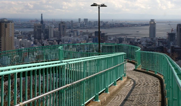
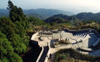
This is one of the most unique runs visitors will find in Kobe. Originally built as an astronomical observatory, this bridge overlooking the port is a popular location for walking (and hill running!) The walkway itself starts near the Suwa Shrine in Chuo Ward, but we’ve mapped a 1.6 km course (one way) from Motomachi Station, passing through lovely Sorakuen Garden. For more mileage, runners can descend the bridge back to Suwayamajido Park and along the riverside Ujigawa Park. There are nice cherry blossom-lined paths along the Ujigawa River all the way to Okurayama Park, where runners can turn around for a ~10 km out and back or hop on the Okurayama Station train for a ~5 km one-way run.
Features:
Categories:
Scroll Down For Route Maps
Essentials
- Up to ~10 km (6 miles)
- 111 meters (365 feet)
- Motomachi Station
- Motomachi Station
Current Weather & Forecast

Kobe, JP
5:59 pm,
Jun 3, 2026
L: 22°
H: 22°
Daily ForecastHourly Forecast
Tomorrow
6:00 am
19° / 27°°C
1 mm
100%
10 mph
98 %
1018 mb
0 mm/h
Friday
6:00 am
21° / 26°°C
1 mm
100%
16 mph
95 %
1018 mb
0 mm/h
Saturday
6:00 am
19° / 26°°C
1 mm
100%
14 mph
89 %
1016 mb
0 mm/h
Sunday
6:00 am
23° / 28°°C
1 mm
100%
11 mph
99 %
1013 mb
0 mm/h
Monday
6:00 am
23° / 33°°C
1 mm
100%
9 mph
98 %
1013 mb
0 mm/h
Today
6:00 pm
23° / 23°°C
0 mm
0%
4 mph
98 %
1015 mb
0 mm/h
Today
9:00 pm
23° / 24°°C
0 mm
0%
4 mph
96 %
1016 mb
0 mm/h
Tomorrow
12:00 am
26° / 27°°C
0.05 mm
5%
8 mph
86 %
1017 mb
0 mm/h
Tomorrow
3:00 am
23° / 23°°C
0.46 mm
46%
9 mph
77 %
1018 mb
0 mm/h
Tomorrow
6:00 am
19° / 19°°C
1 mm
100%
10 mph
90 %
1017 mb
0 mm/h
Tomorrow
9:00 am
26° / 26°°C
1 mm
100%
11 mph
93 %
1017 mb
0 mm/h
Tomorrow
12:00 pm
24° / 24°°C
1 mm
100%
10 mph
95 %
1018 mb
0 mm/h
Other Routes in Kobe, Japan
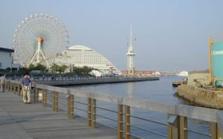
By far the best running in Kobe is along the waterfront promenades of Osaka Bay. There is no one continuous path, but runners can find good sections near Harborland, Suma, Wakinohamakaigandori, and Maiko.
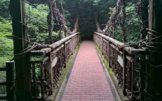
The trail up Mount Maya beginning from Shin-Kobe Station is one of the most popular outdoor spaces in Kobe. Highlights of this uphill run include the Nunobiki Waterfall, an herb garden, and an Observation Deck.
This planned community, intended to support elders and foster community growth, is a great place to run on well-kempt sidewalks and paths. There's also a running track and numerous athletic facilities.

We’ve mapped out three of the best riverside towpaths in Kobe, including nice spots on the Toga River, the Sumiyoshi River, and the Shinminato River. All easily accessible via transport.
Run to the top of Kobe’s tallest mountain on a gentle dirt trail beginning at the gorgeous Rokko Garden Terrace. A not too hilly, 6 km out and back. Numerous other trail options, including an ascent from Ashiyagawa Station.
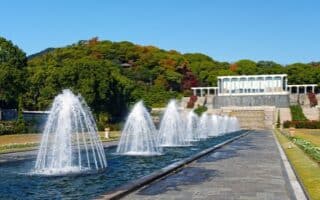
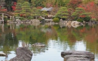
This gorgeous park of gardens and fountains in the Suma area has its own running track, but it can be combined with nearby walkways, the Botanical Gardens, or the Suma Promenade for more mileage.
User Ratings
Leave A Review or Comment
Review or Comment on This Route/Share a Photo!
Share your feedback on this route and see that of other Great Runs users. Click on the image icon to upload a photo. And please let us know if there are notes or changes we should incorporate!