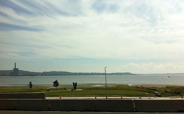
The New Haven area has some attractive waterfront running overlooking Long Island Sound. These are some options just east of I-95:
Long Wharf Dr. and Park has lovely waterfront running along a dedicated path, for 1.5 miles. Great views! Access from Vietnam Veterans Memorial Park ROUTE MAP
Front St. Just north, there’s also really nice waterfront running from Criscuolo Park north to Quinnipiac Terrace near I-91 in Fair Haven, mainly along Front St. It’s possible to combine with the the Long Wharf route (above) using Long Wharf Dr./East St./Chapel St., but it does go through an industrial section for ~1 mile (although there is a bike path). See this MAP for the 4.5 mile combined route, one-way.
From New Haven center it’s 1.7 miles along Grand Ave. to get to Front St.
East Shore Park. Google Street View
East Shore. There’s some great waterfront running in East Haven. We recommend the 3.4 miles from East Shore Park, south to Lighthouse Point Park. Combination of park trails, shore path, and road, with water views much of the way. It’s not one dedicated path — there are some road sections, so helpful to have this MAP of the route.
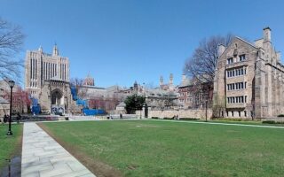
Start with a tour of New Haven Green and cross College Ave. into this classic Olmsted-designed campus. Enjoy 3-4 miles on pedestrian paths passing impressive Gothic style buildings. Add on with adjacent residential streets.
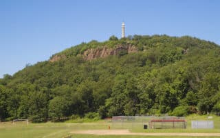
East Rock Park is one of the running highlights of New Haven. A 2.5 mile switchback-ey road leads to the summit, which has great views. Trail runners will enjoy some of the additional, more rugged trails.
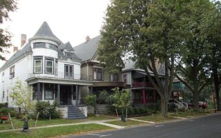
The Prospect Hill Historic District and the residential streets northeast of the Yale campus are a treat for running, with leafy streets and grand Victorian and Colonial homes. We also love running in the affluent suburb of Hamden.
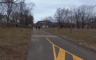
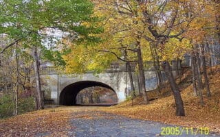
The best option for a long off-road run in New Haven. Paved multi-use trail runs for 58 miles in Connecticut toward the Massachusetts border, passing historic buildings, canal locks, the remains of aqueducts and other landmarks. Trailhead off Temple St.
Some great parks for running just west of central New Haven. Edgewood Park has a 1-mile trail, Yale athletic fields and a running track. Just north, get the heart rate up by running to the summit West Rock Ridge State Park, and enjoy the miles of trails.
Share your feedback on this route and see that of other Great Runs users. Click on the image icon to upload a photo. And please let us know if there are notes or changes we should incorporate!


Review or Comment on This Route/Share a Photo!
Share your feedback on this route and see that of other Great Runs users. Click on the image icon to upload a photo. And please let us know if there are notes or changes we should incorporate!