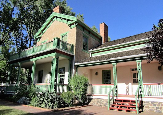
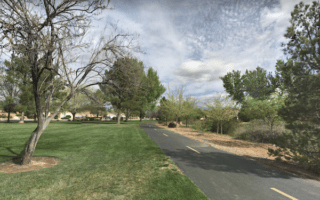
One can stitch together a decent run in downtown St. George, hitting some of the city’s historic highlights and pleasant residential streets. Rather than design a specific route, use the description & map below to create your own route. The area is ~1.5 miles north-south and ~2 miles east-west (I-15 to SR 18/Bluff St.).
The nice area for running is west of I-15. Use Zion Stadium/Dixie State University, and the long St. George Boulevard as anchor points. Be sure to hit the Pioneer Courthouse and the Brigham Young Winter Home, both near the intersection of Main St. & St. George St. At the southern end of the downtown area, Dixie State University has some nice pedestrian paths. The numbered streets East and West tend to be narrower and more residential (i.e. 200 W). We also recommended heading north on 200 E/Skyline Dr. to Pioneer Park, where you can run on some of the park’s roads and trails, as well as a path alongside Red Hills Pkwy, which is a gateway to the Red Cliffs Conservation Area and Snow Canyon State Park.
Essentials
Create your own route. It's ~1.5 miles north-south and ~2 miles east-west (I-15 to SR 18)
Generall flat downtown, hillier toward Pioneer Park
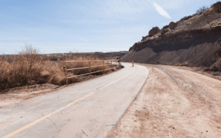
The signature off-road trail in St. George. The paved multi-use path follows the Virgin River for 9 miles between Confluence Park and Washington. Mostly open terrain, with views of the surrounding mountains & rocks. There are several offshoots and spur trails.
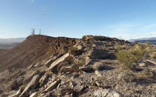
A great run with lots of variety. Follow the Virgin River South spur for up to 2.3 miles through sort of a linear park, then for a challenge, continue for the 1-mile ascent up Webb Hill. A 400-foot gain, with great views from the summit.
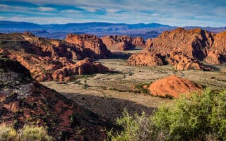
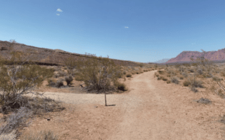
A favorite for running in St. George. The 7,400-acre scenic park is tucked amid lava flows, soaring sandstone cliffs and colorful desert scenery. Easy, scenic running on paved Whiptail Trail. Also some more moderate & challenging trail running.
A decent off-road running opportunity. The two trails combine for ~5 miles, headed north toward Snow Canyon State Park. Nice surrounding desert scenery. Can continue on the Whiptail Trail & other Snow Canyon SP trails.
An easier, wide trail with a good surface. Follows an old pioneer road between the banks of the Santa Clara River and cliffs of Land Hill. Great views of the area landscape, and you might see prehistoric petroglyphs and pioneer graffiti!
Share your feedback on this route and see that of other Great Runs users. Click on the image icon to upload a photo. And please let us know if there are notes or changes we should incorporate!
Subscribe
0 Comments
Oldest
Newest
Inline Feedbacks
View all comments
Essentials
Create your own route. It's ~1.5 miles north-south and ~2 miles east-west (I-15 to SR 18)
Generall flat downtown, hillier toward Pioneer Park


Review or Comment on This Route/Share a Photo!
Share your feedback on this route and see that of other Great Runs users. Click on the image icon to upload a photo. And please let us know if there are notes or changes we should incorporate!