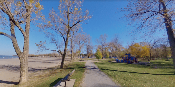
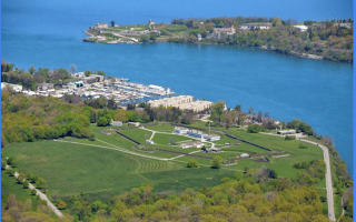
This is our favorite area to run in St. Catharines, with several options to mix & match waterfront paths. Run the 3.3 km Waterfront Trail standalone, combine with a section of the Welland Canal Trail & Walker’s Creek Trail for an 11.5 km loop, or take the George Nicholson Memorial Trail out to MacIntyre Bay.
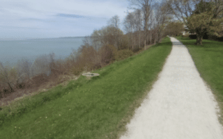
Waterfront Trail Section. The western end of the Waterfront Trail is at Belmont Park off Beachview Dr. Run east along the water for 3.3 km. It’s a mainly gravel path with some nice views of Lake Ontario, passing through several small parks, with a brief on-road section. The path ends at Port Weller Beach. Here, you can continue the Welland Canal Trail (below).
Loop Option: For a terrific 11.5 km loop option, continue east onto the Welland Canal Trail for 2 km to Linwell Rd. The canal trail is a gravel, wooded path inland from the canal for 1 km, then turns to paved and is right alongside the canal. Then head east along Linwell Rd. for 1.6 km to join the Walker’s Creek Trail, a wooded gravel path that heads north through Walker’s Creek Park for 2.3 km to the Lake. Then finish the loop for 2 km east along the Waterfront Trail.
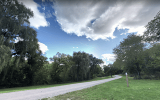
Welland Canal Trail. Google Street View
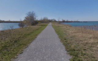
Welland Canal Trail. The gravel path starts just east of the Waterfront Trail off Cumberland Rd. It’s wooded and inland from the canal for 1 km, then turns to paved and is right alongside the canal. We’ve mapped up to 8 km south to the St. Catharines Museum & Welland Canals Centre, though the path continues for several km south of there.
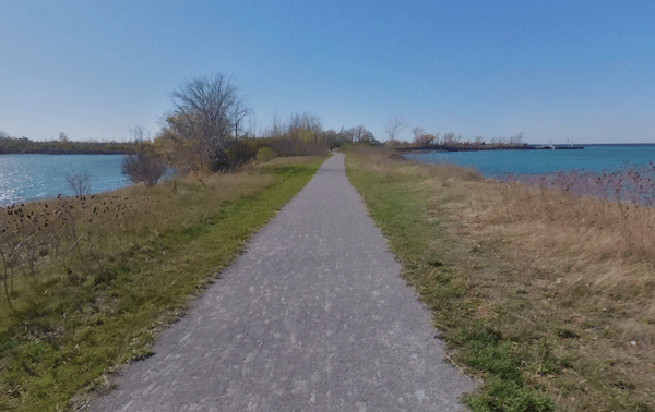
George Nicholson Memorial Trail. Google Street View
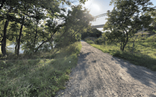
Trail toMacIntyre Bay. On the east side of the Welland Canal/Port Weller Harbour, the George Nicholson Memorial Trail is a scenic, wide dirt path that runs out to MacIntyre Bay. There are fantastic water views, especially at the tip, where the Welland Canal meets Lake Ontario. Starting at Jones Beach, the trail is 5.7 km out and back.
This is our favorite area to run in St. Catharines, with several options to mix & match waterfront paths. Run the 3.3 km Waterfront Trail standalone, combine with a section of the Welland Canal Trail & Walker’s Creek Trail for an 11.5 km loop, or take the George Nicholson Memorial Trail out to MacIntyre Bay.
Waterfront Trail Section. The western end of the Waterfront Trail is at Belmont Park off Beachview Dr. Run east along the water for 3.3 km. It’s a mainly gravel path with some nice views of Lake Ontario, passing through several small parks, with a brief on-road section. The path ends at Port Weller Beach. Here, you can continue the Welland Canal Trail (below).
Loop Option: For a terrific 11.5 km loop option, continue east onto the Welland Canal Trail for 2 km to Linwell Rd. The canal trail is a gravel, wooded path inland from the canal for 1 km, then turns to paved and is right alongside the canal. Then head east along Linwell Rd. for 1.6 km to join the Walker’s Creek Trail, a wooded gravel path that heads north through Walker’s Creek Park for 2.3 km to the Lake. Then finish the loop for 2 km east along the Waterfront Trail.
Welland Canal Trail. Google Street View
Welland Canal Trail. The gravel path starts just east of the Waterfront Trail off Cumberland Rd. It’s wooded and inland from the canal for 1 km, then turns to paved and is right alongside the canal. We’ve mapped up to 8 km south to the St. Catharines Museum & Welland Canals Centre, though the path continues for several km south of there.
George Nicholson Memorial Trail. Google Street View
Trail toMacIntyre Bay. On the east side of the Welland Canal/Port Weller Harbour, the George Nicholson Memorial Trail is a scenic, wide dirt path that runs out to MacIntyre Bay. There are fantastic water views, especially at the tip, where the Welland Canal meets Lake Ontario. Starting at Jones Beach, the trail is 5.7 km out and back.
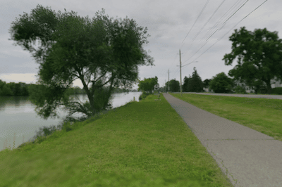
A linear park type trail that runs for 8.5 km along Twelve Mile Creek, downtown St. Catharines, and then Centennial Gardens. The nicest section of this paved/gravel path is the 3.5 km in the Canal Valley, with another 1-2 km possible in Clifford’s Creek Park.
Pleasant gravel trails head south from along Twelve Creek for ~5 km. The Twelve Trail is on the east side, ending at Brock University, and the Participark Trail is on the west side. Loop option using the pedestrian bridge at the halfway point.
Some very nice running in southern St. Catharines. Explore the park-like campus of Brock University, then use the Bruce Trail for an easy trail run around Glenridge Quarry, and/or a run around Lake Moodie for up to 6 km to Decew Falls.
Piers, parks, marinas, and Lake Ontario all in one run! In the Port Dalhousie neighborhood, enjoy the Harbour Walkway Trail to Royal Henley Park and Lockhart Point, then the Waterfront Trail around the Marina and along Lake Ontario.
On the east side of the Welland Canal, the George Nicholson Memorial Trail is a scenic, wide dirt path that runs along Port Weller Harbour out to MacIntyre Bay. There are fantastic water views, especially at the tip, where the Welland Canal meets Lake Ontario.
Pretty town on Lake Ontario known for the Shaw summer theater festival, wineries, historic homes and sites. We've designed a 10.7 km 'grand tour', including a 4 km loop of Fort George, flower-filled Queen St., lakeshore, and Historic Old Town.
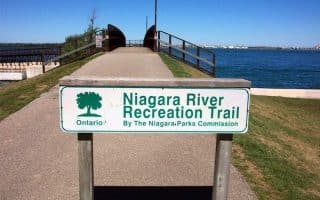
Paved multi-use path that runs for nearly 20 km along the Niagara River between Niagara-on-the-Lake and Niagara Falls. Highlights include some lovely riverfront sections, Queenston Heights Park, Floral Clock, Niagara Botanical Gardens.
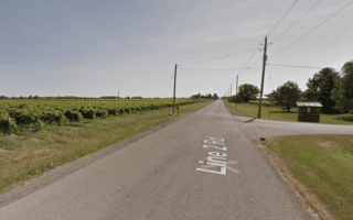
A series of long, flat, open roads between Rt. 55 and the Niagara Parkway passing by wineries and farmland. These roads have relatively little traffic and are a pleasure for running on open terrain. Each of Line 1, Line 2, or Line 3 roads is 4-5 km.
Share your feedback on this route and see that of other Great Runs users. Click on the image icon to upload a photo. And please let us know if there are notes or changes we should incorporate!


Review or Comment on This Route/Share a Photo!
Share your feedback on this route and see that of other Great Runs users. Click on the image icon to upload a photo. And please let us know if there are notes or changes we should incorporate!