There’s some nice waterfront running in the Toulon area, divided into a few non-contiguous sections.
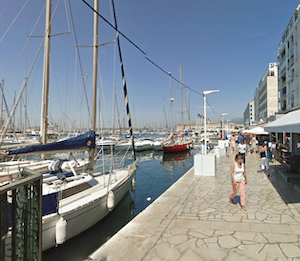
Port of Toulon. Google Street View
Port of Toulon Area. One can run for nearly 6 km along the water in central Toulon near the port area. At the western end, start at the Marine Museum near the ferry terminal. Follow the quai (waterfront path) south for 2.7 km to La Tour Royale (parking there), and then head east toward Fort Saint-Louis and then along Plages du Mourillon (beach) on the Promenade Henri Fabre (also parking). Nice views of the water most of the way. ROUTE MAP
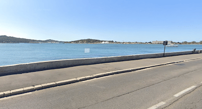
Seyne-sur-Mer. Google Street View
La Seyne-sur-Mer. This community just west of Toulon also has some attractive waterside running. From the 17th-century Fort Balaguier, follow the wide sidewalk along Cor Michel Pacha for up to 4.5 km to the Port Pin Rolland. Nice views of Lazaret Bay the whole way. ROUTE MAP
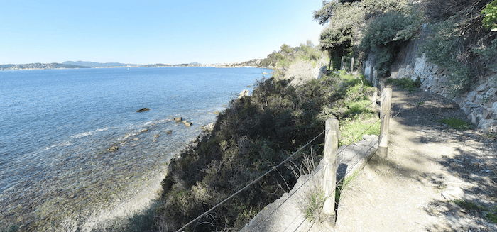
Coastal Trail Running/Hiking (Sentier de Littoral). There’s an extensive network of coastal hiking paths in the Toulon area, making for some scenic but challenging trail running. It’s called the Sentier de Littoral. Lots of ups & downs, and some stairs, with varied footing and narrow in sections. But this is heaven for more experienced trail runners! A few sections:
Crique fred six fours to Fabregas in La Seyne-sur-Mer. 6 km of rugged coastal hiking, with great views. It’s a gain of 420m from west to east, but if you’d prefer a flatter section, choose the 2.5 km section of trail between Cap Sicié and Fabregas, which rises just above the beach. ROUTE MAP
Sentier des Douaniers in Toulon. Just east of Mourillon beach, the Sentier des Douaniers/Chemin du Fort Du Cap coastal path goes for 2.5 km east to Port Mejean. Fairly flat! ROUTE MAP
There’s some nice waterfront running in the Toulon area, divided into a few non-contiguous sections.
Port of Toulon. Google Street View
Port of Toulon Area. One can run for nearly 6 km along the water in central Toulon near the port area. At the western end, start at the Marine Museum near the ferry terminal. Follow the quai (waterfront path) south for 2.7 km to La Tour Royale (parking there), and then head east toward Fort Saint-Louis and then along Plages du Mourillon (beach) on the Promenade Henri Fabre (also parking). Nice views of the water most of the way. ROUTE MAP
Seyne-sur-Mer. Google Street View
La Seyne-sur-Mer. This community just west of Toulon also has some attractive waterside running. From the 17th-century Fort Balaguier, follow the wide sidewalk along Cor Michel Pacha for up to 4.5 km to the Port Pin Rolland. Nice views of Lazaret Bay the whole way. ROUTE MAP
Coastal Trail Running/Hiking (Sentier de Littoral). There’s an extensive network of coastal hiking paths in the Toulon area, making for some scenic but challenging trail running. It’s called the Sentier de Littoral. Lots of ups & downs, and some stairs, with varied footing and narrow in sections. But this is heaven for more experienced trail runners! A few sections:
Crique fred six fours to Fabregas in La Seyne-sur-Mer. 6 km of rugged coastal hiking, with great views. It’s a gain of 420m from west to east, but if you’d prefer a flatter section, choose the 2.5 km section of trail between Cap Sicié and Fabregas, which rises just above the beach. ROUTE MAP
Sentier des Douaniers in Toulon. Just east of Mourillon beach, the Sentier des Douaniers/Chemin du Fort Du Cap coastal path goes for 2.5 km east to Port Mejean. Fairly flat! ROUTE MAP
Scroll Down For Route Maps
Essentials
Depends on route chosen
Good parking in all these areas. Train stations in Toulon and La Seyne-Six-Fours
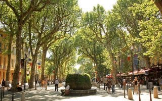
The southwesternmost district of Provence, Bouches du Rhone's most noteworthy running cities are Aix-en-Provence, and of course, Marseille (where we've prepared an extensive separate running guide.
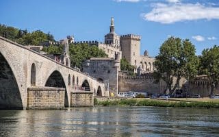
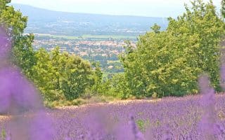
Vaucluse is one of the finest parts of Provence for running. In Avignon, there's terrific riverfront running, while in the countryside of the Luberon, enjoy the famous veloroute, cedar forest, and lavender-lined trails.
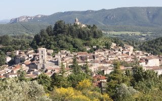
Running in the quiet Haute Alps district of northern Provence is a little harder to find, but we've mapped out a great 10 km route of the vineyards and villages in the area known as Enclave des Papes.
The most central of Provence's districts, Alpes de Haute Provence is home to several pastoral routes. Enjoy the capital of Digne Les Baines, trails in historic Forcalquier, the ski village of Pra Loup, and the pastoral Jabron valley.
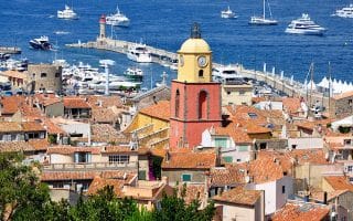
The Var region, on the south central coast, has some of the best running in Provence, from the lengthy cycling paths near Draguignan, to the trails of Villacroze, to the coastal views of Saint Tropez, Saint Cyr, Sansary, and Porquerolles.
For runs in the southeastern region of Provence, also known as the Côte d’Azur or French Riviera, check out our guides to Nice, Cannes, and the surrounding areas, which includes more than 20 spectacular routes along the coast and in the hills.
Share your feedback on this route and see that of other Great Runs users. Click on the image icon to upload a photo. And please let us know if there are notes or changes we should incorporate!
Subscribe
0 Comments
Oldest
Newest
Inline Feedbacks
View all comments
Essentials
Depends on route chosen
Good parking in all these areas. Train stations in Toulon and La Seyne-Six-Fours

Review or Comment on This Route/Share a Photo!
Share your feedback on this route and see that of other Great Runs users. Click on the image icon to upload a photo. And please let us know if there are notes or changes we should incorporate!