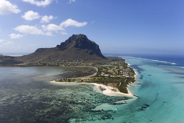
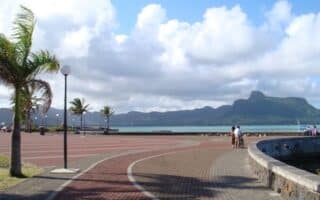
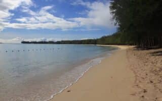
There’s some scenic, safer running in Le Morne. The area is popular for its scenic public beach, and for the Le Morne Trail, a path that passes by several resorts and then along the water around the Baie des Kouillons.
La Morne Trail. 6 km one-way, flat. Access a path at La Morne Beach and follow the road/path, passing several resorts for 2.6 km to the tip of the peninsula. Continuing east on the more dedicated trail section, it’s another 2 km to the eastern trailhead, and 3 km to where the road/trail meets the B9 Highway. It’s possible to use the B9 to complete a loop of Le Morne peninsula, but note there could be traffic and there’s no sidewalk/shoulder. ROUTE MAP
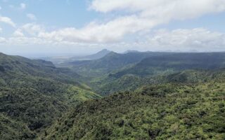
Run/Hike to Le Morne Cross. Here’s one to get the heart rate up! From the tip of the peninsula, a trail leads up rocky Le Morne Mountain to Le Morne Cross. The area is a World Heritage Site. There are fantastic views from the summit. It is a steep climb — 230m over 0.8 km. Overall, this spur is 4 km out and back. Note: It is open & exposed and can be very hot. Also crowded at times, best to go early (officially opens at 7am but according to a GR user in the comments there’s a hole in the fence if you want to go early!
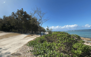
There’s some scenic, safer running in Le Morne. The area is popular for its scenic public beach, and for the Le Morne Trail, a path that passes by several resorts and then along the water around the Baie des Kouillons.
La Morne Trail. 6 km one-way, flat. Access a path at La Morne Beach and follow the road/path, passing several resorts for 2.6 km to the tip of the peninsula. Continuing east on the more dedicated trail section, it’s another 2 km to the eastern trailhead, and 3 km to where the road/trail meets the B9 Highway. It’s possible to use the B9 to complete a loop of Le Morne peninsula, but note there could be traffic and there’s no sidewalk/shoulder. ROUTE MAP
Run/Hike to Le Morne Cross. Here’s one to get the heart rate up! From the tip of the peninsula, a trail leads up rocky Le Morne Mountain to Le Morne Cross. The area is a World Heritage Site. There are fantastic views from the summit. It is a steep climb — 230m over 0.8 km. Overall, this spur is 4 km out and back. Note: It is open & exposed and can be very hot. Also crowded at times, best to go early (officially opens at 7am but according to a GR user in the comments there’s a hole in the fence if you want to go early!


Review or Comment on This Route/Share a Photo!
Share your feedback on this route and see that of other Great Runs users. Click on the image icon to upload a photo. And please let us know if there are notes or changes we should incorporate!