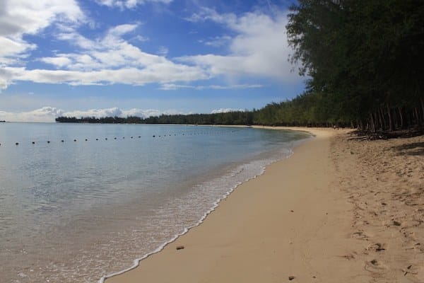
On the northern end of Mauritius, the Grand Baie and Mont Choisy areas are popular with visitors, known for their public beaches, golf course, and resort hotels. There are some decent running options in this area:
Beach Running. The beaches in this area are wider and are among the more ‘runnable’ beaches on Mauritius, as they’re wider and have some decent firm sand near the water. Grand Baie Beach is ~1 km long and is a festive scene, with bars and restaurants. Moint Choisy Beach is ~1.5 km long and is also wider with some decent firm sand.
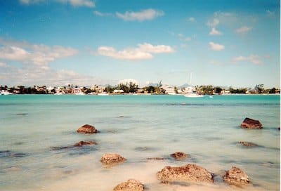
Grand Baie. CC: mwanasimba from La Réunion
Side Roads. Off the main B13 Highway, there are some decent side roads for running. A good option is the Coastal Road that comes off the B13 Highway and leads to Moint Choisy Beach. It’s 3 km long and has less traffic than the main road (Note: no shoulder/sidewalk). There’s also a network of small roads inland from Pereybere Public Beach, where there are numerous villas. Create your own route on some of these quieter roads.
B13 Road. This is the main road in the area, and there are sections of it in Pereybere, Grand Baie and Mont Choisy that have a narrow sidewalk or shoulder, making it ‘runnable’. Use caution and try to go at quiet times.
On the northern end of Mauritius, the Grand Baie and Mont Choisy areas are popular with visitors, known for their public beaches, golf course, and resort hotels. There are some decent running options in this area:
Beach Running. The beaches in this area are wider and are among the more ‘runnable’ beaches on Mauritius, as they’re wider and have some decent firm sand near the water. Grand Baie Beach is ~1 km long and is a festive scene, with bars and restaurants. Moint Choisy Beach is ~1.5 km long and is also wider with some decent firm sand.
Grand Baie. CC: mwanasimba from La Réunion
Side Roads. Off the main B13 Highway, there are some decent side roads for running. A good option is the Coastal Road that comes off the B13 Highway and leads to Moint Choisy Beach. It’s 3 km long and has less traffic than the main road (Note: no shoulder/sidewalk). There’s also a network of small roads inland from Pereybere Public Beach, where there are numerous villas. Create your own route on some of these quieter roads.
B13 Road. This is the main road in the area, and there are sections of it in Pereybere, Grand Baie and Mont Choisy that have a narrow sidewalk or shoulder, making it ‘runnable’. Use caution and try to go at quiet times.
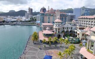
A 9 km 'runseeing' tour of Mauritius' capital city hits the highlights: waterfront, gardens, Citadelle, a loop around Champ de Mars, and some historic buildings and mosques. It's one of the more 'runnable' longer runs on Mauritius.
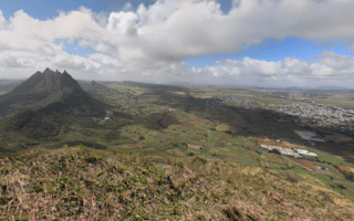
Some excellent hill and trail running options in and near Port Louis. More 'runnable' are Marie Reine/Signal Mountain, and the trail along Canal Anglais to the Plateau. Hiking/challenging trail options in the La Dauguet area.
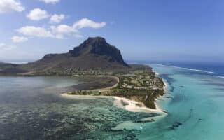
Le Morne is a scenic peninsula at the southwestern tip of Mauritius. Run the flat Le Morne trail along the water, or for a challenge, run/hike the trail to Le Morne Cross.
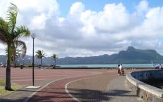
At the southwestern end of Mauritius, there some decent running on the 6 km coastal road between Blue Bay and Mahebourg. It's a quieter road and less trafficked. Flat, with some nice water views. The 0.6 km Esplanade in Mahebourg is the highlight.
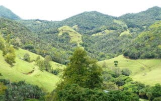
A unique running experience! La Vallée de Ferney is a 'tropical agrihood' consisting of lush, green farm valleys and endemic forests. There's a network of scenic trails, ranging from easy to challenging. One of our favorite spots on Mauritius for running.
The Palmar area is a popular visitor spot on Mauritius, for its beach and beautiful water views. Running options include ~1.5 km of firm sand road alongside the beach, or some quiet farm roads Inland from Belle Mar.
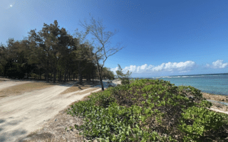
Bras d’Eau National Park, located in the northeast of Mauritius, is a good spot for a fairly easy trail run through a forest consisting of mangroves and other endemic trees. The Coq des Bois Trail is a 5 km out and back from the Bras D’eau Visitor’s Centre.
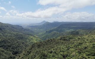
Black River Gorges National Park is a must-see on Mauritius, with rare plants, animals, and birds. It's mainly a hiking and trail running destination, with 60 km of trails. One good, easier option is the Macchabée Trail, which leads to the Macchabée Viewpoint.
Share your feedback on this route and see that of other Great Runs users. Click on the image icon to upload a photo. And please let us know if there are notes or changes we should incorporate!

Review or Comment on This Route/Share a Photo!
Share your feedback on this route and see that of other Great Runs users. Click on the image icon to upload a photo. And please let us know if there are notes or changes we should incorporate!