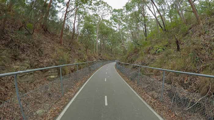
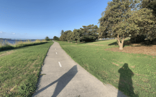
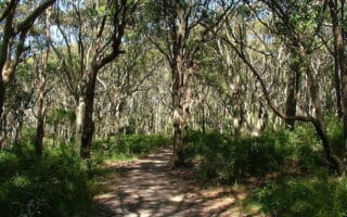
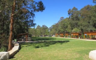
The Fernleigh Track offers a great opportunity for a longer inland run in Newcastle. The paved multi-use path follows an old coal rail line for up to 15 km between Adamstown and Belmont. The terrain is a mix: woods (bushland), residential, and some wetlands. This brochure has detailed information on the path’s features & segment distances.
CC: Maurice van Creij
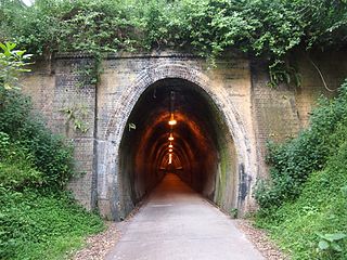
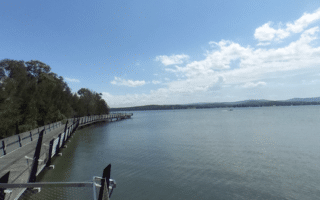
The northern terminus is off Park Ave. near the Adamstown Train Station. Head south for as many km as you like! At the 2 km mark, a tunnel runs underneath the highway. At 3 km, the path passes through the Glenrock Conservation Area, where you can join the Yuelarbah Trail. Other key points: Whitebridge access (km 5.1), Redhead (km 10), Belmont Wetlands State Park (km 12-14).
Add-On/Variation: Connect to the Yuelarbah Trail and other trails at Glenrock Conservation Area.
The Fernleigh Track offers a great opportunity for a longer inland run in Newcastle. The paved multi-use path follows an old coal rail line for up to 15 km between Adamstown and Belmont. The terrain is a mix: woods (bushland), residential, and some wetlands. This brochure has detailed information on the path’s features & segment distances.
CC: Maurice van Creij
The northern terminus is off Park Ave. near the Adamstown Train Station. Head south for as many km as you like! At the 2 km mark, a tunnel runs underneath the highway. At 3 km, the path passes through the Glenrock Conservation Area, where you can join the Yuelarbah Trail. Other key points: Whitebridge access (km 5.1), Redhead (km 10), Belmont Wetlands State Park (km 12-14).
Add-On/Variation: Connect to the Yuelarbah Trail and other trails at Glenrock Conservation Area.
Scroll Down For Route Maps
Essentials
Up to 15 km (9.4 miles) one-way
125m (411 feet) one-way, north to south
North End: Adamstown. Numerous access points
Numerous access points; Adamstown train station at northern end
The iconic run in Newcastle. The centrally-located coastal path runs for 5.5 km between Nobbys Beach and Merewether Beach, featuring great views of the beach, surf, and lots of people watching! One hilly section. Great add-on options!
Another wonderful waterfront run in central Newcastle. From Foreshore Park, a paved path runs west along the Hunter River & Throsby Creek for up to 6 km to Islington Park. Nice water views the whole way.
A scenic run along the Hunter River in Stockton, a suburb of Newcastle just across from Nobbys Beach. A paved multi-use trail runs along the water, featuring nice views. Can add with Shipwreck Walk out the breakwater.
It's a worth-it destination run to head 17 km west of Newcastle to enjoy the scenic path along Cockle Bay, at the northern end of Lake Macquarie. The paved multi-use trail runs for 5.8 km right along the water, with great views.
Located 5 km south of Newcastle, this is a great spot for some scenic trail running. Terrain ranges from easier to more difficult. There are sections of coastal rain forest, waterfalls, and two popular beaches.
Located in the western part of Newcastle, Blackbutt Reserve is a good spot for some easy trail running. There are 7-8 km of mainly wooded trails. Combine the 'Tall Trees' and Main Ridge Trails for a ~5 km run.
Share your feedback on this route and see that of other Great Runs users. Click on the image icon to upload a photo. And please let us know if there are notes or changes we should incorporate!
Subscribe
1 Comment
Oldest
Newest
Inline Feedbacks
View all comments
Essentials
Up to 15 km (9.4 miles) one-way
125m (411 feet) one-way, north to south
North End: Adamstown. Numerous access points
Numerous access points; Adamstown train station at northern end

Review or Comment on This Route/Share a Photo!
Share your feedback on this route and see that of other Great Runs users. Click on the image icon to upload a photo. And please let us know if there are notes or changes we should incorporate!