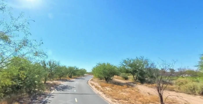
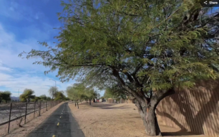
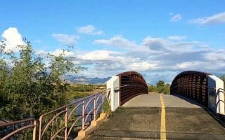
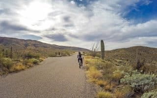
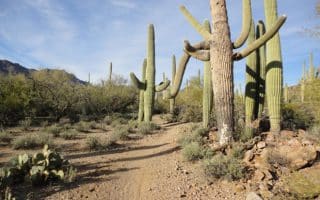
One of the best places to run in central Tucson is to choose a section of many miles of paths that follow the Santa Cruz River. There are 13-14 miles of multi-use paths, mostly paved, that run (mostly) along both banks of the river. Note that it’s a dry riverbed for much of the year, so there’s not much of a ‘water view’. We’ve mapped two separate routes that can be mix & matched: north to Columbus Park and south to Drexel Heights near the airport. Notes: Gradual downhill headed north, gradual uphill headed south.The terrain is very open, so use caution on a hot day!
North Loop: This route starts at Congress St., just across from downtown. The path is called the Diamond St. Loop. Head north for up to 6.7 miles to W El Camino del Cerro, just north of Silverbell Lake. This is mainly a long bike path. It is a gradual downhill headed north. You can run on either side of the river, though north of Grant St. there aren’t opportunities to cross over.
- Option: If you run to the north end of this route, you can loop back along the Rillito River path — this connector adds 2.4 miles.
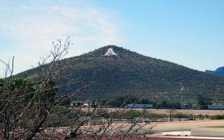
South Loop. Starting at Congress St., head south for up to 6.5 miles to W Valencia Rd. On the west bank of the river, the path is called the Diamond St. Loop, and on the east bank it’s the Chuck Huckelberry Loop. We think the southern section is prettier — especially the first 3 miles, passing A Mountain and then some greenery through Santa Cruz River Park.
Add-Ons: Our downtown/University of Arizona route is just across Congress St. Also, ambitious runners can do the run up A Mountain.
One of the best places to run in central Tucson is to choose a section of many miles of paths that follow the Santa Cruz River. There are 13-14 miles of multi-use paths, mostly paved, that run (mostly) along both banks of the river. Note that it’s a dry riverbed for much of the year, so there’s not much of a ‘water view’. We’ve mapped two separate routes that can be mix & matched: north to Columbus Park and south to Drexel Heights near the airport. Notes: Gradual downhill headed north, gradual uphill headed south.The terrain is very open, so use caution on a hot day!
North Loop: This route starts at Congress St., just across from downtown. The path is called the Diamond St. Loop. Head north for up to 6.7 miles to W El Camino del Cerro, just north of Silverbell Lake. This is mainly a long bike path. It is a gradual downhill headed north. You can run on either side of the river, though north of Grant St. there aren’t opportunities to cross over.
- Option: If you run to the north end of this route, you can loop back along the Rillito River path — this connector adds 2.4 miles.
South Loop. Starting at Congress St., head south for up to 6.5 miles to W Valencia Rd. On the west bank of the river, the path is called the Diamond St. Loop, and on the east bank it’s the Chuck Huckelberry Loop. We think the southern section is prettier — especially the first 3 miles, passing A Mountain and then some greenery through Santa Cruz River Park.
Add-Ons: Our downtown/University of Arizona route is just across Congress St. Also, ambitious runners can do the run up A Mountain.


Review or Comment on This Route/Share a Photo!
Share your feedback on this route and see that of other Great Runs users. Click on the image icon to upload a photo. And please let us know if there are notes or changes we should incorporate!